Madugula
| Madugula | |
|---|---|
| Village | |
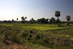 A view of fields near Madugula | |
 Madugula Location in Andhra Pradesh, India  Madugula Madugula (India) | |
| Coordinates: 17°55′00″N 82°48′00″E / 17.9167°N 82.8000°ECoordinates: 17°55′00″N 82°48′00″E / 17.9167°N 82.8000°E | |
| Country |
|
| State | Andhra Pradesh |
| District | Visakhapatnam |
| Elevation | 83 m (272 ft) |
| Languages | |
| • Official | Telugu |
| Time zone | UTC+5:30 (IST) |
| PIN | 531 027 |
| Telephone code | 08934 |
| Vehicle registration | AP |
Madugula is a village in Visakhapatnam district in the state of Andhra Pradesh in India.[1]
Geography
Madugula is located at 17°55′00″N 82°48′00″E / 17.9167°N 82.8°E.[2] It has an average elevation of 83 meters (275 feet).
Legislative Assembly
Madugula is an assembly constituency in Andhra Pradesh. There are 1,70,350 registered voters in Madugula constituency in 2014 elections.
List of Elected Members:[3]
- 1955 - Donda Sreerama Murty
1972 - boddu kalavathi
- 1978 - Kuracha Ramunaidu (Appalarajupuram)
- 1983, 1985, 1989, 1994 and 1999 - Reddi Satyanarayana(Gogada)
- 2004 - Karanam Dharmasri (K.J.puram)
- 2009 - Gavireddi Ramu Naidu (Appalarajupuram)
- 2014 - BUDI. MUTYALA NAIDU (Taruva(v))
References
- ↑ "Mandal wise list of villages in Visakhapatnam district" (PDF). Chief Commissioner of Land Administration. National Informatics Centre. Archived from the original (PDF) on 19 March 2015. Retrieved 6 March 2016.
- ↑ Falling Rain Genomics.Madugula
- ↑ Election Commission of India.A.P.Assembly results.1978-2004 Archived 2007-09-30 at the Wayback Machine.
This article is issued from
Wikipedia.
The text is licensed under Creative Commons - Attribution - Sharealike.
Additional terms may apply for the media files.