Gopalapatnam
Gopalapatnam is a neighbourhood in the city of Visakhapatnam, India. The neighbourhood is considered as the major residential and commercial area in the district. It is located within the jurisdiction of the Greater Visakhapatnam Municipal Corporation, which is responsible for the civic amenities in Gopalapatnam. It is located on the west fringe of Visakhapatnam city.
| Gopalapatnam | |
|---|---|
| Neighbourhood | |
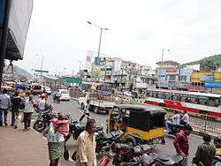 BRTS Road at Gopalapatnam | |
 Gopalapatnam Location in Andhra Pradesh, India | |
| Coordinates: 17°44′53″N 83°13′07″E / 17.748066°N 83.218745°ECoordinates: 17°44′53″N 83°13′07″E / 17.748066°N 83.218745°E | |
| Country |
|
| State | Andhra Pradesh |
| District | Visakhapatnam |
| Founded by | Government of Andhra Pradesh |
| Government | |
| • Type | Mayor-council |
| • Body | Greater Visakhapatnam Municipal Corporation |
| Languages | |
| • Official | Telugu |
| Time zone | UTC+5:30 (IST) |
| PIN | 530027 |
| Vidhan Sabha constituency | Visakhapatnam West |
| Lok Sabha constituency | Visakhapatnam |
Gopalapatnam mandal is one of the 46 mandals of Visakhapatnam District. It is under the administration of Visakhapatnam revenue division and the head quarters is located at Gopalapatnam. The Mandal is bounded by Gajuwaka, Seethammadhara and Pendurthi mandals.
Location and Geography
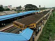
Gopalapatnam is located about 4 km from Visakhapatnam Airport and about 8 km from Visakhapatnam railway station. The neighbourhood is served by Simhachalwm railway station of the Waltair Division. The station is located at the centre of the neighbourhood connecting the Highways NH-16 and SH-39.
Gopalapatnam lies to the west of Visakhapatnam City and is loosely bordered by Gajuwaka to the south and Seethammadhara to the north, Pendurthi to the west, Marripalem to the east.
Etymology
Gopalapatnam was named after Sri Gopala Raju. He used to rule Kota gutta, Enugula Dwaram, Gurrala Cheruvu, Taati Penda areas which were united to form the present Gopalapatnam.
Transport
Gopalapatnam is well connected by road. NH16 or AH45 and SH39 passes through the mandal. It also has major District roads connecting it to nearby mandals and Visakhapatnam. APSRTC runs bus services from Gopalapatnam bus station to major parts of the state and Visakhapatnam
- APSRTC routes
| Route Number | Start | End | Via |
|---|---|---|---|
| 28 | RK Beach | Simhachalam | Jagadamba Centre, RTC Complex, Kancharapalem, NAD Kotharoad, Gopalapatnam |
| 28K/28A | RK Beach | Kothavalasa/Pendurthi | Jagadamba Centre, RTC Complex, Kancharapalem, NAD Kotharoad, Gopalapatnam, Vepagunta |
| 28H | RK Beach | Simhachalam Hill | Jagadamba Centre, RTC Complex, Railway Station, Kancharapalem, NAD Kotharoad, Gopalapatnam |
| 28Z/H | Zilla Parishad | Simhachalam Hill | Jagadamba Centre, RTC Complex, Gurudwara, Birla Junction, NAD Kotharoad, Gopalapatnam |
| 6A/6A/H | RTC Complex | Simhachalam/Simhachalam Hill | Railway Station, Kancharapalem, NAD Kotharoad, Gopalapatnam |
| 6/6H | Old Head Post Office | Simhachalam/Simhachalam Hill | Town Kotharoad, Convent Junction, Kancharapalem, NAD Kotharoad, Gopalapatnam |
| 300C/300M | RTC Complex | Chodavaram/Madugula | Railway Newcolony, Kancharapalem, NAD Kotharoad, Gopalapatnam, Vepagunta, Sabbavaram |
| 555 | RTC Complex | Chodavaram | Gurudwara, NAD Kotharoad, Gopalapatnam, Vepagunta, Sabbavaram |
| 55 | Scindia | Simhachalam | Malkapuram, Sriharipuram, New Gajuwaka, Old Gajuwaka, BHPV, NAD Kotharoad, Gopalapatnam |
| 55K | Scindia | Kothavalasa | Malkapuram, Sriharipuram, New Gajuwaka, Old Gajuwaka, BHPV, NAD Kotharoad, Gopalapatnam, Vepagunta |
| 541 | Maddilapalem | Kothavalasa | Gurudwara, NAD Kotharoad, Gopalapatnam, Vepagunta, Pendurthi |
| 540 | MVP Colony | Simhachalam | Venkojipalem, Maddilapalem, Gurudwara, NAD Kotharoad, Gopalapatnam |
References