Kasimkota
| Kasimkota | |
|---|---|
| Village | |
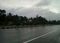 National Highway at Kasimkota | |
 Kasimkota Location in Andhra Pradesh, India  Kasimkota Kasimkota (India) | |
| Coordinates: 17°40′25″N 82°57′48″E / 17.673629°N 82.9634°ECoordinates: 17°40′25″N 82°57′48″E / 17.673629°N 82.9634°E | |
| Country | India |
| State | Andhra Pradesh |
| District | Visakhapatnam |
| Area[1] | |
| • Total | 161.27 km2 (62.27 sq mi) |
| Population (2011)[2] | |
| • Total | 15,753 |
| • Density | 98/km2 (250/sq mi) |
| Languages | |
| • Official | Telugu |
| Time zone | UTC+5:30 (IST) |
| PIN | 531 xxx |
| Telephone code | +91-8924 |
| Vehicle registration | AP 31 XXXX |
Kasimkota is a Village in Visakhapatnam district in the state of Andhra Pradesh in India.[3] Kasimkota was one of the notable villages affected by Cyclone Hudhud.[4]
Kasimkota is also part of the second largest jaggery market of the country in Anakapalle.[5]
References
- ↑ "District Census Handbook – Visakhapatnam" (PDF). Census of India. pp. 26, 52. Retrieved 13 February 2016.
- ↑ "Census 2011". The Registrar General & Census Commissioner, India. Retrieved 26 July 2014.
- ↑ "Mandal wise list of villages in Visakhapatnam district" (PDF). Chief Commissioner of Land Administration. National Informatics Centre. Archived from the original (PDF) on 19 March 2015. Retrieved 6 March 2016.
- ↑ "Kasimkota Hudhud Rehabilitation Database" (PDF). Visakhapatnam Official Website. National Informatics Centre. Retrieved 10 December 2016.
- ↑ Madan, Manish (30 March 2015). "Anakapalli jaggery market stares at bitter future - Times of India". The Times of India. Retrieved 7 June 2016.
This article is issued from
Wikipedia.
The text is licensed under Creative Commons - Attribution - Sharealike.
Additional terms may apply for the media files.