Vamsadhara River
| Vamsadhara | |
| River | |
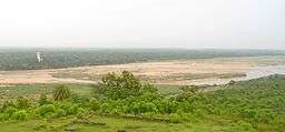 Vamsadhara River as seen from Salihundam in Srikakulam district | |
| Country | India |
|---|---|
| Source | Thuamul Rampur |
| Discharge | for Bay of Bengal |
| - average | 25 m3/s (883 cu ft/s) |
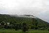
River Vamsadhara is an important east flowing river between Rushikulya and Godavari, in Odisha and Andhra Pradesh states in India.
The river originates in the border of Thuamul Rampur in the Kalahandi district and Kalyansinghpur in Rayagada district of Odisha and runs for a distance of about 254 kilometers, where it joins the Bay of Bengal at Kalingapatnam, Andhra Pradesh. The total catchement area of the river basin is about 10,830 square kilometers.
Tourist attractions of Mukhalingam and Kalingapatnam in Srikakulam district are located on the banks of this river.
Mahendra Tanaya[1]is a major tributary river of Vamsadhara originating in Gajapati district of Odisha and it joins Vamsadhara in Andhra Pradesh upstream of Gotta barrage. Regulapadu barrage in Andhra Pradesh is under construction to divert the river water for irrigation use.[2]
Interstate aspects
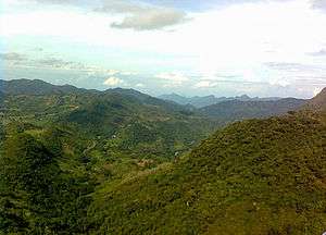
Vamsadhara river basin occupies 8015 square kilometers in Odisha and the remaining 2815 km2 flows in Andhra Pradesh. The river basin receives high annual average rainfall of magnitude 1400 mm. The portion lying in Rayagada district of Odisha is predominantly hilly and tribal populated area. Andhra Pradesh and Odisha roughly estimated that 115 thousand million cubic feet (TMC) water is available for use in the river. They entered into agreements[3] to use the available river water in 50:50 ratio. Andhra Pradesh has taken up Gotta barrage and Neredi barrage projects to put its share of water for use. However Odisha has not taken up new projects in the basin area to utilize its share of water. In fact it is diverting Vamsadhara river waters to adjacent Rushikulya river basin by constructing Harabhangi dam without taking prior consent from Andhra Pradesh.[4] Also, Orissa has raised objections to Neredi barrage project on the grounds of land submergence in its territory during unprecedented floods.
Approximately 25% of the available water in this basin is being utilized during the monsoon season by constructing barrages across the river. Reservoirs up to 100 Tmcft water storage capacity are to be constructed for the non-monsoon period irrigation requirements, by which 100% water utilization can be achieved. Peculiar situation of this river is that most of the land to be irrigated is located in Andhra Pradesh while the possible storage reservoirs are located in Odisha. Vamsadhara River water disputes tribunal was constituted under Interstate River Water Disputes Act[5] to resolve river water sharing issues between the two states. Justice Mukundakam Sharma is the chairman of Vamsadhara Water Dispute Tribunal.[6] The tribunal pronounced its final verdict in September 2017 and permitted AP state to construct the side weir at Katragedda and Neradi barrage.[7] The tribunal also upheld the sharing of 115 tmc ft total yield at Gotta barrage between AP and Odisha in 50:50 ratio as per the agreement reached between the states on 30 September 1962.[8]
The Vamsadhara Project
Boddepalli Rajagopala Rao Project was constructed on Vamsadhara river.[9]
Vamsadhara is the main river of North Eastern Andhra. The North Eastern Andhra region consists of three North Eastern Coastal districts in Andhra Pradesh state in India. Vamsadhara project is designed to meet the irrigation needs of North Eastern Coastal Andhra.[10]
The Vamsadhara project has two canals viz., the left main canal (LMC), irrigating about 148,000 acres (600 km2), and the right main canal (RMC) covering an ayacut of 62,280 acres (252 km2). The left main canal was completed long back. The right main canal was delayed due to various reasons. Gotta Reservoir feeds the right main canal. About 166 villages in seven mandals viz., L.N. Peta, Hiramandalam, Burja, Amadalavalasa, Gara, Sarubujjili and Srikakulam will be benefited from the RMC.
Lower Vamsadhara Project
The Lower Vamsadhara project envisages construction of 58m high & 1700m long dam across the vamsadhara river near Minajhola village (near 19°31′00″N 83°44′30″E / 19.51667°N 83.74167°E ) in Rayagada district creating hydraulic head of nearly 62 meters.[11] This project would be a multipurpose project serving power generation, irrigation and flood control.
Vamsadhara and Nagavali link canal
A 30 km long gravity canal is planned to link the Vamsadhara and Nagavali Rivers.[12] It will run from Hiramandalam reservoir to Narayanapuram barrage near Amudalavalasa and bring an additional 50,000 acres of ayacut under irrigation using 10 Tmcft of water from Vamsadhara basin.[13][14]
Lanjigarh Alumina Refinery
Alumina refinery owned by Vedanta Resources is located in the Lanjigarh town which is regarded to be in the Vamsadhara river basin area by some renowned NGOs. It was a fake propaganda run by foreign funded NGOs linking Vedanta Refinery plant to Environmental issues and Vamsadhara which was quite successful which got support from various parties and so-called National leaders by scraping environmental clearance to Vedanta.
See also
References
- ↑ ]
- ↑ Four years after laying stone river projects fail to take off - The Hindu 19 August 2012
- ↑ Agreements with Odisha on Vamsadhara river waters sharing - pages 256 to 263
- ↑ "Harabhangi Dam D02980". Retrieved 20 April 2015.
- ↑ Interstate river water disputes act - 1956 and its legal provisions
- ↑ "Vamsadhara project okayed with conditions". 2013. Retrieved 20 April 2014.
- ↑ "Vamsadhara Water Disputes Tribunal interim and final awards. Pages 121 ans 138" (PDF). 2017. Retrieved 20 February 2017.
- ↑ "Vamsadhara Water Disputes Tribunal: Andhra Pradesh allowed to build Neradi barrage". 2017. Retrieved 20 February 2017.
- ↑ The Hindu on Vamsadhara project
- ↑ Vamsadhara - Voice of Uttarandhra
- ↑ "Lower Vamsadhara project, Odisha state". Retrieved 23 July 2013.
- ↑ "AP plans to link Vamsadhara, Nagavali". Retrieved 5 September 2016.
- ↑ "Hiramandalam Dam D03520". Retrieved 5 September 2016.
- ↑ "Narayanapuram Anicut Medium Irrigation Project JI00114". Retrieved 5 September 2016.