Valtorta, Lombardy
| Valtorta | |
|---|---|
| Comune | |
| Comune di Valtorta | |
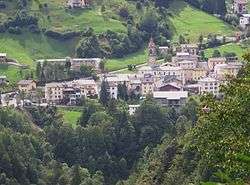 Valtorta | |
 Valtorta Location of Valtorta in Italy | |
| Coordinates: 45°59′N 9°32′E / 45.983°N 9.533°ECoordinates: 45°59′N 9°32′E / 45.983°N 9.533°E | |
| Country | Italy |
| Region | Lombardy |
| Province | Province of Bergamo (BG) |
| Area | |
| • Total | 30.5 km2 (11.8 sq mi) |
| Elevation | 935 m (3,068 ft) |
| Population (Dec. 2004) | |
| • Total | 331 |
| • Density | 11/km2 (28/sq mi) |
| Demonym(s) | Valtortesi |
| Time zone | UTC+1 (CET) |
| • Summer (DST) | UTC+2 (CEST) |
| Postal code | 24010 |
| Dialing code | 0345 |
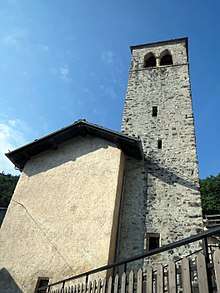
Sant'Antonio Abate tower

S. Maria Assunta church
Valtorta (Bergamasque: Altòrta) is a comune (municipality) in the Province of Bergamo in the Italian region of Lombardy, located about 60 kilometres (37 mi) northeast of Milan and about 35 kilometres (22 mi) northwest of Bergamo. As of 31 December 2004, it had a population of 331 and an area of 30.5 square kilometres (11.8 sq mi).[1]
Valtorta borders the following municipalities: Barzio, Cassiglio, Gerola Alta, Introbio, Ornica, Vedeseta.
Ski
From Valtorta start a cable way that allove the tourist to reach tha ski zone of Piani di Bobbio. At Ceresole there was also a cross country ski track.
External links
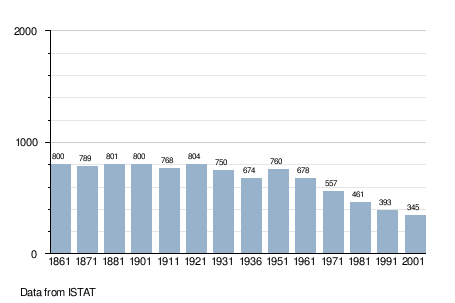
Demographic evolution
References

| Authority control |
|---|
This article is issued from
Wikipedia.
The text is licensed under Creative Commons - Attribution - Sharealike.
Additional terms may apply for the media files.