Barbata
| Barbata | |
|---|---|
| Comune | |
| Comune di Barbata | |
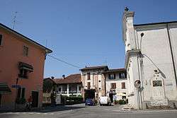 Municipal square | |
 Barbata Location of Barbata in Italy | |
| Coordinates: 45°28′N 9°46′E / 45.467°N 9.767°ECoordinates: 45°28′N 9°46′E / 45.467°N 9.767°E | |
| Country | Italy |
| Region | Lombardy |
| Province | Bergamo (BG) |
| Government | |
| • Mayor | Vincenzo Trapattoni |
| Area | |
| • Total | 7.98 km2 (3.08 sq mi) |
| Elevation | 105 m (344 ft) |
| Population (30 April 2017)[1] | |
| • Total | 703 |
| • Density | 88/km2 (230/sq mi) |
| Demonym(s) | Barbatesi |
| Time zone | UTC+1 (CET) |
| • Summer (DST) | UTC+2 (CEST) |
| Postal code | 24040 |
| Dialing code | 0363 |
| Website | Official website |
Barbata (Bergamasque: Barbàda) is a comune (municipality) in the Province of Bergamo in the Italian region of Lombardy, located about 50 kilometres (31 mi) east of Milan and about 25 kilometres (16 mi) southeast of Bergamo.
Barbata borders the following municipalities: Antegnate, Camisano, Casaletto di Sopra, Covo, Fontanella, Isso.
References

This article is issued from
Wikipedia.
The text is licensed under Creative Commons - Attribution - Sharealike.
Additional terms may apply for the media files.