Locatello
| Locatello | |
|---|---|
| Comune | |
| Comune di Locatello | |
 Locatello | |
 Locatello Location of Locatello in Italy | |
| Coordinates: 45°50′N 9°32′E / 45.833°N 9.533°ECoordinates: 45°50′N 9°32′E / 45.833°N 9.533°E | |
| Country | Italy |
| Region | Lombardy |
| Province | Province of Bergamo (BG) |
| Area | |
| • Total | 3.8 km2 (1.5 sq mi) |
| Elevation | 557 m (1,827 ft) |
| Population (Dec. 2004) | |
| • Total | 785 |
| • Density | 210/km2 (540/sq mi) |
| Demonym(s) | Locatellesi (baeloch de locadel) |
| Time zone | UTC+1 (CET) |
| • Summer (DST) | UTC+2 (CEST) |
| Postal code | 24030 |
| Dialing code | 035 |
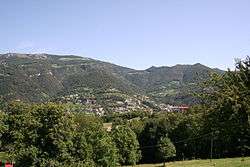
Locatello (Bergamasque: Locadèl) is a comune (municipality) in the Province of Bergamo in the Italian region of Lombardy, located about 50 kilometres (31 mi) northeast of Milan and about 20 kilometres (12 mi) northwest of Bergamo. As of 31 December 2004, it had a population of 785 and an area of 3.8 square kilometres (1.5 sq mi).[1]
Locatello borders the following municipalities: Brumano, Corna Imagna, Fuipiano Valle Imagna, Rota d'Imagna.
The name of this village comes from the family name : "Locatelli", a noble Italian family. The family " Locatelli " is on the base a single family which, later a millennium divided at the four corners of the world.
Demographic evolution

References

This article is issued from
Wikipedia.
The text is licensed under Creative Commons - Attribution - Sharealike.
Additional terms may apply for the media files.