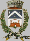
Capriate San Gervasio
| Capriate San Gervasio | ||
|---|---|---|
| Comune | ||
| Comnue di Capriate San Gervasio | ||
|
| ||
| ||
.svg.png) Capriate San Gervasio within the Province of Bergamo | ||
 Capriate San Gervasio Location of Capriate San Gervasio in Italy | ||
| Coordinates: 45°36′32″N 09°31′41″E / 45.60889°N 9.52806°ECoordinates: 45°36′32″N 09°31′41″E / 45.60889°N 9.52806°E | ||
| Country | Italy | |
| Region | Lombardy | |
| Province | Bergamo (BG) | |
| Frazioni | Capriate, Crespi d'Adda, San Gervasio | |
| Government | ||
| • Mayor | Valeria Radaelli | |
| Area | ||
| • Total | 5.83 km2 (2.25 sq mi) | |
| Elevation | 188 m (617 ft) | |
| Population (2016)[1] | ||
| • Total | 8,068 | |
| • Density | 1,400/km2 (3,600/sq mi) | |
| Demonym(s) | Capriatesi | |
| Time zone | UTC+1 (CET) | |
| • Summer (DST) | UTC+2 (CEST) | |
| Postal code | 24040, 24042 | |
| Dialing code | 02 | |
| Patron saint | St. Alexander | |
| Saint day | August 26 | |
| Website | Official website | |
Capriate San Gervasio (Bergamasque: Cavriàt San Gervàs; Milanese: Capriàa San Gervàsi) is a town and comune in the province of Bergamo, in Lombardy, northern Italy. As of 2016, its population was 8,068.[1]
History
It received the honorary title of town (città) with a presidential decree on July 11, 2006.
Geography
It is situated on the southern tip of the so-called Bergamasca Island, a territory delimited by the rivers Adda and Brembo. It includes three hamlets (frazioni) at slightly different altitudes: San Gervasio d'Adda (north), Capriate d'Adda (center) and Crespi d'Adda. The latter, a perfectly preserved example of a 19th-century "workers' village", is a UNESCO World Heritage Site.
The municipality borders with Bottanuco, Brembate, Canonica d'Adda, Filago, Trezzo sull'Adda (MI) and Vaprio d'Adda (MI).[2]
Demographics

References
External links
![]()
- (in Italian) Capriate San Gervasio official website

