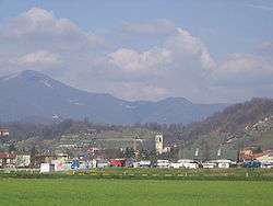
Bagnatica
| Bagnatica | ||
|---|---|---|
| Comune | ||
| Comune di Bagnatica | ||
 | ||
| ||
 Bagnatica Location of Bagnatica in Italy | ||
| Coordinates: 45°40′N 9°47′E / 45.667°N 9.783°ECoordinates: 45°40′N 9°47′E / 45.667°N 9.783°E | ||
| Country | Italy | |
| Region | Lombardy | |
| Province | Bergamo (BG) | |
| Government | ||
| • Mayor | Primo Magli | |
| Area | ||
| • Total | 6.2 km2 (2.4 sq mi) | |
| Elevation | 220 m (720 ft) | |
| Population (28 February 2017)[1] | ||
| • Total | 4,329 | |
| • Density | 700/km2 (1,800/sq mi) | |
| Demonym(s) | Bagnatichesi | |
| Time zone | UTC+1 (CET) | |
| • Summer (DST) | UTC+2 (CEST) | |
| Postal code | 24060 | |
| Dialing code | 035 | |
| Patron saint | St. John the Baptist | |
| Saint day | 24 June | |
| Website | Official website | |

Bagnatica (Bergamasque: Bagnàdega) is a comune (municipality) in the Province of Bergamo in the Italian region of Lombardy, located about 50 kilometres (31 mi) northeast of Milan and about 10 kilometres (6 mi) southeast of Bergamo.
References
External links

This article is issued from
Wikipedia.
The text is licensed under Creative Commons - Attribution - Sharealike.
Additional terms may apply for the media files.