Trikaripur
| Thikaripur Trikaripur | |
|---|---|
| Census Town | |
.jpg) Kallikkadavu Junction | |
 Thikaripur Location in Kerala, India  Thikaripur Thikaripur (India) | |
| Coordinates: 12°08′35″N 75°10′34″E / 12.143°N 75.176°ECoordinates: 12°08′35″N 75°10′34″E / 12.143°N 75.176°E | |
| Country |
|
| State | Kerala |
| District | Kasaragod |
| Talukas | Hosdurg |
| Government | |
| • Body | Panchayat (Special Grade) |
| Area | |
| • Total | 27.3 km2 (10.5 sq mi) |
| Population (2011) | |
| • Total | 41,201[1] |
| Languages | |
| • Official | Malayalam, English |
| Time zone | UTC+5:30 (IST) |
| PIN | 671310 |
| Telephone code | 046722***** |
| ISO 3166 code | IN-KL |
| Vehicle registration | KL-14, KL-60 |
| Sex ratio | 1109 ♂/♀ |
| Literacy | 89.86% |
| Lok Sabha constituency | Kasaragode |
| Vidhan Sabha constituency | Trikaripur |
| Civic agency | Panchayat (Special Grade) |
| Climate | pleasant (Köppen) |
| Website |
lsgkerala |
Trikaripur or Elambachi is a village in Kasaragod District in the state of Kerala, India.
Demographics
The 2001 Census of India determined that the population of Trikaripur had a population of 32,626.[2]
History
Trikaripur was part of the Mooshika Dynasty in ancient days. During the British Raj Trikarpur was administered under the Madras Presidency in Malabar District. It became part of Kerala with that state's formation on November 1, 1956.
Etymology
Parasurama (one of Lord Vishnu's "avathar") during his journey to Kerala concentrated on the construction of temples. He constructed a city of towers and mansions decorated with gold and precious stones. He made a menagerie for elephants with arrangements for feeding and breeding. This place is known as "The sacred Village of elephant "(Thiru-Karipuram) and later on "Thrikkaripuram" (similar to Thrikkanamathilakam which was originally Thiru-Kana Mathilakam) which with the passage of time came to be known as the present day "Thrikaripur".
It was described by some senior citizen, called previously Sree Haripuram and later it became Trikarupur. It was not mentioned anywhere in history.
Geography
Trikaripur lies along the coast of Arabian Sea, at 12°09′N 75°09′E / 12.15°N 75.15°E[3] This Panchayat serves as the separating border for Kasaragod District and Kannur District.
Culture
Trikaripur is notable for its folk arts performances, including Kaliyattam (Theyyam), Poorakkali and Kolkali festivals.
Tourist Attractions
- Idayilakkadu : As the name recites its a small island forest between the rivers which have lush greenery.
- Valiyaparamba: 3 km west of Trikarpur separated from the mainland by back waters. One of the main tourist spots of the District. This is an island in the Arabian Sea. An ideal place for picnic also a fishing centre. This is the longest island in Kerala.
- Kariangode River: Running through the hills and dales of Hosdurg Taluk. Immortalised as Tejaswini by great novelist Niranjana laps on its shore. The famous village of Kayyur - the cradle of agrarian revolutions where the farmers and farm workers staged a historic battle against feudalism and the British imperialism.
- Uliyath Kadavu
Places of worship
- Beericheri Juma Masjid
- Valvakkad Juma Masjid
- Masjid eeman Nadakkav, opp polytechnic
- Kunnacheri Sree Poomala Bhagavathi Kshetram, Thankayam
- Madathinkeezhil Sree Vairajaatha Kshethram, Thankayam
- Manikkanal Sree Vishnumoorthi Kshetram Thankayam
- MettamelSayyid Muhammed Moula Juma Masjid
- Poroppad Badar masjid (historical)
- Thaqwa Juma Masjid Vellap road trikarpur
- Town Juma Masjid, Trikaripur
- Vadakkumbad JUMA MASJID, vadakkumbad trikaripur
- Kannankai JUMA MASJID
- Thoufeeque Masjid, Pekkadam
Educational institutions
- VPP Mohd Kunhi Patelar Smarka GVHSS Trikaripur
- EK Nayanar memorial Govt. Polytechnic College
- Government Higher Secondary School, Elambachi, South Trikaripur
- Sree Narayana Higher Secondary School
- Pookoya Thangal School, Kaikkottukadavu
- Al Mujammu English Medium School, CBSE Approved, Vellap, Trikaripur, http://mujammauschool.com/
- Peace International School
- College of Engineering Trikaripur[4]
- The Rajiv Gandhi Institute of Pharmacy
- Ibnu Seena Special School and LKG, UKG, Udumbunthala
- Olavara Sanketha GUP School, Olavara
- izzathul islam english medium school Thankayam
Members of the village council
- Aneesa, Sukumaran, Kunhambu, Prabhakaran, Liji, Thampan, Nalini, Kunhikrishnan, Vinod, Anitha, Lalitha, Sakkeena, Sharban, Kunhibava, Soudha, Fathima, Reetha, Fousiya, Sathar vadakkumbad and Ameer.
Transportation
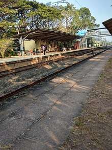
Local roads have access to NH.66 which connects to Mangalore in Karnataka and Calicut in the south of kerela. The nearest major railway station is Trikaripur on Mangalore-Palakkad line. There are airports at Mangaluru and Calicut.
See also
- Payyannur
- Valiyaparamba Backwaters 15 km from Payyanur
- Peringome 20 km from Payyanur
- Ezhimala 12 km from Payyanur Town
- Kunhimangalam village 8 km from Payyanur town
- Kavvayi Island 3 km from Payyanur
- Ramanthali 7 km from Payyanur
- Karivellur 10 km from Payyanur
- Udumbunthala
References
- ↑ List of Cities and Towns in Kasaragod district
- ↑ "Census of India : Villages with population 5000 & above". Registrar General & Census Commissioner, India. Retrieved 2008-12-10.
- ↑ Ornithological gazetteer of the Indian subcontinent, p. 82 ISBN 1-881173-85-2.
- ↑ "College of Engineering Trikaripur". edufaq.com.
External links
| Wikimedia Commons has media related to Trikaripur. |