Tararua District
| Tararua District | |
|---|---|
| Territorial authority | |
 | |
| Country | New Zealand |
| Region | Manawatu-Wanganui |
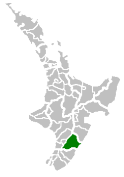
| District | Tararua District |
| Formed | 1989 |
| Seat | Dannevirke |
| Government | |
| • Mayor | Tracey Collis[1] |
| • Deputy Mayor | Allan Benbow |
| Area | |
| • Total | 4,360.56 km2 (1,683.62 sq mi) |
| Population (June 2018)[2] | |
| • Total | 17,900 |
| • Density | 4.1/km2 (11/sq mi) |
| Time zone | UTC+12 (NZST) |
| • Summer (DST) | UTC+13 (NZDT) |
| Postcode(s) | Map of postcodes |
| Website | Tararua District |
The Tararua District is an area near the south-east corner of New Zealand's North Island that is administered by the Tararua District Council. It has a population of 17,900 (June 2018),[2] and an area of 4,360.56 km². The Tararua District Council was created by the amalgamation of the Dannevirke District Council, Eketahuna County Council, Pahiatua Borough Council, Pahiatua County Council and Woodville District Council in the 1989 local government reforms.[3]
The district's northwest boundary runs along the top of the Ruahine Range; its south-east boundary is the Pacific Ocean. The catchment of the Manawatu River generally defines the north and south extremities. The catchment is also the reason the majority of the district is in the Manawatu-Wanganui Region, although traditionally many of the people of the district regard themselves as living in either Hawke's Bay (in the north) or Wairarapa (in the south).
Towns and regional government
The district's chief town is Dannevirke, settled by immigrants from Denmark in the 19th century. It is also the centre for a Community Board. Other towns (from south to north along the main valleys) include Eketahuna and Pahiatua, which have their own Community Boards, and Woodville, Ormondville, and Norsewood. Near the coast are Pongaroa, Herbertville, Akitio, and Alfredton.
While the vast majority (98.42% by land area) of Tararua District is part of the Manawatu-Wanganui Region, a small triangle of rural land (1.58% by land area) north of the Owahanga River in the southeast of the district is part of Wellington Region. According to the 2006 Census this area, known as Mara, has only 3 residents (down from 12 in 1996 and 2001).
"Forty-Mile Bush"
When Europeans settled the area, it was almost entirely forested and was called "Forty-Mile Bush". Industrious clearance has made it a busy pastoral district, although the region close to the Pacific coast is still sparsely populated. The original name lives on in that of the local National Provincial Championship rugby union team, Wairarapa-Bush.
Economy
Agriculture is the district's main industry. Other industries include textiles, food processing, and retailing. Commercial forestry is expected to become more important to the district's economy in the next few years.
Weather forecasts
Before 2006, weather forecasts on National Radio (as provided by MetService) had usually mentioned Hawke's Bay and Wairarapa but rarely if ever Tararua District, probably leaving Tararua District residents wondering which applied to them when the forecasts differed.
Officially it is considered a sub-region of the Wairarapa district. Since early in 2006, Met Service policy is that a separate Tararua District forecast will be issued only if the expected weather in that area differs significantly from the other sub-regions (Masterton, Carterton, and South Wairarapa). However, by the time the forecast is actually broadcast over National Radio (at least until early March 2006), Tararua District is simply listed as a separate District if it is mentioned at all (commonly in the phrase "Tararua and Wairarapa"), and if it is mentioned separately or bracketed with other areas apart from Wairarapa there is no indication that the Wairarapa forecast excludes Tararua District.
Schools
Secondary
- Tararua College, Pahiatua
- Dannevirke High School, Dannevirke
Primary
- Norsewood and District, Norsewood
- Kumeroa School, Kumeroa
References
- ↑ "Meet your Mayor". Tararua District Council. Retrieved 5 April 2017.
- 1 2 "Subnational Population Estimates: At 30 June 2018 (provisional)". Statistics New Zealand. 23 October 2018. Retrieved 23 October 2018. For urban areas, "Subnational population estimates (UA, AU), by age and sex, at 30 June 1996, 2001, 2006-18 (2018 boundary)". Statistics New Zealand. 23 October 2018. Retrieved 23 October 2018.
- ↑ "Tararua District Council". Archives Central. Retrieved 20 December 2015.