Snow Island (South Shetland Islands)
 Topographic map of Livingston Island, Greenwich, Robert, Snow and Smith Islands | |
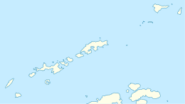 Snow Island Location of Snow Island  Snow Island Snow Island (Antarctica) | |
| Geography | |
|---|---|
| Location | Antarctica |
| Coordinates | 62°47′S 61°23′W / 62.783°S 61.383°WCoordinates: 62°47′S 61°23′W / 62.783°S 61.383°W |
| Archipelago | South Shetland Islands |
| Area | 120.4 km2 (46.5 sq mi) |
| Length | 16 km (9.9 mi) |
| Width | 8 km (5 mi) |
| Administration | |
| Administered under the Antarctic Treaty System | |
| Demographics | |
| Population | Uninhabited |
Snow Island or Isla Nevada is a completely ice-covered island, 16 by 8 kilometres (9.9 by 5.0 mi) in size, lying 6 kilometres (3.7 mi) southwest of Livingston Island in the South Shetland Islands. Surface area 120.4 square kilometres (46.5 sq mi).[1] This island was known to both American and British sealers as early as 1820, and the name has been well established in international usage for over 100 years. Snow Island is also home to the northernmost breeding colony of Emperor penguins.
Maps
- Chart of South Shetland including Coronation Island, &c. from the exploration of the sloop Dove in the years 1821 and 1822 by George Powell Commander of the same. Scale ca. 1:200000. London: Laurie, 1822.
See also
References
- ↑ L.L. Ivanov. Antarctica: Livingston Island and Greenwich, Robert, Snow and Smith Islands. Scale 1:120000 topographic map. Troyan: Manfred Wörner Foundation, 2009. ISBN 978-954-92032-6-4
External links
| General |
| .svg.png) |
|---|---|---|
| Geographic regions | ||
| Waterways | ||
| Famous explorers | ||
This article is issued from
Wikipedia.
The text is licensed under Creative Commons - Attribution - Sharealike.
Additional terms may apply for the media files.