Telish Rock
 Location of on Livingston Island in the South Shetland Islands | |
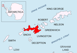
 Telish Rock Location of Telish Rock  Telish Rock Telish Rock (Antarctica) | |
| Geography | |
|---|---|
| Location | Antarctica |
| Coordinates | 62°41′53″S 60°52′08″W / 62.69806°S 60.86889°W |
| Archipelago | South Shetland Islands |
| Length | 0.3 km (0.19 mi) |
| Width | 0.18 km (0.112 mi) |
| Administration | |
| Administered under the Antarctic Treaty System | |
| Demographics | |
| Population | 0 |
Telish Rock (Bulgarian: скала Телиш, ‘Skala Telish’ ska-'la te-'lish) is the islet off the south coast of Livingston Island in the South Shetland Islands, Antarctica situated 400 m (437 yd) south of Elephant Point and 3 km (1.86 mi) northwest by west of Enchantress Rocks. Extending 300 by 180 m (328 by 197 yd). The area was visited by early 19th century sealers.
The islet is named after the settlement of Telish in northern Bulgaria.
Location
Telish Rock is located at 62°41′53″S 60°52′08″W / 62.69806°S 60.86889°W. British mapping in 1968, Chilean in 1971, Argentine in 1980, Spanish in 1993 and Bulgarian in 2005, 2009 and 2010.
See also
Maps
- L.L. Ivanov. Antarctica: Livingston Island and Greenwich, Robert, Snow and Smith Islands. Scale 1:120000 topographic map. Troyan: Manfred Wörner Foundation, 2010. ISBN 978-954-92032-9-5 (First edition 2009. ISBN 978-954-92032-6-4)
- Antarctic Digital Database (ADD). Scale 1:250000 topographic map of Antarctica. Scientific Committee on Antarctic Research (SCAR). Since 1993, regularly upgraded and updated.
- L.L. Ivanov. Antarctica: Livingston Island and Smith Island. Scale 1:100000 topographic map. Manfred Wörner Foundation, 2017. ISBN 978-619-90008-3-0
References
- Telish Rock. SCAR Composite Antarctic Gazetteer
- Bulgarian Antarctic Gazetteer. Antarctic Place-names Commission. (details in Bulgarian, basic data in English)
This article includes information from the Antarctic Place-names Commission of Bulgaria which is used with permission.

Topographic map of Livingston Island and Smith Island
This article is issued from
Wikipedia.
The text is licensed under Creative Commons - Attribution - Sharealike.
Additional terms may apply for the media files.