Kaliman Island
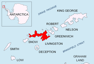 Location of Livingston Island in the South Shetland Islands | |
 Kaliman Island Location of Kaliman Island  Kaliman Island Kaliman Island (Antarctica) | |
| Geography | |
|---|---|
| Location | Antarctica |
| Coordinates | 62°37′31″S 60°39′44″W / 62.62528°S 60.66222°W |
| Archipelago | South Shetland Islands |
| Administration | |
| Administered under the Antarctic Treaty System | |
| Demographics | |
| Population | uninhabited |
Kaliman Island (Bulgarian: остров Калиман, ‘Ostrov Kaliman’ \'os-trov ka-li-'man\) is the triangular, flat rocky island extending 250 m in south-southeast to north-northwest direction and 80 m wide in Walker Bay, Livingston Island in Antarctica. It is named after Czar Kaliman Asen of Bulgaria, 1241-1246 AD.
Location
Kaliman Island is located at 62°37′31″S 60°39′44″W / 62.62528°S 60.66222°WCoordinates: 62°37′31″S 60°39′44″W / 62.62528°S 60.66222°W, which is 3.9 km northwest of Hannah Point, 9.5 km northeast of Bond Point and 4.62 km south of Snow Peak, and connected to Livingston Island on the north by a 600 m long moraine tombolo. Formed as result of the retreat of Verila Glacier in the first decade of 21st century. Bulgarian mapping in 2009 and 2017.
Maps
- L.L. Ivanov. Antarctica: Livingston Island and Greenwich, Robert, Snow and Smith Islands. Scale 1:120000 topographic map. Troyan: Manfred Wörner Foundation, 2009.
- Antarctic Digital Database (ADD). Scale 1:250000 topographic map of Antarctica. Scientific Committee on Antarctic Research (SCAR). Since 1993, regularly upgraded and updated
- L.L. Ivanov. Antarctica: Livingston Island and Smith Island. Scale 1:100000 topographic map. Manfred Wörner Foundation, 2017.
References
- Bulgarian Antarctic Gazetteer. Antarctic Place-names Commission. (details in Bulgarian, basic data in English)
- Kaliman Island. SCAR Composite Gazetteer of Antarctica
This article includes information from the Antarctic Place-names Commission of Bulgaria which is used with permission.

| General |
| .svg.png) |
|---|---|---|
| Geographic regions | ||
| Waterways | ||
| Famous explorers | ||