Shire of Macedon Ranges
| Shire of Macedon Ranges Victoria | |||||||||||||||
|---|---|---|---|---|---|---|---|---|---|---|---|---|---|---|---|
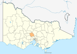 Location in Victoria | |||||||||||||||
| Population | 46,100 (2016 census)[1] | ||||||||||||||
| • Density | 26.39/km2 (68.34/sq mi) | ||||||||||||||
| Established | 1995 | ||||||||||||||
| Gazetted | 19 January 1995[2] | ||||||||||||||
| Area | 1,747 km2 (674.5 sq mi) | ||||||||||||||
| Mayor | Cr Jennifer Anderson | ||||||||||||||
| Council seat | Kyneton | ||||||||||||||
| Region | Northern Victoria | ||||||||||||||
| State electorate(s) | Macedon | ||||||||||||||
| Federal Division(s) | |||||||||||||||
|
| |||||||||||||||
| Website | Shire of Macedon Ranges | ||||||||||||||
| |||||||||||||||
The Shire of Macedon Ranges is a region in Central Victoria, Australia, best known for its expansive native forests, iconic geographical attraction Hanging Rock, and thriving artisan food and wine industries. The region covers an area of 1,747 square kilometres (675 sq mi). At the 2016 Census, had a population of 46,100.[1] It includes the towns of Clarkefield, Gisborne South, Gisborne, Kyneton, Lancefield, Macedon, Malmsbury, Mount Macedon, New Gisborne, Riddells Creek, Romsey and Woodend.
The Shire is named after the region's major geographical feature, the Macedon Ranges. It has become one of Victoria's most popular tourist attractions[3] and contains some of its most sought-after real estate[4].
It is governed and administered by the Macedon Ranges Shire Council; its seat of local government and administrative centre is located at the council headquarters in Kyneton, it also has service centres located in Gisborne, Romsey and Woodend. .
Macedon Ranges was one of the highest-rated areas in Australia in the Quality of Life Index 2008. It was the highest rated in Victoria (outside Melbourne), and was 13th of 590 Australian local government areas.[5]
Council
Current composition
The Shire of Macedon Ranges was formed in 1995 from the amalgamation of the Shire of Romsey, Shire of Gisborne, Shire of Newham and Woodend, and most of the Shire of Kyneton.[2]
The council is composed of three wards and nine councillors, with three councillors per ward elected to represent each ward.[6]
| Ward | Councillor | Notes | |
|---|---|---|---|
| East | Graham Hackett | ||
| Henry McLaughlin | |||
| Ian Ellis | |||
| South | John Letchford | ||
| Russell Mowatt | |||
| Sally Piper | |||
| West | Jennifer Anderson | Mayor 2014-15 | |
| John Connor | |||
| Roger Jukes | |||
Administration and governance
The council meets in the council chambers at the council headquarters in the Kyneton Municipal Offices, which is also the location of the council's administrative activities. It also provides customer services at both its administrative centre in Kyneton, and its service centres in Gisborne, Romsey and Woodend.
Education
Gisborne Secondary College, the largest Secondary School in the shire, is located in Gisborne and provides both academic and vocational programs for over 1000 students from across the Macedon Ranges. Kyneton Secondary College is Kyneton's state secondary school, along with Sacred Heart College (Catholic), and Braemar College east of Woodend (Ecumenical, co-educational) as the largest non-government secondary schools in the shire. Candlebark Primary School and Alice Miller High School (whose principal is John Marsden, renowned Australian author and educator) provide alternative education options.
See also
References
- 1 2 Australian Bureau of Statistics (27 June 2017). "Macedon Ranges (S)". 2016 Census QuickStats. Retrieved 15 November 2017.

- 1 2 Victoria Government Gazette – Online Archive (1837–1997). "S2 of 1995: Order estg (Part 8) the Shire of Macedon Ranges". State Library of Victoria. State Government of Victoria (published 19 January 1995). pp. 3–4. Retrieved 10 January 2014.
- ↑ "Visit Macedon Ranges". Visit Macedon Ranges.
- ↑ de Silva, Christine (December 13, 2017). "Mt Macedon's own legendary Camelot with links to Arthur Streeton hits the market". News.com.au. Retrieved December 13, 2017.
- ↑ "BankWest Quality of Life Index 2008" (PDF). BankWest Quality of Life Index 2008. BankWest. 20 August 2008. p. 8. Archived from the original (pdf) on 25 February 2009. Retrieved 3 September 2008.
- ↑ Local Government in Victoria. "Macedon Ranges Shire Council". Department of Transport, Planning and Local Infrastructure. State Government of Victoria. Retrieved 10 January 2014.
External links
- Macedon Ranges Shire Council official website
- Residents association
- Metlink local public transport map
- Link to Land Victoria interactive maps
- Gisborne & Mount Macedon Districts Historical Society
| Port Phillip | 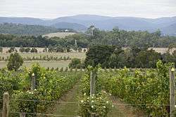 | |
|---|---|---|
| Central Victoria | ||
| Gippsland | ||
| North East Victoria | ||
| North West Victoria | ||
| Western Victoria | ||
Coordinates: 37°21′00″S 144°37′00″E / 37.35000°S 144.61667°E