Gisborne South, Victoria
| Gisborne South Victoria | |||||||||||||||
|---|---|---|---|---|---|---|---|---|---|---|---|---|---|---|---|
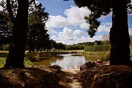 Typical property in Gisborne South | |||||||||||||||
| Population | 742 (2006 census)[1] | ||||||||||||||
| Postcode(s) | 3437 | ||||||||||||||
| Elevation | 443 m (1,453 ft) | ||||||||||||||
| LGA(s) | Shire of Macedon Ranges | ||||||||||||||
| State electorate(s) | Macedon | ||||||||||||||
| Federal Division(s) | McEwen | ||||||||||||||
| |||||||||||||||
Gisborne South is a locality in the southern part of the Macedon Ranges, a forested region of Victoria, Australia, a short drive north west of the city of Melbourne[2][3][4][5] . Known for its vineyards, olive groves and thriving horse and alpaca industries, Gisborne South has a population of 742 as of the 2006 census.[1]
Gisborne South consists entirely of large scenic acreages [6] and as such does not have its own central commercial area. Residents travel to the nearby town of Gisborne to access services and amenities. As Gisborne South is the closest to Melbourne's CBD of the Macedon Ranges' townships, residents of Gisborne South are largely professionals who commute to Melbourne for work whilst enjoying the tranquility, artisan food and wine and comparative affordability of the Macedon Ranges.
References
- 1 2 Australian Bureau of Statistics (25 October 2007). "Gisborne South (State Suburb)". 2006 Census QuickStats. Retrieved 9 May 2010.
- ↑ Victorian Municipal Directory. Brunswick: Arnall & Jackson. 1956. p. 639.
- ↑ VicRoads Country Street Directory, Edition 1, 1992
- ↑ Melway Edition 33, 2006
- ↑ Funston, Rob (December 2011). "'I remember when...'". Gisborne Gazette. p. 27.
- ↑ http://www.mrsc.vic.gov.au/files/assets/public/build-amp-plan/planning-for-our-future/c110/in-the-rural-living-zone-strategy.pdf
Coordinates: 37°32′19″S 144°36′23″E / 37.53861°S 144.60639°E