Shire of Mansfield
| Shire of Mansfield Victoria | |||||||||||||||
|---|---|---|---|---|---|---|---|---|---|---|---|---|---|---|---|
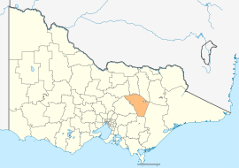 Location in Victoria | |||||||||||||||
| Population | 8,534 (2016 census)[1] | ||||||||||||||
| • Density | 2.2207/km2 (5.7515/sq mi) | ||||||||||||||
| Established | 2002 | ||||||||||||||
| Gazetted | 17 October 2002[2] | ||||||||||||||
| Area | 3,843 km2 (1,483.8 sq mi) | ||||||||||||||
| Mayor | Cr Ray Robinson | ||||||||||||||
| Council seat | Mansfield | ||||||||||||||
| Region | Hume | ||||||||||||||
| State electorate(s) | Eildon | ||||||||||||||
| Federal Division(s) | Indi | ||||||||||||||
|
| |||||||||||||||
| Website | Shire of Mansfield | ||||||||||||||
| |||||||||||||||
The Shire of Mansfield is a local government area in the Hume region of Victoria, Australia, located in the north-east part of the state. It covers an area of 3,843 square kilometres (1,484 sq mi) and at the 2016 Census, had a population of approximately 8,500.
It includes the towns of Mansfield, Mount Buller, Bonnie Doon, Jamieson, Kevington, Merrijig, Tolmie and Woods Point. It was formed in 2002 from the de-amalgamation of the Shire of Delatite into the current shire and the Rural City of Benalla.[2]
The Shire is governed and administered by the Mansfield Shire Council; its seat of local government and administrative centre is located at the council headquarters in Mansfield. The Shire is named after the main urban settlement located in the north of the LGA, that is Mansfield, which is also the LGA's most populous urban centre with a population of 4,360.[3]
The Shire is bordered by the Rural City of Benalla, the Shire of Baw Baw, the Shire of Murrindindi, the Shire of Yarra Ranges, the Shire of Strathbogie and the Shire of Wellington. There are two unincorporated areas within the shire; the areas around Mount Buller and Mount Stirling.
Council
Current composition
The council is composed of four wards and five councillors, with two councillors elected to represent the Mansfield Ward and one councillor per remaining ward elected to represent each of the other wards.[4]
| Ward | Councillor | Notes | |
|---|---|---|---|
| Bonnie Doon | Paul Sladdin | ||
| Jamieson | Harry Westendorp | ||
| Mansfield | Paul Volkering | Mayor | |
| Peter Olver | Deputy Mayor | ||
| Tolmie | Marg Attley | ||
Administration and governance
The council meets in the council chambers at the council headquarters in the Mansfield Municipal Offices, which is also the location of the council's administrative activities. It also provides customer services at its administrative centre in Mansfield.
See also
References
- ↑ Australian Bureau of Statistics (27 June 2017). "Mansfield (S)". 2016 Census QuickStats. Retrieved 28 November 2017.

- 1 2 Victoria Government Gazette – Online Search (1998–present). "G42 of 2002: Order estg the Rural City of Benalla and Shire of Mansfield" (PDF). Victoria Government Gazette. State Government of Victoria (published 17 October 2002). pp. 85–97. Retrieved 10 January 2014. Check date values in:
|year=(help) - ↑ Census QuickStats (2011). "Mansfield (SS) – SSC20844". Australian Bureau of Statistics. Government of Australia. Retrieved 10 January 2014.
- ↑ Local Government in Victoria. "Mansfield Shire Council". Department of Transport, Planning and Local Infrastructure. State Government of Victoria. Retrieved 10 January 2014.
- ↑ http://www.mansfield.vic.gov.au/aboutcouncil/councillorsandstaff.aspx
External links
| Wikimedia Commons has media related to Shire of Mansfield, Victoria. |
- Mansfield Shire Council official website
- Metlink local public transport map
- Link to Land Victoria interactive maps
Coordinates: 37°03′00″S 146°05′00″E / 37.05000°S 146.08333°E