City of Port Phillip
| City of Port Phillip Victoria | |||||||||||||||
|---|---|---|---|---|---|---|---|---|---|---|---|---|---|---|---|
 | |||||||||||||||
| Population | 100,863 (2016 census)[1] | ||||||||||||||
| • Density | 4,871.1/km2 (12,616/sq mi) | ||||||||||||||
| Established | 1994 | ||||||||||||||
| Area | 20.62 km2 (8.0 sq mi) | ||||||||||||||
| Mayor | Bernadene Voss | ||||||||||||||
| Council seat | St Kilda | ||||||||||||||
| State electorate(s) | |||||||||||||||
| Federal Division(s) | Melbourne Ports | ||||||||||||||
 | |||||||||||||||
The City of Port Phillip is a local government area of Victoria, Australia on the northern shores of Port Phillip, south of Melbourne's central business district. It has an area of 20.62 km² and had a population of 100,863 people at the 2016 Census.
Port Phillip contains a number of varied and substantial retail, entertainment and leisure precincts. These include Bay Street (Port Melbourne), Victoria Avenue (Albert Park), Clarendon Street (South Melbourne), Armstrong Street (Middle Park), Fitzroy Street (St Kilda), Acland Street (St Kilda), Carlisle Street (Balaclava) and Ormond Road (Elwood). A number of significant employment areas lie within Port Phillip, including part of the St Kilda Road business district and industrial, warehousing and manufacturing districts in South Melbourne and Port Melbourne. The city has experienced a significant amount of residential development in the 1990s, particularly in areas close to the foreshore. Port Phillip is well served by public transport with a substantial tram network, the St Kilda and Port Melbourne light rail lines and two stations on the Sandringham railway line, in addition to bus services.
Comprising seven wards, it is predominantly an amalgamation of three former cities – St Kilda, parts of South Melbourne, most of Port Melbourne, as well as a small portion of Windsor from the former City of Prahran[2]
The city was created with its present borders in June 1994 under the municipal restructure by the state government. It is bounded by White Reserve and Todd Road to the west, the West Gate Freeway, Kings Way and Dorcas Street to the north, St Kilda Road, High Street, Punt Road, Queens Way, Dandenong Road, Orrong Road, Inkerman Street, Hotham Street, Glen Huntly Road, St Kilda Street and Head Street generally to the east and the foreshore of Port Phillip to the south. Adjacent councils include the City of Melbourne, City of Bayside, City of Glen Eira and the City of Stonnington. When first created, the city was administered by three appointed commissioners, headed by Des Clarke. The first council elections were held in March 1996.
Council offices are currently located in the St Kilda Town Hall, Port Melbourne Town Hall and the South Melbourne Town Hall. The council operates several other facilities including local libraries, child care centres, parks, playgrounds and community centres.
Schools
- Albert Park Primary School
- Elwood Primary School
- Galilee Regional Primary School (Roman Catholic)
- Middle Park Primary School
- Port Melbourne Primary School (formerly Graham Street Primary)
- St Kilda Park Primary School
- St Kilda Primary School
- Albert Park Secondary College. The School Council voted on 11 October 2006 that the school close,[3] although there is much residual opposition, which has resulted in a protest march to John Thwaites office and the formation of a grass roots movement to save the school from closure, called "Save Albert Park College". The re-built school is due to re-open in 2011, but with only an intake of year 7 (form 1) students in that year.
- Elwood Secondary College
- Mac.Robertson Girls' High School (Elite government girls secondary college with an entry test)
- St Michael's Grammar School (Church of England/Anglican)
Offices
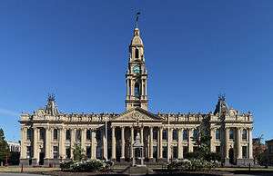
- St Kilda Town Hall
- South Melbourne Town Hall
- Port Melbourne Town Hall
Libraries

- Albert Park
- Emerald Hill (South Melbourne)
- Middle Park
- Port Melbourne
- St Kilda
Notable institutions
- 2/10 Medium Regiment, Royal Australian Artillery (Army Reserve, Chapel Street, St Kilda East)
- Australian National Music Academy (South Melbourne, in former City of South Melbourne Town Hall)
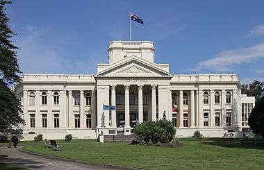
- City of Port Phillip Town Hall, St Kilda (Former City of St Kilda Town Hall, Council meeting usually on Tuesday with about 3 meetings per month. Port Phillip Meeting Agenda.)
- Greek Orthodox Archdiocese of Victoria (South Melbourne)
- Hare Krishna Temple (Albert Park)
- South Melbourne Football Club
- 1st Victorian Sea Scout Group regarded as being the first Scout Group in Australia, founded in 1907, and is still currently active hosting Cubs, Scouts and a Venturer Unit based in the Albert Park Reserve
Notable events
- Gay Pride March (Fitzroy Street and Catani Gardens, St Kilda, dykes on bikes, boot scooting, marching groups, music and political activism)
- Melbourne Formula 1 Grand Prix (Albert Park Reserve), 4-day international motor racing event held in early March; usually on the Labour Day/Moomba holiday long weekend.
- St Kilda Festival (300,000 people attend this annual music event, Fitzroy Street and Upper Esplanade closed, tram services to the event). This free event now cost ratepayers close to $1.5 million annually.
- St Kilda Film Festival (Australia's Top 100 short films, SoundKILDA: Australia Music Video Competition, international films, forums, Industry Open Day and much more)
- St Kilda Writers Festival (local and international writers compare their skills)
- Admiral Napier Cup, held in the last weekend of August and hosted by the 1st Victorian Sea Scout Group on Albert Park lake, is where Scouts and Venturers gather to participate in rowing, paddling and sailing competitions and recent addition of Iron Person events
Suburbs and localities
- Albert Park
- Balaclava
- Beacon Cove (Locality within Port Melbourne)
- Elwood
- Garden City (Locality within Port Melbourne)
- Middle Park
- Port Melbourne (Shared with the City of Melbourne)
- Ripponlea
- Southbank (Shared with the City of Melbourne)
- South Melbourne
- South Wharf (Shared with the City of Melbourne)
- St Kilda
- St Kilda East (Shared with the City of Glen Eira)
- St Kilda Road
- St Kilda West
- Windsor (Shared with the City of Stonnington)
2016 Council
Current composition and election method
Since 2016 Port Phillip City Council is composed of nine Councillors elected from three wards, up from seven in 2012.[4][5] Councillors are elected for a fixed four-year term of office. The Mayor is elected by the Councillors at the first meeting of the Council. The most recent election was held in October 2016.
The current Council, elected in 2016, in order of election by ward, is as follows:[5]
| Ward | Party | Councillor | |
|---|---|---|---|
| Canal Ward | Greens | Tim Baxter | |
| Canal Ward | Community Alliance (CAPP), Australian Labor Party | Louise Crawford | |
| Canal Ward | Australian Labor Party | Dick Gross | |
| Gateway Ward | Australian Labor Party | Bernadene Voss* | |
| Gateway Ward | Liberal Party of Australia | Marcus Pearl | |
| Gateway Ward | Greens | Ogy Simic | |
| Lake Ward | Greens | Katherine Copsey | |
| Lake Ward | Liberal Party of Australia | Andrew Bond* | |
| Lake Ward | Community Alliance (CAPP), Australian Labor Party | David Brand | |
* Reelected
Mayors
Sister Cities and Friendship Links


See also
- List of localities (Victoria) for other Melbourne suburbs and municipalities.
References
- ↑ Australian Bureau of Statistics (27 June 2017). "Port Phillip (C)". 2016 Census QuickStats. Retrieved 15 November 2017.

- ↑ Port Phillip
- ↑ The Age 12 October -
- ↑ "Port Phillip City Council Election Results 2012". Victorian Electoral Commission. October 2012. Retrieved 31 October 2012.
- 1 2 Port Phillip City Council election results 2016, retrieved 4 November 2016
- ↑ International Relations: Sister City Relationship with City of Obu, Japan.
- ↑ Friends of Suai
- ↑ Friends of Suai/Covalima Strategic Plan: 2010-2020.