City of Wyndham
| City of Wyndham Victoria | |||||||||||||||
|---|---|---|---|---|---|---|---|---|---|---|---|---|---|---|---|
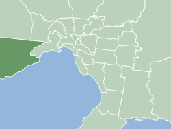 Location of City of Wyndham within Melbourne. | |||||||||||||||
| Population | 217,122 (2016)[1] (14th) | ||||||||||||||
| • Density | 400.89/km2 (1,038.30/sq mi) | ||||||||||||||
| Established | 1862 | ||||||||||||||
| Area | 541.6 km2 (209.1 sq mi) | ||||||||||||||
| Mayor | Peter Maynard | ||||||||||||||
| Council seat | Werribee | ||||||||||||||
| County | Bourke, Grant | ||||||||||||||
| State electorate(s) | |||||||||||||||
| Federal Division(s) | Lalor | ||||||||||||||
|
| |||||||||||||||
| Website | City of Wyndham | ||||||||||||||
| |||||||||||||||
The City of Wyndham is a local government area in Victoria, Australia in the outer south-western suburbs of Melbourne, within the Melbourne Metropolitan Area, between Melbourne and the regional city of Geelong. It has an area of 542 square kilometres (209 sq mi). The city recorded a population of 217,122 at the 2016 Census.
At 30 June 2014 the population was 199,715.[2]
History
The Wyndham District was first incorporated as a local government entity on 6 October 1862. Under changes made to Local Government legislation, it became the Shire of Wyndham on 7 March 1864 and was renamed the Shire of Werribee on 15 December 1909.[3]
With an initial size of 715 square kilometres (276 sq mi) and being largely rural in character, the shire ceded land to metropolitan Melbourne as suburban development encroached. On 6 January 1922 and 5 February 1941, the City of Footscray annexed two parcels of land totalling about 700 hectares. On 20 February 1957, the Altona Riding of the Shire of Werribee was severed and incorporated as the Shire of Altona, which became a City eleven years later. After this, the boundaries remained fairly stable, and on 20 March 1987 Werribee was proclaimed a City.[3]
On 15 December 1994, during major restructuring of Victoria's local governments, Werribee changed less than most – losing only some rural land around Exford in its north to the Shire of Melton, and Laverton Reserve on its eastern boundary to the City of Hobsons Bay. After 85 years of being known as Werribee, the area's former name of Wyndham was restored.[4]
Population
The City is home to numerous new housing estates in suburbs such as Williams Landing, Point Cook, Wyndham Vale, Truganina and Tarneit. The following table presents data from official census and other publications by the Australian Bureau of Statistics:
| Year | Population | Growth rate (%) |
|---|---|---|
| 1871 | 1,476 | |
| 1933 | 7,853 | |
| 1954 | 9,414# | 19.88 |
| 1958 | 10,520* | 11.75 |
| 1961 | 13,629 | 29.55 |
| 1966 | 18,369 | 34.78 |
| 1971 | 25,116 | 36.73 |
| 1976 | 31,790 | 26.57 |
| 1981 | 40,555 | 27.57 |
| 1986 | 52,458 | 29.35 |
| 1991 | 60,563 | 15.45 |
| 1996 | 73,691 | 21.68 |
| 2001 | 84,861 | 15.16 |
| 2006 | 112,695 | 32.80 |
| 2011 | 161,575 | 43.37 |
| 2016 | 217,122[5] | 34.38 |
* Estimates in 1958, 1983 and 1988 Victorian Year Books.
# Excludes Altona Shire which was severed in 1957. Source: 1958 Victorian Year Book.
^ Based on 2011 Census data.[6]
Wards and councillors
The City of Wyndham is divided into three wards (Chaffey, Harrison and Iramoo) and is represented by eleven elected councillors. The Victorian Electoral Commission undertook a representation review in 2011–2012, which resulted in the former Truganina ward being renamed Harrison ward. Ward boundaries were also redrawn.[7] The council has adopted a portfolio system for councillors from 2013 onward.
Victorian Local Government elections were held on Saturday 22 October 2016 and the following were elected as councillors:
| Ward | Party | Councillor | Notes | |
|---|---|---|---|---|
| Harrison | Independent | Tony Hooper | ||
| Independent | Aaron An | |||
| Labor | Intaj Khan | |||
| Independent | Kim McAliney | |||
| Chaffey | Independent | John Gibbons | ||
| Independent | Walter Villagonzalo | Deputy Mayor | ||
| Labor | Josh Gilligan | |||
| Labor | Henry Barlow | |||
| Iramoo | Independent | Heather Marcus | ||
| Labor | Peter Maynard | Mayor | ||
| Independent | Mia Shaw | |||
Mayor
- 2012-2013: Heather Marcus
- 2013-2014: Bob Fairclough
- 2014-2015: Peter Maynard
- 2015-2016: Adele Hegedich
- 2016-2017: Henry Barlow
- 2017-2018: Peter Maynard
Suburbs
- Cocoroc
- Eynesbury (Shared with the City of Melton)
- Hoppers Crossing
- Laverton (Shared with the City of Hobsons Bay)
- Laverton North
- Little River (Shared with the City of Greater Geelong)
- Mambourin
- Manor Lakes
- Mount Cottrell (Shared with the City of Melton)
- Point Cook
- Tarneit
- Quandong
- Truganina (Shared with the City of Melton)
- Werribee
- Werribee South
- Williams Landing
- Wyndham Vale
Sister cities
See also
References
- ↑ Australian Bureau of Statistics (27 June 2017). "Wyndham (C)". 2016 Census QuickStats. Retrieved 21 July 2017.

- ↑ .id Consulting Pty Ltd (30 June 2014). "Wyndham City Community Profile at profile.id". Wyndham City Community Profile. Retrieved 15 August 2015.
- 1 2 Victorian Municipal Directory. Brunswick: Arnall & Jackson. 1992. pp. 282, 524–525. Accessed at State Library of Victoria, La Trobe Reading Room.
- ↑ Australian Bureau of Statistics (1 August 1995). Victorian local government amalgamations 1994–1995: Changes to the Australian Standard Geographical Classification (PDF). Commonwealth of Australia. p. 7. ISBN 0-642-23117-6. Retrieved 16 December 2007.
- ↑ "2016 Census QuickStats: Wyndham (C)". www.censusdata.abs.gov.au. Retrieved 20 April 2018.
- ↑ .id Consulting Pty Ltd (30 June 2011). "Wyndham City Community Profile at profile.id". Wyndham City Community Profile. Retrieved 6 September 2012.
- ↑ Victorian Electoral Commission – Wyndham City Council profile Archived 26 June 2012 at the Wayback Machine.
- ↑ "Sister City Program". Costa Mesa Gov. Retrieved 2017-09-04.
Notes
External links
| Wikivoyage has a travel guide for City of Wyndham. |
- Wyndham City Council
- Wyndham Local Resident & Community Online Portal
- City of Wyndham (Local Government Victoria)
- Link to Land Victoria interactive maps