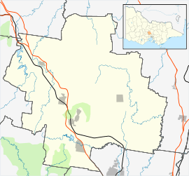
Carlsruhe, Victoria
| Carlsruhe Victoria | |||||||||||||||
|---|---|---|---|---|---|---|---|---|---|---|---|---|---|---|---|
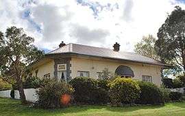 "River Lodge" at Carlsruhe | |||||||||||||||
 Carlsruhe | |||||||||||||||
| Coordinates | 37°17′S 144°30′E / 37.283°S 144.500°ECoordinates: 37°17′S 144°30′E / 37.283°S 144.500°E | ||||||||||||||
| Population | 456 (2011 census)[1] | ||||||||||||||
| Postcode(s) | 3442 | ||||||||||||||
| Elevation | 526 m (1,726 ft) | ||||||||||||||
| Location | |||||||||||||||
| LGA(s) | Shire of Macedon Ranges | ||||||||||||||
| State electorate(s) | Macedon | ||||||||||||||
| Federal Division(s) | Bendigo, McEwen | ||||||||||||||
| |||||||||||||||
Carlsruhe (/ˈkɑːrlzruː/) is a small rural town in the Shire of Macedon Ranges between Woodend and Kyneton, alongside the old Calder Highway, although now bypassed by the Calder Freeway. It is approximately 50 minutes from both Melbourne and Bendigo. At the 2011 census, Carlsruhe and the surrounding area had a population of 456.[1]
History
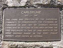
Carlsruhe was initially a sheep run established in August 1837 by Charles Ebden. Carlsruhe was the first rural property north of the Port Phillip settlement. It was named after Karlsruhe, Germany, where Ebden received part of his education. Although Carlsruhe is named after the German city, the German pronunciation of the name is very different from the Australian town which is pronounced using English spelling conventions. This is because in German the final "e" is pronounced with an "uh sound, whereas in English the "e" it is silent when at the end of a word.
Carlsruhe has a graveyard with many tombstones dating back to the 19th century.
A township was established in the 1850s; the post office opened on 1 September 1854, closed after a few months and reopened in 1858. After the railway arrived in 1862, Carlsruhe Railway Station post office opened some distance away, in October 1865. The original Carlsruhe post office closed in 1957; in July 1958 the name of the Railway Station post office was changed to Carlsruhe; this office closed in March 1965.[2]
Gallery
 |
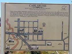 |
| On a cairn in the centre of Carlsruhe | A map on display in Carlsruhe |
See also
References
- 1 2 Australian Bureau of Statistics (31 October 2012). "Carlsruhe (State Suburb)". 2011 Census QuickStats. Retrieved 9 December 2014.

- ↑ Premier Postal History, Post Office List, retrieved 2008-11-13
External links
- Charles Hotson Ebden in Australian Dictionary of Biography
- Pictures, history, maps etc.