Shire of Moyne
| Shire of Moyne Victoria | |||||||||||||||
|---|---|---|---|---|---|---|---|---|---|---|---|---|---|---|---|
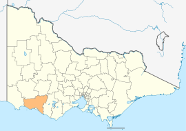 Location in Victoria | |||||||||||||||
| Population | 16,495 (2016 census)[1] | ||||||||||||||
| • Density | 3.0111/km2 (7.7988/sq mi) | ||||||||||||||
| Established | 1994 | ||||||||||||||
| Gazetted | 23 September 1994[2] | ||||||||||||||
| Area | 5,478 km2 (2,115.1 sq mi) | ||||||||||||||
| Mayor | Cr Mick Wolfe | ||||||||||||||
| Council seat | Port Fairy | ||||||||||||||
| Region | Barwon South West | ||||||||||||||
| State electorate(s) | |||||||||||||||
| Federal Division(s) | Wannon | ||||||||||||||
 | |||||||||||||||
| Website | Shire of Moyne | ||||||||||||||
| |||||||||||||||
The Shire of Moyne is a local government area in the Barwon South West region of Victoria, Australia, located in the south-western part of the state. It covers an area of 5,478 square kilometres (2,115 sq mi) and at the 2016 Census had a population of approximately 16,500. It includes the towns of Port Fairy, Koroit, Mortlake, Macarthur, Peterborough, Caramut, Ellerslie, Framlingham, Garvoc, Hawkesdale, Kirkstall, Panmure, Mailors Flat, Purnim, Wangoom and Woolsthorpe. It also entirely surrounds the City of Warrnambool, a separate local government area. It was formed in 1994 from the amalgamation of the Shire of Belfast, Shire of Minhamite, Borough of Port Fairy, and parts of the Shire of Mortlake, Shire of Warrnambool, Shire of Dundas, Shire of Mount Rouse and Shire of Hampden.[2]
The Shire is governed and administered by the Moyne Shire Council; its seat of local government and administrative centre is located at the council headquarters in Port Fairy, it also has service centres located in Macarthur and Mortlake. The Shire is named after the Moyne River, a major geographical feature that meanders through the LGA.
The industry base for the area includes: Dairy, beef cattle, sheep, vegetable production, manufacturing (quarrying, food products, pharmaceuticals, seafood), tourism.
Council
Current composition
The council is composed of seven councillors elected to represent an unsubdivided municipality.[3]
| Ward | Councillor | Notes | |
|---|---|---|---|
| Unsubdivided | Jim Doukas | ||
| Daniel Meade | |||
| Jordan Lockett | Deputy Mayor | ||
| Colin Ryan | |||
| Jill Parker | |||
| Ian Smith | |||
| Mick Wolfe | Mayor | ||
Administration and governance
The council meets in the council chambers at the council headquarters in the Port Fairy Municipal Offices, which is also the location of the council's administrative activities. It also provides customer services at both its administrative centre in Port Fairy, and its service centres in Macarthur and Mortlake.
See also
References
- ↑ Australian Bureau of Statistics (27 June 2017). "Moyne (S)". 2016 Census QuickStats. Retrieved 28 November 2017.

- 1 2 Victoria Government Gazette – Online Archive (1837–1997). "S63 of 1994: Order estg (Part 4) the Shire of Moyne". State Library of Victoria. State Government of Victoria (published 23 September 1994). p. 4. Retrieved 10 January 2014.
- ↑ Local Government in Victoria. "Moyne Shire Council". Department of Transport, Planning and Local Infrastructure. State Government of Victoria. Retrieved 12 January 2017.
External links
![]()
- Moyne Shire Council official website
- Metlink local public transport map
- Link to Land Victoria interactive maps
Coordinates: 38°22′S 142°14′E / 38.367°S 142.233°E