Wartime, Saskatchewan
| Wartime | |
|---|---|
| Unincorporated community | |
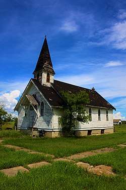 Old church in Wartime | |
 Wartime  Wartime | |
| Coordinates: 51°07′30″N 108°06′47″W / 51.1250°N 108.1130°W | |
| Country |
|
| Province |
|
| Region | Southwest |
| Census division | 8 |
| Rural Municipality | Monet No. 257 |
| Government | |
| • Type | Municipal |
| • Governing body | Rural Municipality of Monet |
| Time zone | UTC-6 (CST) |
| Area code(s) | 306 |
| Highways |
|
| Railways | Canadian Pacific Railway |
| [1][2][3][4] | |
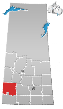
Wartime is an unincorporated community, within the Rural Municipality of Monet No. 257, Saskatchewan, Canada. The community is located along Highway 44 approximately 13 km west of Elrose.
See also
References
- ↑ National Archives, Archivia Net, Post Offices and Postmasters, archived from the original on 2006-10-06
- ↑ Canadian Textiles Institute. (2005), CTI Determine your provincial constituency, archived from the original on 2007-09-11
- ↑ Government of Saskatchewan, MRD Home. "Municipal Directory System". Archived from the original on 2016-01-15. Retrieved 2014-12-16.
- ↑ Commissioner of Canada Elections, Chief Electoral Officer of Canada (2005), Elections Canada On-line, archived from the original on 2007-04-21
Places adjacent to Wartime, Saskatchewan | ||||||||||
|---|---|---|---|---|---|---|---|---|---|---|
| ||||||||||
| Subdivisions | |
|---|---|
| Communities | |
| Cities | |
| Topics |
|
| |
Coordinates: 51°12′50″N 108°11′30″W / 51.21389°N 108.19167°W
This article is issued from
Wikipedia.
The text is licensed under Creative Commons - Attribution - Sharealike.
Additional terms may apply for the media files.