Eyre, Saskatchewan
| Eyre, Saskatchewan | |
|---|---|
| Unincorporated Hamlet | |
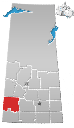
 Location of Eyre in Saskatchewan | |
| Coordinates: 51°16′00″N 109°49′03″W / 51.2667250°N 109.8174518°W | |
| Country |
|
| Province |
|
| Region | Southwest Saskatchewan |
| Census division | 8 |
| Rural Municipality | Chesterfield |
| Established | 1910 |
| Post Office Established | August 1, 1914 |
| Post Office Closed | December 9, 1963 |
| Postal code | NA |
| Area code(s) | 306 |
| Highways | Highway 44 |
| [1] | |
Eyre[2] is a ghost town in Chesterfield Rural Municipality, Saskatchewan, Canada. Originally established by the Jewish Colonization Association. The Jewish block settlement was established in 1910 mostly of immigrants from Russia and some from the United States. [3]
See also
References
- ↑ National Archives, Archivia Net, Post Offices and Postmasters, retrieved 2011-08-01
- ↑ "Canadian Geographical Names Data Base Search - Eyre". Natural Resources Canada. Retrieved 2011-08-01.
- ↑ Feldman, Anna, JEWISH RURAL SETTLEMENTS, Encyclopedia of Saskatchewan - University of Regina, retrieved 2011-08-01
Places adjacent to Eyre, Saskatchewan | |
|---|---|
Coordinates: 51°16′00″N 109°49′03″W / 51.2667250°N 109.8174518°W
This article is issued from
Wikipedia.
The text is licensed under Creative Commons - Attribution - Sharealike.
Additional terms may apply for the media files.