Rural Municipality of Newcombe No. 260
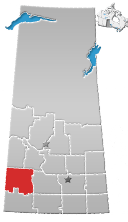
Newcombe No. 260 (2006 Population 361) is a rural municipality in west-central Saskatchewan, Canada encompassing 1,075.60 square kilometers in area. The rural municipality is at the intersection of Highway 21 and Highway 44. The Lemsford Ferry is located within the rural municipality. The rural municipality maintains its office in Glidden, Saskatchewan.[1] The rural municipality in conjunction with the provincial government is in charge of maintenance of highways in its area. The rural municipality was established in 1911 and is named after Allan Simpson Newcombe who played a leadership role in establishing the Boston Colony of immigrants from Massachusetts. Glidden is named after Charles Glidden (an immigrant from Paw Paw, Michigan) who sold the town site to the Canadian Pacific Railway.[2]
Statistics
| Canada census – Rural Municipality of Newcombe No. 260 community profile | |||
|---|---|---|---|
| 2006 | |||
| Population: | 361 (-10.9% from 2001) | ||
| Land area: | 1,075.60 km2 (415.29 sq mi) | ||
| Population density: | 0.3/km2 (0.78/sq mi) | ||
| Median age: | 39.8 (M: 42.0, F: 36.8) | ||
| Total private dwellings: | 128 | ||
| Median household income: | $43,918 | ||
| References: 2006[3] earlier[4] | |||
Communities and localities
The following urban municipalities are surrounded by the Rural Municipality of Newcombe No. 260:
- none
- none
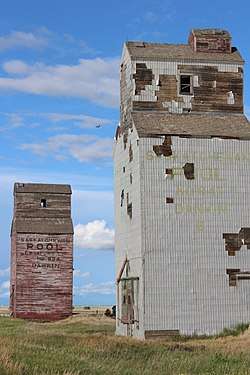
- Gildden, (seat of municipality)
- none
The following hamlets are located within the Rural Municipality of Newcombe No. 260:
- none
- none
- none
Heritage properties
There is one designated heritage property:
- Ukrainian Catholic Parish of St. John the Baptist - Constructed in 1944 the church is located 20 km southwest of Kindersley. The site also contains a one-room school that was related to the site in 1961 for use as a church hall. Religious services were last conducted at the church in 1986.[5]
References
- ↑ Saskatchewan Municipal Database
- ↑ Sask Biz
- ↑ "2006 Community Profiles". Canada 2006 Census. Statistics Canada. March 30, 2011. Retrieved 2009-02-24.
- ↑ "2001 Community Profiles". Canada 2001 Census. Statistics Canada. February 17, 2012.
- ↑ Ukrainian Catholic Parish of St. John the Baptist
Coordinates: 51°02′33″N 109°06′40″W / 51.04250°N 109.11111°W