Kisoro District
| Kisoro District | |
|---|---|
| District | |
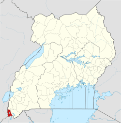 District location in Uganda | |
| Coordinates: 01°17′S 29°41′E / 1.283°S 29.683°ECoordinates: 01°17′S 29°41′E / 1.283°S 29.683°E | |
| Country |
|
| Region | Western Region |
| Sub-region | Kigezi sub-region |
| Capital | Kisoro |
| Area | |
| • Total | 701.4 km2 (270.8 sq mi) |
| • Land | 644.6 km2 (248.9 sq mi) |
| • Water | 56.8 km2 (21.9 sq mi) |
| Population (2012 estimate) | |
| • Total | 254,300 |
| • Density | 362.6/km2 (939/sq mi) |
| Time zone | UTC+3 (EAT) |
| Website |
www |
Kisoro District is a district in the Western Region of Uganda. The town of Kisoro is the site of the district headquarters.
Location
Kisoro District is bordered by Kanungu District to the north, Kabale District to the east, Rwanda to the south, and the Democratic Republic of the Congo to the west. The town of Kisoro is approximately 45 kilometres (28 mi), by road, west of Kabale, the largest town in the sub-region.[1]
Population
In 1991, the national population census estimated the district population at 186,870. The population was estimated at 220,300 during the 2002 national census. The annual population growth rate in the district was calculated at 1.5 percent. In 2012, the population was estimated at 254,300.[2]
Religion
As of September 2002, the religious affiliations of the district residents broke down as follows: Christianity - 95.8 percent, Islam - 0.8 percent, Other - 1.3 percent, None - 2.2 percent.[3]
Tourist attractions
- Bwindi Impenetrable Forest National Park, one of only four national parks in the world where the African mountain gorilla can be observed in the wild.
- Mgahinga Gorilla National Park has mountain gorillas and covers three of the eight Virunga Volcanoes (Muhabura, Gahinga, and Sabyinyo) all of which lie on the Uganda-Rwanda border.
References
- ↑ "Distance Between Kabale and Kisoro With Map". Globefeed.com. Retrieved 21 May 2014.
- ↑ "Estimated Population of Kisoro District In 1991, 2002 & 2012". Citypopulation.de. Retrieved 21 May 2014.
- ↑ "Religious Affiliations Among Ugandans By District As of 2002" (PDF). Uganda Bureau of Statistics. Retrieved 21 May 2014.