Balkan Region
Coordinates: 40°0′N 55°0′E / 40.000°N 55.000°E
| Balkan | |
|---|---|
| Region | |
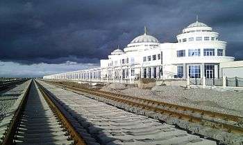
 Balkan region in Turkmenistan | |
| Country | Turkmenistan |
| Capital | Balkanabat |
| Area | |
| • Total | 139,270 km2 (53,770 sq mi) |
| Population (2005) | |
| • Total | 553,500 |
| • Density | 4.0/km2 (10/sq mi) |
Balkan Region (Turkmen: Balkan welaýaty, Балкан велаяты, بلقان ولايتى) is one of the regions of Turkmenistan. It is in the far west of the country, bordering Uzbekistan, Kazakhstan, the Caspian Sea, and Iran. Its capital is Balkanabat, formerly known as Nebit Dag. Balkan is Turkish for "Wooded mountain". It has an area of 139,270 square kilometers and a population of approximately 553,500 people (2005 est.).[1] Its population density of 3.3 persons per square kilometer is the lowest in Turkmenistan.
Other cities include: Bereket, Türkmenbaşy, Gumdag, Serdar, Hazar, Etrek, Esenguly.
The Balkan Region has significant energy reserves, which account for 94% of Turkmenistan's natural gas production and 12% of its petroleum production. It also generates 18% of the country's electric power. Due to the very low water supply, agriculture is negligible, and only 4.5% of Turkmenistan's arable lands are within the province.
Off its Caspian shores the Balkan Region includes the island of Ogurja Ada, the most important island in Turkmenistan and one of the largest in the Caspian Sea.
Districts
Balkan Province (Balkan welaýaty) is subdivided into 6 districts (etrap, plural etraplar):[2][3]
- Bereket (previously Gazanjik)
- Esenguly
- Etrek (previously Gyzylektrek)
- Magtymguly (previously Garry Gala)
- Serdar (previously Gyzylarvat)
- Türkmenbaşy
As of January 1, 2017, the province includes 10 cities (города or şäherler), 13 towns (посёлки or şäherçeler), 33 rural or village councils (сельские советы or geňeşlikler), and 112 villages (села, сельские населенные пункты or obalar).[3]
- Cities include:
- Balkanabat (formerly Nebit-Dag)
- Bereket (formerly Gazanjyk, (Russian: Казанджик or Газанджык))
- Garabogaz (formerly Bekdaş)
- Gumdag
- Hazar (formerly Çeleken)
- Serdar (formerly Kyzyl-Arvat, Gyzylarbat)
- Türkmenbaşy City (formerly Krasnovodsk)
See also
References
- ↑ Statistical Yearbook of Turkmenistan 2000-2004, National Institute of State Statistics and Information of Turkmenistan, Ashgabat, 2005.
- ↑ Türkmenistanyň Mejlisi (2010–2018). "Türkmenistanyň dolandyryş-çäk birlikleriniň Sanawy". Türkmenistanyş Mejlisiniň Karary. Ashgabat. This document is reproduced online at https://wiki.openstreetmap.org/wiki/Districts_in_Turkmenistan.
- 1 2 "Административно-территориальное деление Туркменистана по регионам по состоянию на 1 января 2017 года".
Places adjacent to Balkan Region | |
|---|---|
Links
| Wikivoyage has a travel guide for Balkan Province. |
Region (capital) | |
|