Jász-Nagykun-Szolnok County
| Jász-Nagykun-Szolnok County Jász-Nagykun-Szolnok megye | |||
|---|---|---|---|
| Counties of Hungary | |||
_3.jpg)  _3.jpg) | |||
| |||
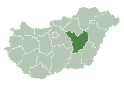 Jász-Nagykun-Szolnok County within Hungary | |||
| Country |
| ||
| Region | Northern Great Plain | ||
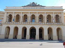
| County seat | Szolnok | ||
| Districts | |||
| Government | |||
| • President of the General Assembly | Dr. Sándor Kovács (Fidesz-KDNP) | ||
| Area | |||
| • Total | 5,581.61 km2 (2,155.07 sq mi) | ||
| Area rank | 8th in Hungary | ||
| Population (2015) | |||
| • Total | 379,897[1] | ||
| • Rank | 9th in Hungary | ||
| Postal code | 50xx – 54xx | ||
| Area code(s) | (+36) 56, 57, 59 | ||
| ISO 3166 code | HU-JN | ||
| Website |
www | ||
Jász-Nagykun-Szolnok (Hungarian: Jász-Nagykun-Szolnok megye, pronounced [ˈjaːs ˈnɒckun ˈsolnok]) is the name of an administrative county (comitatus or megye) in Hungary. It lies in central Hungary and shares borders with the Hungarian counties Pest, Heves, Borsod-Abaúj-Zemplén, Hajdú-Bihar, Békés, Csongrád, and Bács-Kiskun. The rivers Tisza and Körös flow through the county. The capital of Jász-Nagykun-Szolnok county is Szolnok. Its area is 5582 km². The county is named after the Ossetians (Jasz) and Cumans (Kun) who settled there, along with Szolnok. The county was part of the Danube–Criș–Mureș–Tisa Euroregion between 1997 and 2004.
Geography
This county has a total area of 5,582 km2 (2,155 sq mi) – 6,00% of Hungary.
Neighbouring counties
- Heves and Borsod-Abaúj-Zemplén County in the North.
- Hajdú-Bihar and Békés County in the East.
- Csongrád County in the South.
- Bács-Kiskun and Pest County in the West.
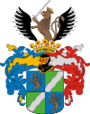
Symbols
Coat of arms and flag
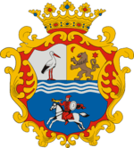
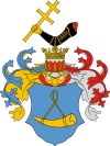
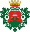
The county's coat of arms was recreated in 1991 from the coats of arms of the former Jászkun periphery, with the crown and frame decoration on it. It consists of the unification of the coat of arms of Jászság, Nagykunság and former Exterior-Szolnok County. The upper part is divided into two equally spaced vertices from top to bottom.[2]
 |
|
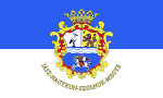
The flag is vertically divided into two equal sections (blue and white), with the coat of arms on it, and the county's name embroidered with gold thread under the coat of arms. Its ratio is 2:1. The use of both coat of arms and flag is regulated by the county council.[3]
Demographics
Religion in Jász-Nagykun-Szolnok County (2011 census)
In 2015, it had a population of 379,897 and the population density was 68/km².
| Year | County population[4] | Change |
|---|---|---|
| 1949 | 449,551 | n/a |
| 1960 | 2.62% | |
| 1970 | -5.08% | |
| 1980 | 1.77% | |
| 1990 | -4.50% | |
| 2001 | -2.27% | |
| 2011 | -7.05% |
Ethnicity
Besides the Hungarian majority, the main minorities are the Roma (approx. 19,000), German and Romanian (500).
Total population (2011 census): 386,594
Ethnic groups (2011 census):[5]
Identified themselves: 344,488 persons:
- Hungarians: 323,293 (93.85%)
- Gypsies: 18,935 (5.50%)
- Others and indefinable: 2,260 (0.66%)
Approx. 56,000 persons in Jász-Nagykun-Szolnok County did not declare their ethnic group at the 2011 census.
Religion
Religious adherence in the county according to 2011 census:[6]
- Catholic – 124,331 (Roman Catholic – 123,208; Greek Catholic – 1,106);
- Reformed – 42,968;
- Evangelical – 1,127;
- other religions – 4,312;
- Non-religious – 108,247;
- Atheism – 4,651;
- Undeclared – 100,958.
Regional structure
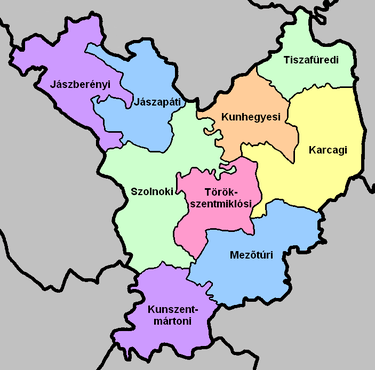
| № | English and Hungarian names |
Area (km²) |
Population (2011) |
Density (pop./km²) |
Seat | № of municipalities |
| 1 | Jászapáti District Jászapáti járás |
544.45 | 33,172 | 61 | Jászapáti | 9 |
| 2 | Jászberény District Jászberényi járás |
617.01 | 51,274 | 83 | Jászberény | 9 |
| 3 | Karcag District Karcagi járás |
857.26 | 43,226 | 50 | Karcag | 5 |
| 4 | Kunhegyes District Kunhegyesi járás |
464.58 | 20,045 | 43 | Kunhegyes | 7 |
| 5 | Kunszentmárton District Kunszentmártoni járás |
576.49 | 36,147 | 63 | Kunszentmárton | 11 |
| 6 | Mezőtúr District Mezőtúri járás |
725.74 | 28,191 | 39 | Mezőtúr | 5 |
| 7 | Szolnok District Szolnoki járás |
914.48 | 118,241 | 129 | Szolnok | 18 |
| 8 | Tiszafüred District Tiszafüredi járás |
417.05 | 19,559 | 47 | Tiszafüred | 7 |
| 9 | Törökszentmiklós District Törökszentmiklósi járás |
464.54 | 36,739 | 79 | Törökszentmiklós | 7 |
| Jász-Nagykun-Szolnok County | 5,581.61 | 386,594 | 69 | Szolnok | 78 | |
|---|---|---|---|---|---|---|
Transport
Road network
In 2012, Jász-Nagykun-Szolnok County has a dense network of public roads, in total length of 1,330 km, of which 112 km are primary and 283 km are secondary main roads.[7] Inland, connections are provided by 935 km of county and communal roads and 14 km are covered with light road surfaces.
- Highway network
_Otszogletu_kek_tabla.svg.png)
_Otszogletu_kek_tabla.svg.png)
_Otszogletu_kek_tabla.svg.png)
- Road network
_Otszogletu_zold_tabla.svg.png)

_Otszogletu_zold_tabla.svg.png)
_Otszogletu_zold_tabla.svg.png)
_Otszogletu_zold_tabla.svg.png)
_Otszogletu_zold_tabla.svg.png)
_Otszogletu_zold_tabla.svg.png)
_Otszogletu_zold_tabla.svg.png)
_Otszogletu_zold_tabla.svg.png)
_Otszogletu_zold_tabla.svg.png)
- 402 runs from Szolnok-center to Main road 4.
_Otszogletu_zold_tabla.svg.png)
Rail network
At county level, double railway lines have a share of 35%, and the degree of electrification is over 45% (243 km) of existing railway lines. The length of railways that cross the county is 503 km.
Politics
The Jász-Nagykun-Szolnok County Council, elected at the 2014 local government elections, is made up of 19 counselors, with the following party composition:[8]
| Party | Seats | Current County Assembly | |||||||||||
|---|---|---|---|---|---|---|---|---|---|---|---|---|---|
| Fidesz-KDNP | 11 | ||||||||||||
| Movement for a Better Hungary (Jobbik) | 5 | ||||||||||||
| Hungarian Socialist Party (MSZP) | 2 | ||||||||||||
| Democratic Coalition (DK) | 1 | ||||||||||||
Presidents of the General Assembly
| List of Presidents, from 1990[9] | |
|---|---|
| Lajos Boros (MDF) | 1990–1994 |
| Imre Iváncsik (MSZP) | 1994–1998 |
| Lajos Búsi (Fidesz) | 1998–2002 |
| István Tokár (MSZP) | 2002–2006 |
| Andor Fejér (Fidesz-KDNP) | 2006–2010 |
| Sándor Kovács (Fidesz-KDNP) | 2010– |
Municipalities
Jász-Nagykun-Szolnok County has 1 urban county, 21 towns, 4 large villages and 52 villages.
- City with county rights
(ordered by population, as of 2011 census)

- Towns


- Villages
- Alattyán
- Berekfürdő
- Cibakháza

- Csataszög
- Csépa
- Cserkeszőlő
- Fegyvernek
- Hunyadfalva
- Jánoshida
- Jászágó
- Jászalsószentgyörgy
- Jászboldogháza
- Jászdózsa
- Jászfelsőszentgyörgy
- Jászivány
- Jászjákóhalma
- Jászladány
- Jászszentandrás
- Jásztelek
- Kengyel
- Kétpó
- Kőtelek
- Kuncsorba
- Kunmadaras
- Mesterszállás
- Mezőhék
- Nagyiván
- Nagykörű
- Nagyrév
- Öcsöd
- Örményes
- Pusztamonostor
- Rákócziújfalu
- Szajol
- Szászberek
- Szelevény
- Tiszabő
- Tiszabura
- Tiszaderzs
- Tiszagyenda
- Tiszaigar
- Tiszainoka
- Tiszajenő
- Tiszakürt
- Tiszaörs
- Tiszapüspöki
- Tiszaroff
- Tiszasas
- Tiszasüly
- Tiszaszentimre
- Tiszaszőlős
- Tiszatenyő
- Tiszavárkony
- Tomajmonostora
- Tószeg
- Vezseny
- Zagyvarékas
![]()
Gallery
- Szolnok Gallery (former synagogue) in Szolnok
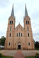 Holy Trinity Church in Törökszentmiklós
.JPG)
 Horn of Lehel in Jászberény
.jpg) Chapel in Kunhegyes
Chapel in Kunhegyes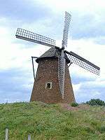 Windmill Hill in Kengyel
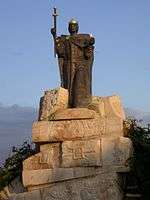 Statue of Stephen I of Hungary in Martfű
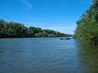 River Tisza near Tiszapüspöki
Notable people
Many famous people have been born or lived in present-day Jász-Nagykun-Szolnok County:
- Statesman: Miklós Horthy
- Politicians: János Tóth, István Antal, Sándor Fazekas, Mihály Varga
- Writers, poets and playwrights: Ferenc Verseghy, István Csukás
- Musicians Classical: Déryné Róza Széppataki, Zoltán Jeney, Zoltán Mága. Other: Pál Kalmár, Ferenc Molnár "Caramel"
- Scientists: Gábor Szegő, Kalman Laki, Albert Kónya, József Hámori, Avram Hershko
- Sportspeople: Aladár Gerevich, Bertalan Papp, Gábor Benedek, Tibor Csík, Pál B. Nagy, Géza Csapó
- Actors, entertainers and film directors: Alexander Korda, Zoltan Korda, Vincent Korda, János Görbe, Gyula Szabó, Eszter Tamási
- Militarian: Lajos Czinege
- Businessman: Sándor Csányi
- Others: Gyula Németh, István Sándor
International relations

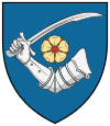
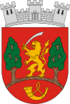
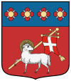
Jász-Nagykun-Szolnok County has a partnership relationship with:[10]
|
|
See also
- Cumans - the ancient nomadic warriors after whom the county is named
References
| Wikimedia Commons has media related to Jász-Nagykun-Szolnok County. |
| Wikivoyage has a travel guide for Jász-Nagykun-Szolnok County. |
- ↑ nepesseg.com, population data of Hungarian settlements
- ↑ magyarcimerek.hu, "Coat of arms of Jász-Nagykun-Szolnok County"
- ↑ Jász-Nagykun-Szolnok Megye lobogója (in Hungarian)
- ↑ népesség.com, "Jász-Nagykun-Szolnok megye népessége 1870-2015"
- ↑ 1.1.6. A népesség anyanyelv, nemzetiség és nemek szerint – Frissítve: 2013.04.17.; Hungarian Central Statistical Office (in Hungarian)
- ↑ 2011. ÉVI NÉPSZÁMLÁLÁS, 3. Területi adatok, 3.11 Jász-Nagykun-Szolnok megye, (in Hungarian)
- ↑ "Tájékoztató JÁSZ-NAGYKUN-SZOLNOK MEGYE állami közúthálózatának állapotáról és fejlesztlési lehetőségeiről" (PDF) (in Hungarian).
- ↑ Jász-Nagykun-Szolnok Megyei Közgyűlés tagjai 2014 - 2019, (in Hungarian)
- ↑ Önkormányzati választások eredményei (in Hungarian)
- ↑ A testvérmegyék rövid bemutatása (Jász-Nagykun-Szolnok megye)
External links
- Official site in Hungarian, English, German and French
- Új-Néplap (szoljon.hu) - The county portal
- Hungary at GeoHive
| City with county rights |
| |
|---|---|---|
| Towns | ||
| Large villages | ||
| Villages |
| |
| Other topics |
| |
Coordinates: 47°15′N 20°30′E / 47.250°N 20.500°E
| Authority control |
|---|