Interstate 91
| ||||||||||||
|---|---|---|---|---|---|---|---|---|---|---|---|---|
|
I-91 highlighted in red | ||||||||||||
| Route information | ||||||||||||
| Length | 290.37 mi[1] (467.31 km) | |||||||||||
| Major junctions | ||||||||||||
| South end |
| |||||||||||
| ||||||||||||
| North end |
| |||||||||||
| Location | ||||||||||||
| States | Connecticut, Massachusetts, Vermont | |||||||||||
| Counties |
CT: New Haven, Middlesex, Hartford MA: Hampden, Hampshire, Franklin VT: Windham, Windsor, Orange, Caledonia, Orleans | |||||||||||
| Highway system | ||||||||||||
| ||||||||||||

Interstate 91 (I-91) is an Interstate Highway in the New England region of the United States. It provides the primary north–south thoroughfare in the western part of the region. The Interstate's southern end is in New Haven, Connecticut,[2] at Interstate 95 and its northern end is at Derby Line, Vermont, a village in the town of Derby at the Canadian border, where it continues past the Derby Line-Rock Island Border Crossing as Autoroute 55. I-91 is the longest of three Interstate highways whose entire route is located within the New England states (the other two highways being I-89 and I-93) and is also the only primary (two-digit) Interstate Highway in New England to intersect all five of the others that run through the region. The largest cities along its route are New Haven, Connecticut, Hartford, Connecticut, and Springfield, Massachusetts, in order from south to north.
Route description
| mi[3][4] | km | |
|---|---|---|
| CT | 58.00 | 93.34 |
| MA | 54.90 | 88.35 |
| VT | 177.43 | 285.55 |
| Total | 290.33 | 467.24 |
I-91 is 290 miles (470 km) long and travels nearly straight north and south: 58 miles (93 km) in Connecticut, 55 miles (89 km) in Massachusetts, and 177 miles (285 km) in Vermont. I-91 parallels U.S. Route 5 (US 5) for all of its length, and many of the exits along I-91 provide direct or indirect access to the older highway. Much of the route of I-91 follows the Connecticut River, traveling from Hartford, Connecticut, northward to St. Johnsbury, Vermont.[5]
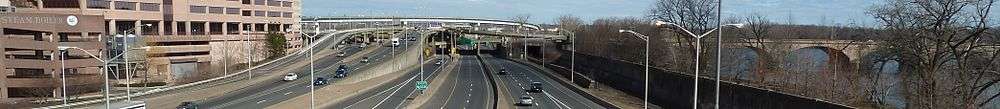
_in_Hartford%2C_Hartford_County%2C_Connecticut.jpg)
Connecticut
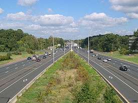
I-91 is the major north–south transportation corridor for the center of the state. It is the main route between the larger cities of New Haven, Hartford, and Springfield, Massachusetts. As such, it is almost always heavily trafficked (especially during rush hour), and maintains at least three lanes in each direction through Connecticut except for a short portion in Hartford at the interchange with I-84 and in Meriden at the interchange with Route 15. The three cities also serve as Connecticut's control points along its length of the Interstate.[6][7]
I-91 begins just east of downtown New Haven at an interchange with I-95 (the Connecticut Turnpike), and Route 34. At the bottom of the ramp for exit 5, US 5 begins at the first of its many interchanges with the freeway.[8] Leaving New Haven, I-91 follows a northeastward trek into North Haven, where it meets the southern end of the Route 40 expressway.[9] It travels through the eastern part of Wallingford before entering the eastern part of the city of Meriden. In Meriden, about halfway between Hartford and New Haven, I-91 sees a complex set of interchanges with the Wilbur Cross Parkway (Route 15), the Route 66 expressway, and its first spur route, I-691.[8] I-691 provides a westward link to I-84 and the city of Waterbury.[8] Leaving Meriden, I-91 enters Middlesex County as it briefly travels through the western part of Middletown before entering Cromwell, where it has an interchange with the Route 9 expressway.[10][11]
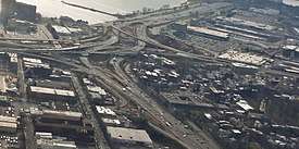
It then enters Hartford County in the town of Rocky Hill, and then enters Wethersfield, where it meets the southern end of the Route 3 expressway, which leads to Glastonbury and the Route 2 expressway via the Putnam Bridge over the Connecticut River. From here to St. Johnsbury, Vermont, I-91 parallels the river, never more than five miles (8.0 km) from its shore.[12] I-91 then enters the Hartford city limits. In Hartford, I-91 it has a set of interchanges with US 5/Route 15 (Wilbur Cross Highway), which provides access from I-91 north to I-84 east, and from I-84 west to I-91 south via the Charter Oak Bridge.[13] I-91 then has an interchange with I-84, where all other movements to and from I-84 take place. Before leaving the city limits, an HOV lane begins that has its own set of interchanges up to exit 38.[14]
I-91 then enters Windsor, where it meets the western end of its other Connecticut spur route, I-291. At the Windsor–Windsor Locks town line, it meets the eastern terminus of the Route 20 expressway, which provides direct access to Bradley International Airport.[7] A couple miles north, I-91 crosses the Connecticut River on the Dexter Coffin Bridge into East Windsor. After traveling through East Windsor and Enfield, it crosses the Massachusetts state line into Longmeadow at milepost 58.[8]
Massachusetts
I-91 travels 55 miles (89 km) through the Pioneer Valley of western Massachusetts paralleling the Connecticut River.[15] I-91 serves as the major transportation corridor through three Massachusetts counties, linking the cities of Springfield, Northampton, and Greenfield.[15] The three cities serve as the control cities listed on guide and mileage signs, along with Brattleboro, Vermont beginning with the first northbound conventional mileage sign (63 miles (101 km)) in Longmeadow.[3]
In Springfield, I-91 has an interchange with I-291 at exit 8, a 5.44-mile-long (8.75 km) spur going eastbound connecting with the Massachusetts Turnpike, for travelers going either east to Boston or west to Albany, New York.[16][17]
North of Springfield, I-91 briefly enters Chicopee itself where there is an interchange with the spur of I-391 at exit 12 before turning westward to cross the Connecticut River into West Springfield. I-391 provides direct access to Holyoke center, while I-91 continues on the western side of the river.[11]
Just after the river crossing, exit 14 is a major interchange with the Massachusetts Turnpike (I-90) before entering the city of Holyoke where exit 15 is located. Just after exit 16 U.S. Route 202, I-91 goes from three lanes to two lanes in each direction to the Vermont state line.[11]
After a short exit-less stretch, I-91 enters Northampton, passing the Northampton Airport and an oxbow lake. The towns of Hadley and Amherst, home to the main campus of the University of Massachusetts Amherst, are accessible from I-91 exits in Northampton via Route 9.[11]
Continuing north, I-91 enters Hatfield, and where it begins a straight section—nearly six miles (9.7 km) without a bend in the road. Several exits provide access to US 5 and Route 10 in Hatfield and Whately before entering Deerfield.[18]
I-91 has two exits in Greenfield. At exit 26, there is a rest area/visitor information center for Franklin County.[19] Exit 28 in Bernardston is the last exit in Massachusetts. Beyond exit 28, I-91 continues for about five miles (8.0 km) more before crossing into Vermont.[3]
Massachusetts is the only state traversed by I-91 where another numbered highway is concurrent with the Interstate (in this case, US 5, for a one-half mile (800 m) spur near the Springfield-Longmeadow town line and Route 2, for approximately three miles (4.8 km) in Greenfield).[20]
Vermont
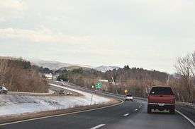
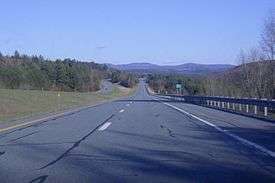
I-91 travels along the eastern border of Vermont and serves as a major transportation corridor for eastern Vermont and western New Hampshire. Many exits along Vermont's length of I-91 feature New Hampshire towns on the guide signs (for example, exit 3, which lists Brattleboro and Keene, as the points of access). The length of I-91 within Vermont is 177 miles (285 km) and has two lanes in each direction the entire way from the Massachusetts state line at Guilford to Derby Line at the Canadian border (nearly two-thirds of I-91's length) with 29 Vermont interchanges. The highway's rural character and long distances between exits in Vermont are in stark contrast to its south, where exits are more frequent and the road carries four lanes of traffic in each direction at some points. The major control cities in Vermont are Brattleboro, White River Junction, St. Johnsbury, and Newport. When re-entering northbound I-91 at exit 28 in Derby, the control city sign is for Canada. Of these destinations, only Newport is a city, although the other towns are sizable. In general, the road parallels its predecessor, US 5.
I-91 enters Vermont in the town of Guilford. Just before exit 1 in Brattleboro is the Vermont Welcome Center in Guilford. The first three Vermont exits (northbound) serve the town of Brattleboro. At exit 1, northbound Route 5 provides access to stores and a small industrial area before reaching the south end of the town's center, where a bridge crosses the Connecticut River into Hinsdale, New Hampshire via NH 119. Exit 2 (VT 9) provides access to the western village of the town (West Brattleboro), then continues west to Marlboro, Wilmington, and Bennington. Brattleboro's main retail strip is located at and just south of the exit 3 trumpet interchange and traffic circle. Following VT 9 eastward, one can reach Keene, New Hampshire in 15 miles (24 km).
After exit 3, I-91 heads north to travel through the towns of Dummerston, Putney, Westminster, Rockingham, Springfield, Weathersfield, Windsor, Hartland, and Hartford, home of the village of White River Junction. White River Junction, listed as a control city on mileage signs as far south as Greenfield, Massachusetts, is where I-91 and I-89 meet and provide access to many points in Vermont and New Hampshire, at exit 10.[21]
North of the interchange with I-89, I-91 continues towards St. Johnsbury and travels through the towns of Norwich, Thetford, Fairlee, Bradford, Newbury (with access to the village of Wells River), and Barnet, before coming to its next major intersection. Towns in New Hampshire on the other side of the river can also be easily accessed in this stretch. At exit 19 is the northern terminus of I-93, a major interstate highway in New England, which provides a direct route south through the White Mountains and to almost all major cities in New Hampshire. Just after exit 19, there are three exits for St. Johnsbury, including a major intersection with US 2. Along westbound US 2, the capital of Vermont, Montpelier, is eventually reached from I-91, although I-89 provides Montpelier with immediate Interstate access.
I-91 continues northward, now following the Passumpsic River valley. It travels through Vermont's Northeast Kingdom region and the town of Lyndon. Two exits in Lyndon serve the village of Lyndonville and Lyndon State College. After exit 24, I-91 departs Route 5, which it had been closely paralleling since the Massachusetts state line. I-91 follows the valley of Miller Run,[22][lower-alpha 1] and there are no convenient services until Barton at exit 25.[23]
The interstate proceeds through Sheffield. Here it reaches the highest point on the road, just north of mile marker 150 on Sheffield Heights, elevation 1,856 feet (566 m).[24]
After leaving the Heights, it enters Orleans County and follows the Barton River valley north with exits in Barton, Orleans, and Derby. Exit 29 is the final U.S. exit on I-91 just after mile marker 177 at Derby Line. Beyond the exit ramp, northbound motorists enter Canada Customs at Stanstead, Quebec, and continue into Canada on Autoroute 55 through the Eastern Townships.[25][26]
As with Connecticut and Massachusetts, US 5 closely parallels I-91 for their entire lengths in Vermont. While paralleling I-91 in Vermont, US 5 is never concurrent with the freeway, but remains its own two-lane road, except for a portion in White River Junction where it is a four-lane divided surface arterial.[27][28]
Traffic and the population of each successive town tend to diminish as the road proceeds northward. Average daily traffic count for 2015 were—St. Johnsbury (34,000), Lyndon (17,900), Barton (13,500), and Derby (Canadian Border) (10,300).[29]
History
A limited-access highway replacement for US 5 was planned at the federal level starting in 1944. A 1953 Massachusetts plan was funded by the Federal Aid Highway Act of 1956, along with spur I-291 (but not I-391). The Vermont section of I-91 was built in stages from 1958 to 1965.[30] In Massachusetts from Bernardston to Northampton, I-91 follows an abandoned right-of-way of the New York, New Haven and Hartford Railroad. To support plans for urban renewal along the "low value" waterfront, the highway crossed the Connecticut River to parallel active NYNHH railroad tracks on the Springfield side of the river, bypassing West Springfield, Massachusetts and Agawam, Massachusetts. Later, this path was perceived as cutting off the city from the river, restricting further commercial development. By 1960, a few miles in Massachusetts were completed, starting from the Connecticut and Vermont state lines. Massachusetts construction was completed from 1960s to 1970.[31] In the 1970s there were plans to extend I-91 along the Long Island Sound link across from New Haven, Connecticut, to Long Island in New York.[32] The extension would have continued southward to the southern shore of the island perhaps along the route of the current William Floyd Parkway in central Suffolk County. It would also provide easier access to New York City via the Long Island Expressway, as well as to The Hamptons via Sunrise Highway (New York State Route 27). The various proposals for a bridge were dropped after a 1979 study of the concept.[33] Vermont completed its last sections of I-91 in 1978.[34]
Starting in the 1990s, several rest areas were downgraded in Vermont, increasing distances between facilities. In 2008, Vermont closed the Springfield–Rockingham rest areas because of suspected use by drug abusers. In 2009, the northbound rest area in Hartford was closed, creating a 90-mile (145 km) gap in on-highway facilities. At the present time, there exist two intermediate rest areas with facilities in each direction, in addition to a welcome center at each end of the state. Several parking areas remain open.[35]
In the early 1990s after the I-284 project was canceled, the exit 44 interchange in East Windsor, Connecticut, was altered as it was designed to be part of the freeway. After alterations, exit 44 connected to Route 5 for all traffic to get on and off. As a result, exit 43 was shut down and closed in that same time frame. Exit 43 was a northbound exit/southbound entrance on State Route 510/Main Street in East Windsor, which was about 1,050 feet (320 m) away from exit 44.
After the September 11 attacks, there has been a seldom-staffed temporary border patrol checkpoint near White River Junction, Vermont, that is about 100 miles (160 km) from the Canadian border.[36]
In 2005, the Massachusetts Highway Department completed a rebuild of on- and off-ramps in Springfield, to reduce accidents caused by weaving near the tightly spaced exits.[31]
Future
During its construction in the 1960s, I-91 sliced through three Springfield neighborhoods: the North End, Metro Center, and the South End. Widely regarded as positive progress at the time, by 2011, Springfield's portion of I-91 was perceived as disrupting the urban fabric of each riverfront neighborhood, while in effect amputating everything east of the highway—the majority of the city—from the Connecticut River, the Connecticut River Walk Park, and the Basketball Hall of Fame. However, I-91 was erected without tunnels, footbridges, and other paths leading to the riverfront, and thus continues to pose logistical problems for people getting to the riverfront, which in turn poses problems for businesses that would like to set up along Springfield's riverfront. The placement of I-91 has left Springfield's riverfront virtually undeveloped aside from the sliver of land surrounding the Basketball Hall of Fame.[37]
In 2010, the Urban Land Institute made recommendations for how Springfield might reconnect with its riverfront, suggesting the most cost-effective but also the most development-limiting strategy (constructing pathways beneath I-91). No decision has been reached regarding those recommendations.[38] As of 2011, academic and civic studies are still underway. Preliminary findings indicate that I-91's placement negatively impacts tourism in Springfield's Metro Center—the site of many of Springfield's historic, cultural, and entertainment venues. Springfield's most popular tourist attraction, the riverfront Basketball Hall of Fame, is separated from Metro Center by a 20-foot (6.1 m) stone wall, buttressing an elevated portion of the six-lane Interstate 91, and greatly discouraging travel between the two areas. Academic suggestions that involve the demolition of the current highway and moving it to a less obtrusive site in the city have been proposed, including the demolition of the highway and following the original path suggested, Riverdale Road, and, least obtrusive but still requiring a great deal of work, a plan to construct numerous walkways beneath the elevated highway to better integrate the neighborhoods with the waterfront despite the highway's presence.[39]
Exit list
All interchanges in Massachusetts were to be renumbered to milepost-based numbers under a project scheduled to start in 2016. However, this project has now been indefinitely postponed.[40][26]
| State | County | Location[3][41] | mi[3][4][42] | km | Exit[43] | Destinations | Notes |
|---|---|---|---|---|---|---|---|
| Connecticut | New Haven | New Haven | 0.00 | 0.00 | – | Exit 48 on I-95 | |
| 0.09 | 0.14 | 1 | MLK Boulevard (Route 34) – Downtown New Haven | Southbound exit and northbound entrance; eastern terminus of Route 34 | |||
| — | Includes direct entrance ramp from Wooster Street / Franklin Street | ||||||
| 0.63 | 1.01 | 2 | Hamilton Street | Northbound exit only from I-95S entrance ramp Southbound exit and northbound entrance | |||
| 0.99– 1.02 | 1.59– 1.64 | 3 | Trumbull Street | Additional northbound entrance merge from State Street | |||
| 1.30 | 2.09 | 4 | State Street | Southbound exit only (via Humphrey Street) | |||
| 1.33 | 2.14 | 5 | Northbound exit only | ||||
| 1.44– 1.80 | 2.32– 2.90 | 6 | Left exit northbound; US 5 only appears on southbound signage | ||||
| 1.78– 2.15 | 2.86– 3.46 | 7 | Ferry Street – Fair Haven | Southbound exit and northbound entrance | |||
| 2.78 | 4.47 | 8 | |||||
| North Haven | 4.81 | 7.74 | 9 | Montowese Avenue (SR 17) | |||
| 6.63 | 10.67 | 10 | Also serves Quinnipiac University | ||||
| 7.72 | 12.42 | 11 | Northbound exit and southbound entrance | ||||
| 8.58 | 13.81 | 12 | |||||
| Wallingford | 10.94 | 17.61 | 13 | Access to Wharton Brook State Park via Connector; left exit northbound | |||
| 12.30 | 19.79 | 14 | Northbound signage | ||||
| 13.25 | 21.32 | Southbound signage | |||||
| 16.01 | 25.77 | 15 | |||||
| Meriden | 19.22 | 30.93 | 16 | East Main Street | Southbound exit from exit 17 | ||
| 18.87 | 30.37 | 17 | Northbound signage | ||||
| 19.74 | 31.77 | Southbound signage | |||||
| 20.11 | 32.36 | 18 | Eastern terminus of I-691; western terminus of Route 66 | ||||
| 20.74 | 33.38 | 19 | Baldwin Avenue / Preston Avenue | Southbound exit and northbound entrance | |||
| Middlesex | Middletown | 23.16 | 37.27 | 20 | Country Club Road / Middle Street | ||
| Cromwell | 25.74 | 41.42 | 21 | ||||
| 27.28– 27.43 | 43.90– 44.14 | 22 | Signed as exit 22N-S northbound and exits 22N (north) and 22S (south) southbound; exit 22S southbound on left | ||||
| Hartford | Rocky Hill | 29.39 | 47.30 | 23 | Via West Street (SSR 411) | ||
| 31.67 | 50.97 | 24 | |||||
| Wethersfield | 33.67– 33.76 | 54.19– 54.33 | 25 | Northbound signage; former proposed I-491 and part of proposed westward extension of former I-86 | |||
| 25N | Southbound signage | ||||||
| 25S | |||||||
| 34.13 | 54.93 | 26 | Old Wethersfield | Northbound exit part of exit 25 | |||
| Hartford | 35.54– 36.51 | 57.20– 58.76 | 27 | Ramps shared with Route 15 exit 87; northbound access via entrance to Route 15 north to exit 89 | |||
| 35.97 | 57.89 | 28 | Left entrance northbound | ||||
| 36.99 | 59.53 | 29 | Northbound exit and southbound left entrance | ||||
| 37.55 | 60.43 | 29A | Capitol Area | Via Whitehead Highway (SR 598); left exit and entrance northbound; former proposed I-484 | |||
| 38.34 | 61.70 | 30 | Southbound left exit and northbound entrance; I-84 exits 51–52 | ||||
| 38.18 | 61.44 | 31 | State Street | No northbound exit | |||
| 38.47 | 61.91 | 32A | Left exit northbound | ||||
| 32B | Trumbull Street | Exits only | |||||
| 39.55 | 63.65 | ♦ | Leibert Road | Southbound exit and northbound entrance for HOV only; southern end of HOV lanes | |||
| 39.86 | 64.15 | 33 | Jennings Road | ||||
| Windsor | 41.14 | 66.21 | 34 | ||||
| 42.20– 42.22 | 67.91– 67.95 | 35A-B | Signed as exits 35A (I-291) and 35B (Route 218); I-291 exits 1 & 2B | ||||
| 42.22 | 67.95 | ♦ | Northbound exit and southbound entrance for HOV only | ||||
| 43.52 | 70.04 | 36 | |||||
| 44.50 | 71.62 | ♦ | Northbound exit and southbound entrance for HOV only | ||||
| 37 | |||||||
| 45.99 | 74.01 | ♦ | Northbound exit and southbound entrance for HOV only | ||||
| 38 | Split into exits 38A (Route 75) and 38B (Day Hill Road) southbound | ||||||
| 46.69– 46.98 | 75.14– 75.61 | Northern end of HOV lanes | |||||
| 47.44 | 76.35 | 39&41 | Kennedy Road to Center Street | Northbound exit and southbound entrance | |||
| Windsor–Windsor Locks line | 48.22 | 77.60 | 40 | ||||
| Windsor Locks | 48.62 | 78.25 | 41&39 | Center Street | Southbound exit only | ||
| 49.58 | 79.79 | 42 | |||||
| Connecticut River | 49.58– 49.90 | 79.79– 80.31 | Dexter Coffin Bridge | ||||
| East Windsor | 50.33 | 81.00 | 44 | ||||
| 51.09 | 82.22 | 45 | |||||
| Enfield | 52.74 | 84.88 | 46 | ||||
| 55.57 | 89.43 | 47E | |||||
| 47W | |||||||
| 56.10 | 90.28 | 48 | |||||
| 57.73 | 92.91 | 49 | |||||
| 58.00 0.000 | 93.34 0.000 | Connecticut–Massachusetts line | |||||
| Massachusetts | Hampden | Springfield | 3.836 | 6.173 | 1 | Southern end of US 5 concurrency; southbound exit and northbound entrance | |
| 3.694 | 5.945 | 2 | No southbound exit | ||||
| 4.142 | 6.666 | 3 | Northern end of US 5 concurrency | ||||
| 4.722 | 7.599 | 4 | No northbound entrance; northbound exit combined with exit 3 | ||||
| 4.568 | 7.351 | 5 | Broad Street | Northbound exit only | |||
| 5.253 | 8.454 | 6 | Springfield Center (northbound) Union Street (southbound) | Old exit 5 merged with exit 6 | |||
| 5.989 | 9.638 | 7 | Hall of Fame Avenue – Downtown Springfield | Southbound exit and Northbound entrance only | |||
| 6.295 | 10.131 | 8 | I-90 only appears on northbound signage; I-291 exit 1 | ||||
| 6.677 | 10.746 | 9 | No southbound exit to or southbound entrance from Route 20A | ||||
| 7.172 | 11.542 | 10 | Main Street – Chicopee, North Springfield | No southbound entrance; southbound exit combined with exit 11 | |||
| 7.481 | 12.040 | 11 | Southbound exit and entrance only | ||||
| Chicopee | 8.289 | 13.340 | 12 | I-391 exit 1 | |||
| West Springfield | 9.177 | 14.769 | 13A | ||||
| 9.184 | 14.780 | 13B | |||||
| 11.547 | 18.583 | 14 | I-90 exit 4 | ||||
| Holyoke | 12.396 | 19.949 | 15 | Lower Westfield Road – Ingleside | |||
| 14.218 | 22.882 | 16 | |||||
| 15.188 | 24.443 | 17 | Signed as exit 17A (east) and exit 17B (west) northbound | ||||
| Hampshire | Northampton | 22.816 | 36.719 | 18 | |||
| 24.760 | 39.847 | 19 | Northbound exit and southbound entrance | ||||
| 26.016 | 41.869 | 20 | Southbound exit and northbound entrance | ||||
| 27.277 | 43.898 | 21 | |||||
| Hatfield | 29.938 | 48.181 | 22 | Northbound exit and southbound entrance | |||
| Franklin | Whately | 32.309 | 51.996 | 23 | Southbound exit and northbound entrance | ||
| 34.709 | 55.859 | 24 | No northbound entrance | ||||
| Deerfield | 35.891 | 57.761 | 25 | Southbound exit and northbound entrance | |||
| Greenfield | 43.011 | 69.219 | 26 | Southern end of Route 2 overlap; also serves John W. Olver Transit Center, Mass MoCA, Shelburne Falls, Bridge of Flowers | |||
| 45.752 | 73.631 | 27 | Northern end of Route 2 overlap; left exit and entry southbound | ||||
| Bernardston | 50.360 | 81.047 | 28 | Signed as exit 28A (north) and exit 28B (south) northbound | |||
| 54.90 0.000 | 88.35 0.000 | Massachusetts–Vermont line | |||||
| Vermont | Windham | Brattleboro | 7.480 | 12.038 | 1 | Also serves Vernon and Hinsdale NH | |
| 9.095 | 14.637 | 2 | Also serves Manchester via VT 30, Marlboro College, and Wilmington | ||||
| 11.550 | 18.588 | 3 | Also serves World Learning SIT Graduate Institute | ||||
| Putney | 17.952 | 28.891 | 4 | Also serves Landmark College | |||
| Town of Westminster | 28.610 | 46.043 | 5 | ||||
| Rockingham | 35.200 | 56.649 | 6 | Also serves Chester and Ludlow | |||
| Windsor | Springfield | 41.690 | 67.094 | 7 | Also serves Charlestown NH and the Fort at Number 4 | ||
| Weathersfield | 51.370 | 82.672 | 8 | Also serves Ludlow and Claremont NH | |||
| Hartland | 60.450 | 97.285 | 9 | ||||
| Hartford | 69.810 | 112.348 | 10 | Signed as exits 10B (southbound) and 10A (northbound); originally exits 10S and 10N respectively | |||
| 70.200 | 112.976 | 11 | Also serves VA Hospital | ||||
| 72.010 | 115.889 | 12 | |||||
| Norwich | 74.830 | 120.427 | 13 | Also serves Montshire Museum of Science | |||
| Orange | Thetford | 84.210 | 135.523 | 14 | Also serves Chelsea and Lyme NH | ||
| Fairlee | 91.540 | 147.319 | 15 | Also serves Lake Morey and Lake Fairlee | |||
| Bradford | 97.630 | 157.120 | 16 | Also serves Newbury and Piermont | |||
| Town of Newbury | 110.340 | 177.575 | 17 | Also serves South Ryegate and Groton | |||
| Caledonia | Barnet | 120.450 | 193.845 | 18 | Also serves West Barnet, Monroe NH, McIndoe Falls, and East Ryegate | ||
| Waterford–St. Johnsbury line | 128.250 | 206.398 | 19 | ||||
| St. Johnsbury | 128.890 | 207.428 | 20 | ||||
| 130.600 | 210.180 | 21 | Also serves Danville and Hardwick | ||||
| 132.550 | 213.319 | 22 | |||||
| Lyndon | 137.110 | 220.657 | 23 | Also serves Lyndon State College | |||
| 140.178 | 225.595 | 24 | Also serves Caledonia County Airport | ||||
| Orleans | Barton | 155.950 | 250.977 | 25 | Also serves Hardwick and Crystal Lake | ||
| Barton–Orleans– Irasburg tripoint | 161.410 | 259.764 | 26 | Also serves Lake Willoughby and Jay | |||
| Derby | 170.060 | 273.685 | 27 | Also serves Lake Memphremagog | |||
| 172.400 | 277.451 | 28 | Also serves Seymour Lake and Lake Memphremagog | ||||
| 177.269 | 285.287 | 29 | Last exit in the United States | ||||
| 177.432 | 285.549 | Derby Line–Rock Island Border Crossing | |||||
| Continuation into Quebec | |||||||
1.000 mi = 1.609 km; 1.000 km = 0.621 mi
| |||||||
See also


Notes
- ↑ Miller Run feeds southeast into the Passumpsic River.
References
- ↑ Federal Highway Administration (October 31, 2002). "Table 1: Main Routes of the Dwight D. Eisenhower National System of Interstate and Defense Highways as of October 31, 2002". Route Log and Finder List. Federal Highway Administration. Retrieved March 28, 2007.
- ↑ Google (June 8, 2009). "New Haven, CT" (Map). Google Maps. Google. Retrieved June 8, 2009.
- 1 2 3 4 5 Planning Division (2012). "Route Selection Page". Massachusetts Route Log Application. Massachusetts Department of Transportation. I-91 NB. Retrieved August 22, 2014.
- 1 2 Policy, Planning and Intermodal Development Division Traffic Research Unit (May 2013). 2012 (Route Log) AADTs for State Highways (PDF). Montpelier: Vermont Agency of Transportation. pp. 4–5. Retrieved March 8, 2015.
- ↑ "Background Information on the Interstate". Town of Berlin, Connecticut. Retrieved December 29, 2017.
- ↑ Boyle, Doe (2011). Fun with the Family Connecticut: Hundreds of Ideas for Day Trips with the Kids. Rowman & Littlefield. ISBN 978-0-7627-6879-0. Retrieved August 10, 2018 – via Google Books.
- 1 2 Bureau of Planning and Research (August 1984). I-91 Reconstruction from Hartford to Enfield; I-291 Construction from Windsor to Manchester: Environmental Impact Statement. [Wethersfield, CT]: [Connecticut Department of Transportation]. p. 49. OCLC 53099516. Retrieved August 10, 2018 – via Google Books.
- 1 2 3 4 "Highway Log" (PDF). Connecticut Department of Transportation. Archived from the original (PDF) on July 26, 2015. Retrieved August 21, 2016.
- ↑ Connecticut Department of Transportation. "ConnDOT: Nighttime Installation of Rumble Strips on Route 40 in North Haven and Hamden and I-91 in Wallingford". Connecticut Department of Transportation. Retrieved August 10, 2018.
- ↑ Google (August 10, 2018). "Route 9 Interchange" (Map). Google Maps. Google. Retrieved August 10, 2018.
- 1 2 3 4 "Interchanges" (PDF). ctps.org. Boston region Metropolitan Planning Organization. Retrieved August 10, 2018.
- ↑ "Interstate Route I-91 Corridor Planning Study" (PDF). pvpc.org. Pioneer Valley Planning Commission. Retrieved August 10, 2018.
- ↑ Connecticut Department of Transportation. "Department of Transportation Event Detail". www.ct.gov. The State of Connecticut. Retrieved August 10, 2018.
- ↑ "I-84 HOV Lanes-Hartford, Connecticut – Advancing Mobility – Research – CMAQ – Air Quality – Environment – FHWA". www.fhwa.dot.gov. The Federal Highway Administration. Retrieved 15 August 2018.
- 1 2 Olia, Maria (2013). Insiders' Guide to Massachusetts. Rowman & Littlefield. ISBN 978-1-4930-0163-7. Retrieved August 10, 2018 – via Google Bools.
- ↑ "I-91 Springfield viaduct project ahead of schedule". www.recorder.com. Greenfield Recorder. Retrieved August 10, 2018.
- ↑ Fay, Tony (8 April 2016). "Cone Zone Alert: Interstate 91 Exit 8". WWLP. Retrieved 15 August 2018.
- ↑ Google (August 10, 2018). "I-91 to 40 Old State Rd" (Map). Google Maps. Google. Retrieved August 10, 2018.
- ↑ "Service Plaza Locations". Mass.gov. Retrieved August 10, 2018.
- ↑ "Concurrent Roads" (PDF). ctps.org. Retrieved December 29, 2017.
- ↑ "I-91 to I-91". www.google.com/maps. Google Maps. Retrieved 15 August 2018.
- ↑ "Passumpsic River Valley" (PDF). dec.vermont.gov. Vermont Department of Environmental Conservation. Retrieved August 10, 2018.
- ↑ "Trucker's Exit Guide to Interstate 91" (PDF). truckerguide.com. Trucker Guide Inc. Retrieved August 10, 2018.
- ↑ "Highest Elevation on I-91 - Sheffield, Vermont - Elevation Signs on Waymarking.com". www.waymarking.com. Waymarking. Retrieved 15 August 2018.
- ↑ "I-91 to 1 Autoroute 55". www.google.com/maps. Google Maps. Retrieved 15 August 2018.
- 1 2 "Vermont I-91 Exits" (PDF). vtransmaps.vermont.gov. Vermont Transportation. Retrieved 15 August 2018.
- ↑ Inc, Fodor's Travel Publications (2004). Fodor's Where to Weekend Around Boston, 1st Edition. Fodor's Travel Publications. p. 197. ISBN 9781400013012. Retrieved 15 August 2018.
- ↑ "I-91 to 1 Autoroute 55 Route 5 Parallel". www.google.com/maps. Google Maps. Retrieved 15 August 2018.
- ↑ "Interstate 91 Traffic Statistics" (PDF). vtrans.vermont.gov. Vermont Agency of Transportation. Retrieved August 12, 2018.
- ↑ "Building of Vermont section". digital.vpr.net. Retrieved January 5, 2018.
- 1 2 "I-91 Springfield: MassDOT answers your questions about Interstate 91 reconstruction". masslive.com. Retrieved August 10, 2018.
- ↑ Madden, Steve. "Spanning the Sound". Newsday. Archived from the original on July 10, 2004. Retrieved September 18, 2015.
- ↑ Stannard, Charles (May 14, 2002). "The Bridge That Never Was: Cable Flap Brings To Mind Sound-Crossing Controversy". Hartford Courant. Retrieved September 18, 2015.
- ↑ Division for Historic Preservation (n.d.). "Vermont History Timeline". HistoricVermont.org. Vermont Agency of Commerce and Community Development. Archived from the original on September 27, 2011. Retrieved December 17, 2011.
- ↑ "Drugs, Sex Force Rest Stop Closure". Rutland Herald. Associated Press. December 10, 2008. Retrieved May 10, 2009.
- ↑ American Civil Liberties Union of Vermont (n.d.). "Border Patrol Stops". American Civil Liberties Union of Vermont. Archived from the original on February 13, 2012. Retrieved December 17, 2011.
- ↑ The Republican Editorials (February 26, 2010). "Editorial: Tapping Potential of Springfield's Riverfront". MassLive. Retrieved December 17, 2011.
- ↑ Office of Planning and Economic Development (2008). "River's Landing Project". City of Springfield, MA. Archived from the original on July 3, 2008. Retrieved December 17, 2011.
- ↑ Fay, Tony (29 January 2016). "Long term solutions: What could become of I-91 in Springfield?". WWLP.com/news. WWLP News. Retrieved 15 August 2018.
- ↑ Commonwealth of Massachusetts (2015). "Bid Solicitation FAP# HSIP-002S(874) Exit Signage Conversion to Milepost-Based Numbering System along Various Interstates, Routes and the Lowell Connector". COMMBUYS. Retrieved January 5, 2016.
- ↑ Division of Policy, Planning and Intermodal Development. "General Highway Maps". Vermont Agency of Transportation. Retrieved December 3, 2015.
- Town of Brattleboro, Windham County Archived December 8, 2015, at the Wayback Machine. (June 10, 2015)
- Urban Compact of Brattleboro–West Brattleboro, Windham County Archived December 8, 2015, at the Wayback Machine. (June 16, 2015)
- Town of Dummerston, Windham County Archived March 4, 2016, at the Wayback Machine. (June 10, 2015)
- Town of Putney, Windham County Archived December 8, 2015, at the Wayback Machine. (June 10, 2015)
- Town of Westminster, Windham County Archived December 8, 2015, at the Wayback Machine. (June 22, 2015)
- Town of Rockingham, Windham County Archived December 8, 2015, at the Wayback Machine. (June 18, 2015)
- Town of Springfield, Windsor County Archived December 8, 2015, at the Wayback Machine. (June 18, 2015)
- Town of Weathersfield, Windsor County Archived December 8, 2015, at the Wayback Machine. (June 11, 2015)
- Town of Hartland, Windsor County Archived December 8, 2015, at the Wayback Machine. (June 18, 2015)
- Town of Hartford, Windsor County Archived December 8, 2015, at the Wayback Machine. (June 19, 2015)
- Town of Norwich, Windsor County Archived December 8, 2015, at the Wayback Machine. (June 18, 2015)
- Town of Thetford, Orange County Archived December 8, 2015, at the Wayback Machine. (June 11, 2015)
- Town of Fairlee, Orange County Archived December 8, 2015, at the Wayback Machine. (June 18, 2015)
- Town of Bradford, Orange County Archived December 8, 2015, at the Wayback Machine. (June 11, 2015)
- Town of Newbury, Orange County Archived December 8, 2015, at the Wayback Machine. (June 11, 2015)
- Town of Barnet, Caledonia County Archived December 8, 2015, at the Wayback Machine. (June 19, 2015)
- Town of Waterford, Caledonia County Archived December 8, 2015, at the Wayback Machine. (June 18, 2015)
- Town of St. Johnsbury, Caledonia County Archived December 8, 2015, at the Wayback Machine. (June 18, 2015)
- Town of Lyndon, Caledonia County Archived December 8, 2015, at the Wayback Machine. (June 18, 2015)
- Town of Barton, Orleans County Archived December 8, 2015, at the Wayback Machine. (June 18, 2015)
- Village of Orleans, Orleans County Archived December 8, 2015, at the Wayback Machine. (June 18, 2015)
- Town of Irasburg, Orleans County Archived December 8, 2015, at the Wayback Machine. (June 18, 2015)
- Town of Derby, Orleans County Archived December 8, 2015, at the Wayback Machine. (June 16, 2015)
- Village of Derby Line, Orleans County Archived December 8, 2015, at the Wayback Machine. (June 17, 2015)
- ↑ Connecticut Department of Transportation Bureau of Policy and Planning Data Inventory and Statewide Coordination Division of Systems Information (December 31, 2014). Highway Log: Connecticut State Numbered Routes And Roads as of December 31, 2014 (PDF). Hartford: Connecticut Department of Transportation. pp. 163–172. Archived from the original (PDF) on July 26, 2015. Retrieved September 10, 2015.
- ↑ Massachusetts Department of Transportation (2014). "Exit Numbers and Names: Route I-91 (Longmeadow to Bernardston)". Massachusetts Department of Transportation. Retrieved August 22, 2014.
External links
| Wikimedia Commons has media related to Interstate 91. |
Route map:
- I-91 historical overview from bostonroads.com
- Mass. I-91 Current and Speculative Future Exit Numbers List
- Exit list by Nutmeg Roads
| Signed | |
|---|---|
| Unsigned | |
| Lists | |
| Other | |
Major Interstates highlighted | |
1Former | ||