Bradford, Vermont
| Bradford, Vermont | |
|---|---|
| Town | |
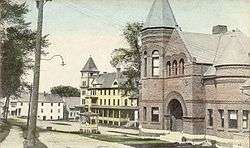
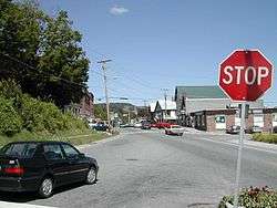 Main Street | |
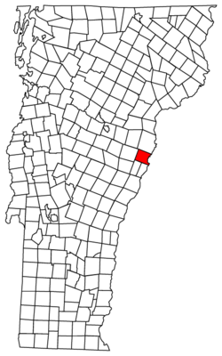 Located in Orange County, Vermont | |
 Location of Vermont with the U.S.A. | |
 Bradford, Vermont Located in Orange County, Vermont | |
| Coordinates: 43°59′41″N 72°7′58″W / 43.99472°N 72.13278°WCoordinates: 43°59′41″N 72°7′58″W / 43.99472°N 72.13278°W | |
| Country | United States |
| State | Vermont |
| County | Orange |
| Chartered | 1770 |
| Communities |
Bradford Bradford Center |
| Area | |
| • Total | 29.9 sq mi (77.4 km2) |
| • Land | 29.8 sq mi (77.2 km2) |
| • Water | 0.1 sq mi (0.2 km2) |
| Elevation | 425 ft (263 m) |
| Population (2000) | |
| • Total | 2,619 |
| • Density | 87.8/sq mi (33.9/km2) |
| • Households | 1,028 |
| • Families | 692 |
| Time zone | UTC-5 (EST) |
| • Summer (DST) | UTC-4 (EDT) |
| ZIP code | 05033 |
| Area code(s) | 802 |
| FIPS code | 50-07375[1] |
| GNIS feature ID | 1462046[2] |
| Website | bradford-vt.us |
Bradford is a town in Orange County, Vermont, United States. The population was 2,797 at the 2010 census. Bradford is located on the county's eastern border, bordering both the Connecticut River and New Hampshire, and is a commercial center for some of its surrounding towns.
History
The earliest name of the settlement was Wait's River Town or Waitstown,[3] in honor of Joseph Wait, a member of Rogers' Rangers.[4] The town was originally part of Gloucester County in the Province of New York before becoming part of Vermont.[3] In 1770, the town was established by New York patent: 3,000 acres (1200 hectares) were granted on May 3, 1770, and the town was named Mooretown after Sir Henry Moore, 1st Baronet, then the royal governor of New York.[3][4] On October 23, 1788, at the request of town's residents, the town was renamed Bradford by the Vermont General Assembly,[3] likely after Bradford, Massachusetts.[4] According to the Vermont Encyclopedia, Bradford "has always been an industrial and commercial center for the surrounding rural towns and villages."[4]
Geography
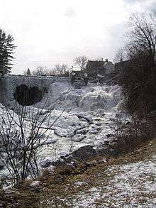
According to the United States Census Bureau, the town has a total area of 29.9 square miles (77.4 km2), of which 29.8 square miles (77.2 km2) is land and 0.1 square mile (0.2 km2) (0.20%) is water. The Waits River flows through Bradford in a southeasterly direction to its confluence with the Connecticut River, which forms the eastern boundary of the town.[3][5] The town rises from the river's meadows through low hills and river valleys and finally Wright's Mountain (at an elevation of 1,822 feet) close to the border with Newbury to the north.[3]
Bradford is bordered by the towns of Newbury to the north, West Fairlee and Fairlee to the south, and Corinth to the west.[6]
Piermont, New Hampshire lies across the Connecticut River to the east. The Piermont Bridge, a Pennsylvania truss bridge erected in 1928, connects Bradford and Piermont.[7]
Demographics
| Historical population | |||
|---|---|---|---|
| Census | Pop. | %± | |
| 1790 | 654 | — | |
| 1800 | 1,064 | 62.7% | |
| 1810 | 1,302 | 22.4% | |
| 1820 | 1,411 | 8.4% | |
| 1830 | 1,507 | 6.8% | |
| 1840 | 1,655 | 9.8% | |
| 1850 | 1,723 | 4.1% | |
| 1860 | 1,689 | −2.0% | |
| 1870 | 1,492 | −11.7% | |
| 1880 | 1,520 | 1.9% | |
| 1890 | 1,429 | −6.0% | |
| 1900 | 1,338 | −6.4% | |
| 1910 | 1,372 | 2.5% | |
| 1920 | 1,422 | 3.6% | |
| 1930 | 1,235 | −13.2% | |
| 1940 | 1,507 | 22.0% | |
| 1950 | 1,551 | 2.9% | |
| 1960 | 1,619 | 4.4% | |
| 1970 | 1,527 | −5.7% | |
| 1980 | 2,191 | 43.5% | |
| 1990 | 2,522 | 15.1% | |
| 2000 | 2,619 | 3.8% | |
| 2010 | 2,797 | 6.8% | |
| Est. 2014 | 2,765 | [8] | −1.1% |
| U.S. Decennial Census[9] | |||
As of the census[1] of 2000, there were 2,619 people, 1,028 households, and 692 families residing in the town. The population density was 87.8 people per square mile (33.9/km2). There were 1,217 housing units at an average density of 40.8 per square mile (15.8/km2). The racial makeup of the town was 97.71% White, 0.46% Black or African American, 0.46% Native American, 0.23% Asian, 0.15% Pacific Islander, and 0.99% from two or more races. Hispanic or Latino of any race were 0.61% of the population.
There were 1,028 households out of which 33.8% had children under the age of 18 living with them. 51.8% were married couples living together, 12.5% had a female householder with no husband present, and 32.6% were non-families. 25.5% of all households were made up of individuals and 11.8% had someone living alone who was 65 years of age or older. The average household size was 2.48 and the average family size was 2.98.
In the town, the population was spread out with 26.2% under the age of 18, 7.6% from 18 to 24, 25.5% from 25 to 44, 25.1% from 45 to 64, and 15.6% who were 65 years of age or older. The median age was 40 years. For every 100 females, there were 91.0 males. For every 100 females age 18 and over, there were 88.3 males.
The median income for a household in the town was $37,270, and the median income for a family was $42,128. Males had a median income of $30,865 versus $28,857 for females. The per capita income for the town was $18,452. About 7.9% of families and 11.3% of the population were below the poverty line, including 15.5% of those under age 18 and 8.1% of those age 65 or over.
Education
Bradford has two public schools: Bradford Elementary School for kindergarten through grade 6 and Oxbow High School for grades 7-12. Attached to Oxford High School is the Riverbend Career and Technical Center for adults, a vocational center. Total school enrollment for fiscal year 2017-2018 was 242 at Bradford Elementary[10] and approximately 373 at Oxbow/Riverbend.[11] While Bradford Elementary serves only the Town of Bradford, Oxbow/Riverbend is part of a supervisory union, and so has students from the surrounding area as well.[12]
A private school, the Connecticut River Academy, is also located in the town.[13]
Transportation
The town is crossed by Interstate 91 (6.42 miles (10.33 km) in the town), U.S. Route 5 (5.85 miles (9.41 km)) and Vermont Routes 25 and 25B (8.01 miles (12.89 km)).[14]
Sites of interest
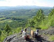
The town has a number of scenic views, including of the Connecticut River Valley, Waits River Valley, and White Mountains. Also of note is the view from Wright's Mountain.[15]
- Bradford Village Historic District – added to the National Register of Historic Places in 1975.[15]
- Bradford Academy/Woods School Building at 172 North Main Street – an 1893 building (with a 1935 addition) that has been held by the town under a 99-year lease. The building houses the town government offices, town police department, and Bradford Historical Society.[16]
- Bradford Public Library – designed by architect Lambert Packard and constructed in 1895.[17]
- Old Church Theater – Permanently located in a 1793 building behind the Congregational Church on Main Street, the Old Church Theater has presented over 28 years of summer productions geared for family entertainment. The organization moved to temporary quarters adjacent to the Orange East Senior Center in November 2017, while the permanent building undergoes restoration. The actors are local residents from various backgrounds and some have gone on to make a career in the theater world. The theater is open to anyone wishing to act, direct, work backstage, help with set design, ticket sales and more.[18][19]
Notable people
- John Putnam Chapin, mayor of Chicago; born in Bradford in 1810 and arrived in Chicago in 1832.[20]
- Charles Edgar Clark, captain of the USS Oregon during the Spanish–American War - born in Bradford in 1843.[21]
- Ned O'Gorman, poet and educator - spent part of his youth in Bradford.[22]
- Herbert Thomas Johnson, Adjutant General of the Vermont National Guard and namesake of Camp Johnson, the state National Guard Headquarters
- Albert Sleeper, 29th governor of Michigan - born in Bradford in 1862, moved to Michigan in 1884.[23]
- Abel Underwood, U.S. Attorney for Vermont and state circuit court judge. Born in Bradford.[24]
- John H. Watson, Chief Justice of the Vermont Supreme Court[25]
- James Wilson, first American globe maker - lived in Bradford[4]
- Jay Wright, poet - lives in Bradford[26]
References
- 1 2 "American FactFinder". United States Census Bureau. Archived from the original on 2013-09-11. Retrieved 2008-01-31.
- ↑ "US Board on Geographic Names". United States Geological Survey. 2007-10-25. Retrieved 2008-01-31.
- 1 2 3 4 5 6 Silas McKeen, A History of Bradford, Vermont (J.D. Clark & Son: Montpelier, Vermont: 1875), pp. 29-30.
- 1 2 3 4 5 "Bradford" in The Vermont Encyclopedia (eds. John J. Duffy, Samuel B. Hand & Ralph H. Orth: University of Vermont Press, 2003), p. 61.
- ↑ DeLorme (1996). Vermont Atlas & Gazetteer. Yarmouth, Maine: DeLorme. ISBN 0-89933-016-9
- ↑ Vermont Town and County Boundaries, Vermont Center for Geographic Information, Vermont Agency of Commerce and Community Development (accessed March 19, 2017).
- ↑ Tim Camerato, Repairs to Piermont-Bradford Bridge Raise Concerns, Valley News (November 14, 2016).
- ↑ "Annual Estimates of the Resident Population for Incorporated Places: April 1, 2010 to July 1, 2014". Retrieved June 4, 2015.
- ↑ "U.S. Decennial Census". United States Census Bureau. Archived from the original on May 12, 2015. Retrieved May 16, 2015.
- ↑ 2016-2017 BAGSD Annual Report
- ↑ Oxbow High School Profile 2015–2016 CEEB 460045
- ↑ Bradford Town Plan, pp. 19-21.
- ↑ Bradford Town Plan, p. 19.
- ↑ Bradford Town Plan, p. 73.
- 1 2 Bradford Town Plan, p. 70.
- ↑ Bradford Town Plan, p. 23.
- ↑ Bradford Town Plan, p. 30.
- ↑ Bradford Town Plan, p.29.
- ↑ Journal Opinion (newspaper) 01 November 2017
- ↑ Chaim M. Rosenberg, Yankee Colonies across America: Cities upon the Hills (Lexington Books, 2015), p. 74.
- ↑ Spencer C. Tucker, ""Clark, Charles Edgar" in The Encyclopedia of the Spanish–American and Philippine–American Wars: A Political, Social, and Military History, Vol. 1 (A-L) (ed. Spencer C. Tucker).
- ↑ Douglas Martin, Ned O'Gorman, 84, Dies; Poet Founded Innovative Harlem School, New York Times (March 7, 2014).
- ↑ Caryn Hannan, Michigan Biographical Dictionary (2008-09 ed., Vol. 1: Somerset Publishers: 1998), p. 253.
- ↑ Underwood, Lucien Marcus (1913). The Underwood Families of America. 1. Lancaster, PA: New Era Printing Company. p. 1.
- ↑ Bigelow, Walter J. (1919). Vermont, Its Government. Montpelier, VT: Historical Publishing Company. p. 12.
- ↑ Jay Wright (1935-), Library of Congress.
Works cited
- Bradford Town Plan: Adopted September 10, 2009, prepared by the Bradford Planning Commission with assistance from the Two Rivers Ottauquechee Regional Commission
Further reading
External links
| Wikimedia Commons has media related to Bradford, Vermont. |
Places adjacent to Bradford, Vermont | |
|---|---|
Municipalities and communities of Orange County, Vermont, United States | ||
|---|---|---|
| Towns | 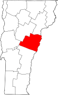 | |
| Villages | ||
| CDPs | ||
| Other communities | ||