Park River (Connecticut)
Coordinates: 41°45′36.1″N 72°39′52.7″W / 41.760028°N 72.664639°W
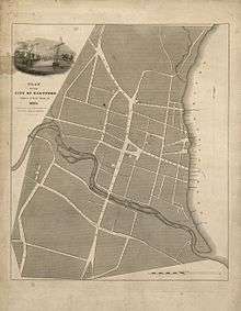
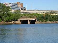
The Park River, sometimes called the Hog River, flows through and under the city of Hartford, Connecticut. Between 1940 and the 1980s, the 2.3-mile (3.7 km) river was buried by the Army Corps of Engineers to prevent the spring floods regularly caused by increased surface runoff from urban development.[1][2]
History
Before European settlement, the Suckiaug people (their name derived from the word sucki-auke, meaning "black earth") lived on the fertile banks of the Connecticut and Park rivers.[3] In 1633, fur traders from the Dutch West India Company set up Fort Goede Hoop at the rivers' confluence. The Dutch referred to today's Connecticut River as the "Great River", and called its tributary, the Park, the "Little River".[4]
The first English settlers arrived in the area in 1635; the following year, the Reverend Thomas Hooker led 100 of his congregation to form a new settlement north of the Dutch fort. The first mill in the settlement was built on the Little River by Matthew Allyn to grind local corn. During industrialization, the Little River became known as Mill River because of the numerous mills built to use its water power.
The lower part of the river was prone to flooding. Damaging floods in 1936 and 1938 led to a public works project to move the lower part underground, which was started by the US Army Corps of Engineers in 1940. The conduit under Bushnell Park (for which the river was named) was completed in 1943-1949.[5] Sections farther upriver were completed after the next big floods in August 1955, which followed two hurricanes (Connie and Diane) that came about a week apart, and the whole project was completed in the 1980s, with a total of more than 9 miles of river underground.[1]
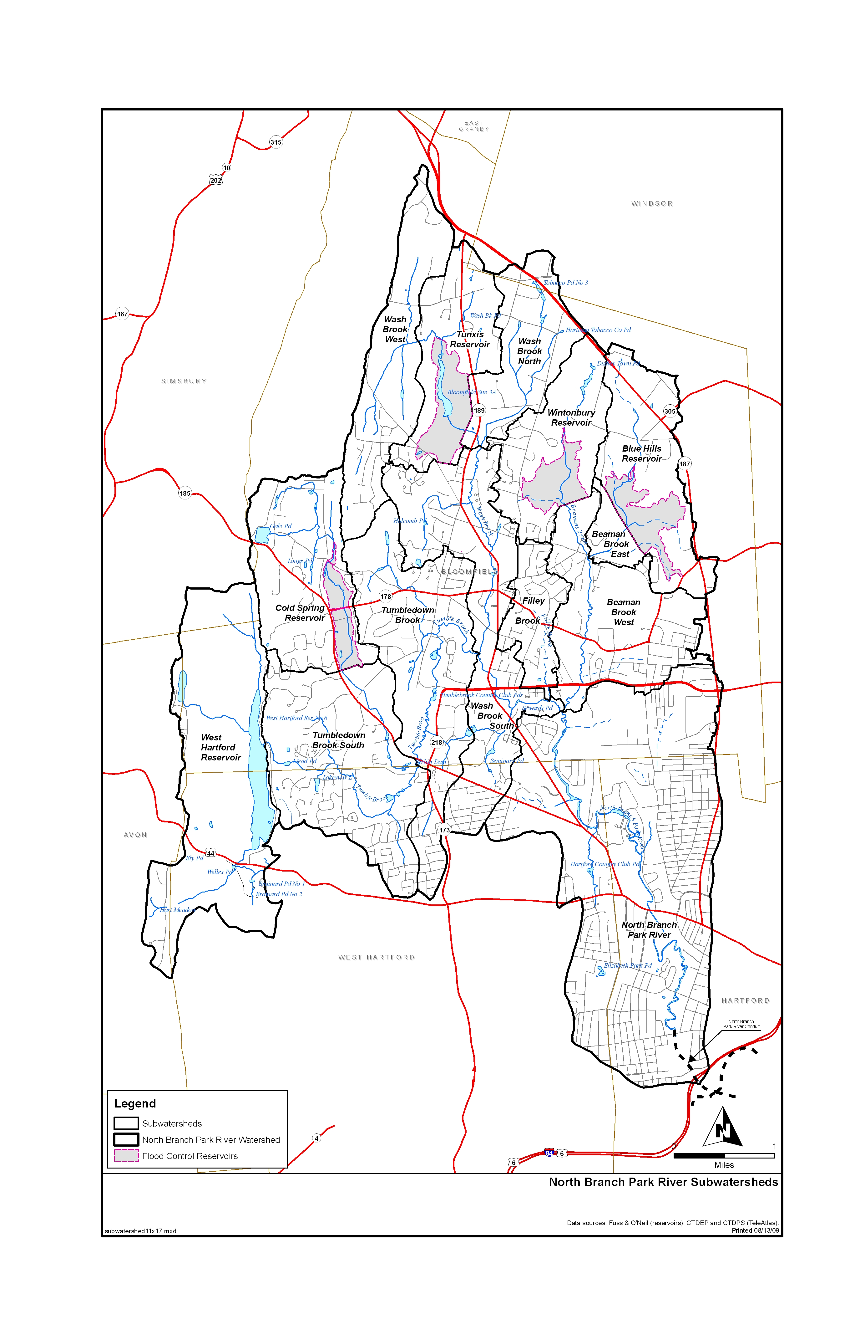
North Branch Park River watershed
The North Branch Park River watershed is a 28.6 square-mile basin within the Park watershed. It has a watershed management plan that was completed in 2010,[6] and its subwatersheds are mapped here.[7] Four major tributaries — Beamans Brook, Wash Brook, Filley Brook, and Tumbledown Brook — drain from Bloomfield and northern parts of West Hartford, converging near the University of Hartford to form the North Branch of the Park River. Upstream drainage from the entire watershed flows between the West End, Blue Hills, and Asylum Hill neighborhoods of Hartford, Connecticut’s capital city, before pouring into an underground conduit north of Farmington Avenue. The North Branch is exposed once more on the northern edge of Pope Park, just before it joins the South Branch and flows from there to the Connecticut River in a conduit.[8]
South Branch Park River watershed
The South Branch Park River watershed covers 39.6 square miles,[9] and the river is formed by the confluence of Trout Brook and Piper Brook, near New Britain Avenue in the Elmwood section of West Hartford. The South Branch is exposed from there to Pope Park, where it joins the North Branch and flows from there to the Connecticut River in a conduit.[8] The Trout Brook watershed covers 17.7 square miles,[9] and, 66% of West Hartford is in the Trout Brook watershed.[10] Sections of Trout Brook are impaired.[11] Piper Brook starts in St. Mary's Cemetery in New Britain,[12] has an 11.5 square mile watershed,[9] and also has impaired sections.[13] Bass Brook is the other brook in the watershed, with a 10.4 square mile watershed,[9] which starts near Farmington Ave. and flows into Piper Brook near CT Rt. 9 in New Britain.[14] Other towns in the South Branch watershed are Newington, Farmington and Wethersfield.[15]
See also
References
- 1 2 "The Park River – Bushnell Park Foundation". www.bushnellpark.org.
- ↑ U.S. Geological Survey. National Hydrography Dataset high-resolution flowline data. The National Map Archived 2012-04-05 at WebCite, accessed April 1, 2011
- ↑ Love, William DeLoss. The Colonial History of Hartford. Hartford. 1914. Page 82
- ↑ Alberta Eiseman, "The Industrialization of the Great River, New England's Longest," New York Times, 30 August 1998
- ↑ "Hog River Journal - Hog River History". www.hogriver.org.
- ↑ "North Park - Park Watershed". www.parkwatershed.org.
- ↑ "Watershed" (JPG). www.parkwatershed.org. 2012.
- 1 2 "Pope Park". Pope Park.
- 1 2 3 4 "Watershed summary" (PDF). clear.uconn.edu.
- ↑ "West Hartford info" (PDF). clear.uconn.edu.
- ↑ "Bacteria info" (PDF). www.ct.gov.
- ↑ "GNIS Detail - Piper Brook". geonames.usgs.gov.
- ↑ "Bacteria info" (PDF). www.ct.gov.
- ↑ "GNIS Detail - Bass Brook". geonames.usgs.gov.
- ↑ "Science - Park Watershed". www.parkwatershed.org.
External links
| Wikimedia Commons has media related to Park River (Connecticut). |
- Hog River History
- Bushnell Park Foundation, Park River
- Park River Watershed Revitalization Initiative