Gallatin County, Montana
| Gallatin County, Montana | ||
|---|---|---|
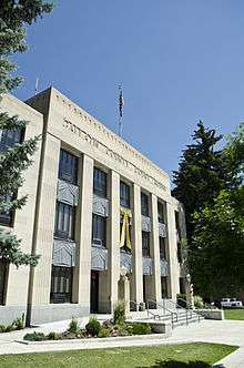 Gallatin County Courthouse | ||
| ||
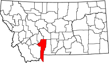 Location in the U.S. state of Montana | ||
 Montana's location in the U.S. | ||
| Founded | 1865 | |
| Named for | Albert Gallatin | |
| Seat | Bozeman | |
| Largest city | Bozeman | |
| Area | ||
| • Total | 2,632 sq mi (6,817 km2) | |
| • Land | 2,603 sq mi (6,742 km2) | |
| • Water | 29 sq mi (75 km2), 1.1% | |
| Population (est.) | ||
| • (2017) | 107,810 | |
| • Density | 41/sq mi (16/km2) | |
| Congressional district | At-large | |
| Time zone | Mountain: UTC−7/−6 | |
| Website |
www | |

Gallatin County is a county in the U.S. state of Montana. With its county seat in Bozeman, it is the third-most populous county in Montana, with a population of 89,513 in 2010.[1]
The prominent geographical feature in the north is the Bridger mountains in the north and in the south the eponymous Gallatin mountains mountains and Gallatin River, named by Meriwether Lewis in 1805 for Albert Gallatin,[2] the United States Treasury Secretary who formulated the Lewis and Clark Expedition.
At the southern end of the county, West Yellowstone's entrance into Yellowstone National Park accounts for roughly half of all park visitors. Big Sky Resort, the largest ski resort in the United States, lies in Gallatin and neighboring Madison counties, midway between Bozeman and West Yellowstone.
History
During the territorial era, a small patch of land known as "Lost Dakota" existed as a remote exclave of Dakota Territory until it was transferred to Gallatin County, Montana Territory, in 1873.[3]
Geography
According to the U.S. Census Bureau, the county has a total area of 2,632 square miles (6,820 km2), of which 2,603 square miles (6,740 km2) is land and 29 square miles (75 km2) (1.1%) is water.[4] The county attained its present boundaries in 1978, when the former Yellowstone National Park (part) county-equivalent was dissolved and apportioned between Gallatin County and Park County. Gallatin County received 99.155 square miles (256.8 km2) of land area and 0.119 square miles (0.3 km2) of water area, whereas Park County received 146.229 square miles (378.7 km2) of land area and 0.608 square miles (1.6 km2) of water area. The geographies transferred are known now as Census Tract 14 in Gallatin County, and as Census Tract 6 in Park County.
Major highways


Adjacent counties
- Madison County - west
- Jefferson County - northwest
- Broadwater County - north
- Meagher County - northeast
- Park County - east
- Park County, Wyoming - southeast
- Teton County, Wyoming - southeast
- Fremont County, Idaho - southwest
National protected areas
- Gallatin National Forest (part)
- Yellowstone National Park (part)
Demographics
| Historical population | |||
|---|---|---|---|
| Census | Pop. | %± | |
| 1870 | 1,578 | — | |
| 1880 | 3,643 | 130.9% | |
| 1890 | 6,246 | 71.5% | |
| 1900 | 9,553 | 52.9% | |
| 1910 | 14,079 | 47.4% | |
| 1920 | 15,864 | 12.7% | |
| 1930 | 16,124 | 1.6% | |
| 1940 | 18,269 | 13.3% | |
| 1950 | 21,902 | 19.9% | |
| 1960 | 26,045 | 18.9% | |
| 1970 | 32,505 | 24.8% | |
| 1980 | 42,865 | 31.9% | |
| 1990 | 50,463 | 17.7% | |
| 2000 | 67,831 | 34.4% | |
| 2010 | 89,513 | 32.0% | |
| Est. 2017 | 107,810 | [5] | 20.4% |
| U.S. Decennial Census[6] 1790-1960[7] 1900-1990[8] 1990-2000[9] 2010-2015[1] | |||
2000 census
As of the census[10] of 2000, there were 67,831 people, 26,323 households, and 16,188 families residing in the county. The population density was 26 people per square mile (10/km²). There were 29,489 housing units at an average density of 11 per square mile (4/km²). The racial makeup of the county was:
- 96.20% White
- 0.23% Black or African American
- 0.88% Native American
- 0.89% Asian
- 0.06% Pacific Islander
- 0.54% from other races
- 1.19% from two or more races
1.54% of the population were Hispanic or Latino of any race. 23.7% were of German, 11.2% Irish, 10.4% English, 9.0% Norwegian and 5.5% American ancestry.
There were 26,323 households out of which 29.70% had children under the age of 18 living with them, 51.80% were married couples living together, 6.60% had a female householder with no husband present, and 38.50% were non-families. 24.10% of all households were made up of individuals and 5.70% had someone living alone who was 65 years of age or older. The average household size was 2.46 and the average family size was 2.94.
In the county, the population was spread out with 22.00% under the age of 18, 18.50% from 18 to 24, 30.40% from 25 to 44, 20.60% from 45 to 64, and 8.50% who were 65 years of age or older. The median age was 31 years. For every 100 females there were 108.30 males. For every 100 females age 18 and over, there were 108.70 males.
The median income for a household in the county was $38,120, and the median income for a family was $46,639. Males had a median income of $30,866 versus $21,330 for females. The per capita income for the county was $19,074. About 6.30% of families and 12.80% of the population were below the poverty line, including 10.50% of those under age 18 and 5.60% of those age 65 or over.
2010 census
As of the 2010 United States Census, there were 89,513 people, 36,550 households, and 21,263 families residing in the county.[11] The population density was 34.4 inhabitants per square mile (13.3/km2). There were 42,289 housing units at an average density of 16.2 per square mile (6.3/km2).[12] The racial makeup of the county was 95.1% white, 1.1% Asian, 0.9% American Indian, 0.3% black or African American, 0.1% Pacific islander, 0.7% from other races, and 1.9% from two or more races. Those of Hispanic or Latino origin made up 2.8% of the population.[11] In terms of ancestry, 32.2% were German, 18.1% were Irish, 14.7% were English, 9.4% were Norwegian, and 3.5% were American.[13]
Of the 36,550 households, 27.8% had children under the age of 18 living with them, 47.8% were married couples living together, 6.6% had a female householder with no husband present, 41.8% were non-families, and 27.3% of all households were made up of individuals. The average household size was 2.36 and the average family size was 2.90. The median age was 32.5 years.[11]
The median income for a household in the county was $50,136 and the median income for a family was $65,029. Males had a median income of $42,245 versus $31,349 for females. The per capita income for the county was $27,423. About 7.4% of families and 13.5% of the population were below the poverty line, including 12.5% of those under age 18 and 8.2% of those age 65 or over.[14]
Government and politics
Gallatin County has traditionally favored Republican presidential candidates, often by large margins. Recent changes to Gallatin County's demographics (including immigration from Democratic-leaning areas,[15] and younger voters adopting more liberal political positions)[16] have made the county more competitive.
Democratic candidates Barack Obama and Hillary Clinton narrowly won Gallatin County in 2008 and 2016 respectively, with Republican Mitt Romney winning in 2012.
| Year | Republican | Democratic | Third parties |
|---|---|---|---|
| 2016 | 44.2% 23,802 | 45.1% 24,246 | 10.7% 5,771 |
| 2012 | 50.8% 24,358 | 45.8% 21,961 | 3.3% 1,589 |
| 2008 | 46.8% 22,578 | 50.1% 24,205 | 3.1% 1,489 |
| 2004 | 56.2% 22,392 | 41.2% 16,405 | 2.6% 1,045 |
| 2000 | 58.8% 18,833 | 31.2% 10,009 | 10.0% 3,198 |
| 1996 | 50.1% 14,559 | 37.7% 10,972 | 12.2% 3,547 |
| 1992 | 38.6% 11,109 | 33.1% 9,535 | 28.3% 8,135 |
| 1988 | 56.9% 13,214 | 41.1% 9,527 | 2.0% 464 |
| 1984 | 64.8% 15,643 | 33.8% 8,163 | 1.4% 334 |
| 1980 | 58.6% 12,738 | 26.5% 5,747 | 14.9% 3,241 |
| 1976 | 63.4% 11,062 | 35.6% 6,215 | 1.1% 183 |
| 1972 | 66.3% 10,663 | 31.7% 5,096 | 2.1% 329 |
| 1968 | 62.1% 7,433 | 31.9% 3,818 | 6.1% 727 |
| 1964 | 50.0% 5,621 | 49.8% 5,600 | 0.2% 27 |
| 1960 | 64.5% 6,870 | 35.3% 3,761 | 0.2% 21 |
| 1956 | 67.2% 6,680 | 32.8% 3,260 | 0.0% 0 |
| 1952 | 71.9% 6,998 | 27.7% 2,697 | 0.4% 34 |
| 1948 | 53.1% 4,220 | 44.6% 3,548 | 2.3% 182 |
| 1944 | 47.0% 3,120 | 52.5% 3,479 | 0.5% 33 |
| 1940 | 41.8% 3,430 | 57.6% 4,718 | 0.6% 50 |
| 1936 | 30.0% 2,151 | 65.5% 4,697 | 4.5% 320 |
| 1932 | 36.0% 2,553 | 61.4% 4,359 | 2.6% 183 |
| 1928 | 61.1% 3,861 | 38.4% 2,423 | 0.5% 34 |
| 1924 | 44.4% 2,494 | 27.8% 1,564 | 27.8% 1,565 |
| 1920 | 54.7% 3,238 | 40.0% 2,370 | 5.3% 312 |
| 1916 | 40.1% 2,527 | 58.1% 3,661 | 1.9% 118 |
| 1912 | 21.1% 683 | 43.4% 1,407 | 35.5% 1,151 |
| 1908 | 47.2% 1,519 | 46.1% 1,485 | 6.7% 215 |
| 1904 | 55.8% 1,700 | 37.1% 1,130 | 7.2% 218 |
Communities
Cities
- Belgrade
- Bozeman (county seat)
- Three Forks
Towns
Census-designated places
Unincorporated communities
Notable people
- Zales Ecton, United States Senator from Montana, lived in Gallatin County.
See also
References
- 1 2 "State & County QuickFacts". United States Census Bureau. Archived from the original on July 10, 2011. Retrieved September 15, 2013.
- ↑ Gannett, Henry (1905). The Origin of Certain Place Names in the United States. Govt. Print. Off. p. 133.
- ↑ Beyond 50: American States That Might Have Been : NPR
- ↑ "2010 Census Gazetteer Files". United States Census Bureau. August 22, 2012. Archived from the original on December 5, 2014. Retrieved November 28, 2014.
- ↑ "Population and Housing Unit Estimates". Retrieved March 22, 2018.
- ↑ "U.S. Decennial Census". United States Census Bureau. Archived from the original on May 12, 2015. Retrieved November 28, 2014.
- ↑ "Historical Census Browser". University of Virginia Library. Retrieved November 28, 2014.
- ↑ "Population of Counties by Decennial Census: 1900 to 1990". United States Census Bureau. Retrieved November 28, 2014.
- ↑ "Census 2000 PHC-T-4. Ranking Tables for Counties: 1990 and 2000" (PDF). United States Census Bureau. Retrieved November 28, 2014.
- ↑ "American FactFinder". United States Census Bureau. Archived from the original on 2013-09-11. Retrieved 2008-01-31.
- 1 2 3 "DP-1 Profile of General Population and Housing Characteristics: 2010 Demographic Profile Data". United States Census Bureau. Retrieved 2016-01-10.
- ↑ "Population, Housing Units, Area, and Density: 2010 - County". United States Census Bureau. Retrieved 2016-01-10.
- ↑ "DP02 SELECTED SOCIAL CHARACTERISTICS IN THE UNITED STATES – 2006-2010 American Community Survey 5-Year Estimates". United States Census Bureau. Retrieved 2016-01-10.
- ↑ "DP03 SELECTED ECONOMIC CHARACTERISTICS – 2006-2010 American Community Survey 5-Year Estimates". United States Census Bureau. Retrieved 2016-01-10.
- ↑ Cohen, Micah (2012-06-21). "Presidential Geography: Montana". FiveThirtyEight. Retrieved 2018-04-02.
- ↑ "A wider partisan and ideological gap between younger, older generations". Pew Research Center. 2017-03-20. Retrieved 2018-04-02.
- ↑ Leip, David. "Dave Leip's Atlas of U.S. Presidential Elections". uselectionatlas.org. Retrieved 2018-04-02.
External links
- Gallatin County, MT Official Website
- Gallatin County Emergency Management
- Census Tract 14, Gallatin County; Census Tract 6, Park County United States Census Bureau
Places adjacent to Gallatin County, Montana | |
|---|---|
Municipalities and communities of Gallatin County, Montana, United States | ||
|---|---|---|
| Cities | | |
| Towns | ||
| CDPs | ||
| Other unincorporated communities | ||
| Footnotes | ‡This populated place also has portions in an adjacent county or counties | |
