Columbia Falls, Montana
| Columbia Falls, Montana | |
|---|---|
| City | |
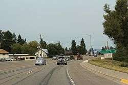 The sign for Columbia Falls on U.S. Route 2 | |
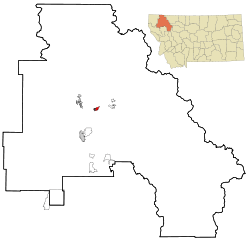 Location of Columbia Falls, Montana | |
| Coordinates: 48°22′13″N 114°11′20″W / 48.37028°N 114.18889°WCoordinates: 48°22′13″N 114°11′20″W / 48.37028°N 114.18889°W | |
| Country |
|
| State |
|
| County | Flathead |
| Government | |
| • Mayor | Donald Barnhart |
| Area[1] | |
| • Total | 2.05 sq mi (5.31 km2) |
| • Land | 2.05 sq mi (5.31 km2) |
| • Water | 0 sq mi (0 km2) |
| Elevation | 3,087 ft (941 m) |
| Population (2010)[2] | |
| • Total | 4,688 |
| • Estimate (2016)[3] | 5,241 |
| • Density | 2,300/sq mi (880/km2) |
| Time zone | UTC−7 (Mountain (MST)) |
| • Summer (DST) | UTC−6 (MDT) |
| ZIP code | 59912 |
| Area code(s) | 406 |
| FIPS code | 30-16600 |
| GNIS feature ID | 0806934 |
| Website | City website |
Columbia Falls (Salish: nq̓éyɫkʷm[4]) is a city in Flathead County, Montana, United States. The population was 4,710 at the 2010 census (though a 2016 estimate puts it at 5,241)
Geography
Columbia Falls is located at 48°22′13″N 114°11′20″W / 48.37028°N 114.18889°W (48.370379, -114.188943).[5]
According to the United States Census Bureau, the city has a total area of 2.05 square miles (5.31 km2), all of it land.[1]
History
The Montana Veterans Home in Columbia Falls has served veterans since 1896.[7] Its current housing facility was opened by Montana Governor Forrest H. Anderson at an official dedication ceremony in 1970.[8] An E. M. Viquesney statue of a World War I doughboy was moved to the front of the Veterans' Home in 1972. The statue "originally stood in Kalispell in the Main Street median in front of the Flathead County Courthouse."[9]
The aluminum plant northeast of the city was built in the mid-1950s, utilizing the electrical power generated at the new Hungry Horse Dam.[10]
Demographics
| Historical population | |||
|---|---|---|---|
| Census | Pop. | %± | |
| 1910 | 601 | — | |
| 1920 | 611 | 1.7% | |
| 1930 | 637 | 4.3% | |
| 1940 | 637 | 0.0% | |
| 1950 | 1,232 | 93.4% | |
| 1960 | 2,132 | 73.1% | |
| 1970 | 2,652 | 24.4% | |
| 1980 | 3,112 | 17.3% | |
| 1990 | 2,942 | −5.5% | |
| 2000 | 3,645 | 23.9% | |
| 2010 | 4,688 | 28.6% | |
| Est. 2016 | 5,241 | [3] | 11.8% |
| U.S. Decennial Census[11] 2015 Estimate[12] | |||
2010 census
As of the census[2] of 2010, there were 4,688 people, 1,863 households, and 1,215 families residing in the city. The population density was 2,286.8 inhabitants per square mile (882.9/km2). There were 1,994 housing units at an average density of 972.7 per square mile (375.6/km2). The racial makeup of the city was 94.4% White, 0.2% African American, 1.8% Native American, 0.4% Asian, 0.3% from other races, and 2.9% from two or more races. Hispanic or Latino of any race were 2.8% of the population.
There were 1,863 households of which 35.0% had children under the age of 18 living with them, 47.9% were married couples living together, 12.9% had a female householder with no husband present, 4.5% had a male householder with no wife present, and 34.8% were non-families. 28.8% of all households were made up of individuals and 11% had someone living alone who was 65 years of age or older. The average household size was 2.47 and the average family size was 3.02.
The median age in the city was 35.6 years. 26% of residents were under the age of 18; 8.5% were between the ages of 18 and 24; 26.8% were from 25 to 44; 25.3% were from 45 to 64; and 13.2% were 65 years of age or older. The gender makeup of the city was 48.1% male and 51.9% female.
2000 census
As of the census[13] of 2000, there were 3,645 people, 1,400 households, and 966 families residing in the city. The population density was 2,402.9 people per square mile (925.9/km²). There were 1,470 housing units at an average density of 969.1 per square mile (373.4/km²). The racial makeup of the city was 96.27% White, 0.25% African American, 1.23% Native American, 0.49% Asian, 0.08% Pacific Islander, 0.41% from other races, and 1.26% from two or more races. Hispanic or Latino of any race were 1.84% of the population.
There were 1,400 households out of which 36.3% had children under the age of 18 living with them, 52.0% were married couples living together, 12.1% had a female householder with no husband present, and 31.0% were non-families. 25.7% of all households were made up of individuals and 11.0% had someone living alone who was 65 years of age or older. The average household size was 2.52 and the average family size was 3.06.
In the city, the population was spread out with 28.3% under the age of 18, 8.1% from 18 to 24, 28.6% from 25 to 44, 21.5% from 45 to 64, and 13.4% who were 65 years of age or older. The median age was 36 years. For every 100 females there were 99.2 males. For every 100 females age 18 and over, there were 97.4 males.
The median income for a household in the city was $31,128, and the median income for a family was $40,794. Males had a median income of $32,109 versus $20,023 for females. The per capita income for the city was $14,355. About 12.5% of families and 17.1% of the population were below the poverty line, including 25.8% of those under age 18 and 4.0% of those age 65 or over.
Notable people
- Joe Bereta, member of the Spokane-based sketch comedy duo Barats and Bereta.
- Paula Houston, Obscenity and Pornography Complaints Ombudsman for the State of Utah.
References
- 1 2 "US Gazetteer files 2010". United States Census Bureau. Archived from the original on July 14, 2012. Retrieved December 18, 2012.
- 1 2 "American FactFinder". United States Census Bureau. Retrieved December 18, 2012.
- 1 2 "Population and Housing Unit Estimates". Retrieved June 9, 2017.
- ↑ Tachini, Pete; Louie Adams, Sophie Mays, Mary Lucy Parker, Johnny Arlee, Frances Vanderburg, Lucy Vanderburg, Diana Christopher-Cote (1998). nyoʻnuntn q̓éymin, Flathead Nation Salish dictionary. Pablo, MT: Bilingual Education Department, Salish Kootenai College. p. 31.
- ↑ "US Gazetteer files: 2010, 2000, and 1990". United States Census Bureau. February 12, 2011. Retrieved April 23, 2011.
- ↑ Tachini, Pete (2010). Seliš nyoʻnuntn, Medicine for the Salish language : English to Salish translation dictionary (2nd ed.). Pablo, MT: Salish Kootenai College Press. p. 125. ISBN 9781934594063.
- ↑ "Montana Veterans' Home - Columbia Falls". Montana Department of Public Health & Human Services - Senior & Long Term Care. Retrieved February 6, 2014.
- ↑ Montana Veterans Home (1970). History and future of Montana Veterans' Home, Columbia Falls, Montana. Columbia Falls, MT. Retrieved February 6, 2014.
- ↑ "Columbia Falls, Montana Viquesney Doughboy Statue". The E. M. Viquesney Doughboy Database. Retrieved February 6, 2014.
- ↑ Ruder, Mel (November 14, 1954). "Anaconda aluminum plant past halfway mark". Spokesman-Review. (Spokane, Washington). (photo). p. 27.
- ↑ United States Census Bureau. "Census of Population and Housing". Archived from the original on May 12, 2015. Retrieved July 14, 2016.
- ↑ "Population Estimates". United States Census Bureau. Retrieved July 14, 2016.
- ↑ "American FactFinder". United States Census Bureau. Archived from the original on September 11, 2013. Retrieved January 31, 2008.
External links
Municipalities and communities of Flathead County, Montana, United States | ||
|---|---|---|
| Cities | 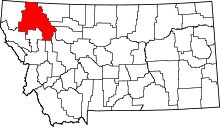 | |
| CDPs | ||
| Unincorporated communities | ||
| Indian reservation | ||
| Footnotes | ‡This populated place also has portions in an adjacent county or counties | |