Gallatin Gateway, Montana
| Gallatin Gateway, Montana | |
|---|---|
| Census-designated place | |
 Gallatin Gateway  Gallatin Gateway | |
| Coordinates: 45°35′29″N 111°11′51″W / 45.59139°N 111.19750°WCoordinates: 45°35′29″N 111°11′51″W / 45.59139°N 111.19750°W | |
| Country | United States |
| State | Montana |
| County | Gallatin |
| Area | |
| • Total | 5.9 sq mi (15.4 km2) |
| • Land | 5.8 sq mi (15.1 km2) |
| • Water | 0.1 sq mi (0.3 km2) |
| Elevation | 4,953 ft (1,510 m) |
| Population (2010) | |
| • Total | 856 |
| • Density | 56.6/sq mi (21.9/km2) |
| Time zone | UTC-7 (Mountain (MST)) |
| • Summer (DST) | UTC-6 (MDT) |
| ZIP code | 59730 |
| Area code(s) | 406 |
| FIPS code | 30-29875 |
| GNIS feature ID | 2583809 |
Gallatin Gateway is a census-designated place (CDP) in Gallatin County, Montana, United States. As of the 2010 census it had a population of 856.[1]
The community is located along U.S. Route 191 in the valley of the Gallatin River, a north-flowing tributary of the Missouri River. US 191 leads north then east 13 miles (21 km) to Bozeman and south 28 miles (45 km) to Big Sky. According to the U.S. Census Bureau, the CDP has a total area of 5.9 square miles (15.4 km2), of which 5.8 square miles (15.1 km2) is land and 0.1 square miles (0.3 km2), or 1.83%, is water.[1]
References
- 1 2 "Geographic Identifiers: 2010 Demographic Profile Data (G001): Gallatin Gateway CDP, Montana". American Factfinder. U.S. Census Bureau. Retrieved December 21, 2016.
Municipalities and communities of Gallatin County, Montana, United States | ||
|---|---|---|
| Cities | 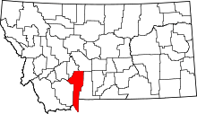 | |
| Towns | ||
| CDPs | ||
| Other unincorporated communities | ||
| Footnotes | ‡This populated place also has portions in an adjacent county or counties | |
This article is issued from
Wikipedia.
The text is licensed under Creative Commons - Attribution - Sharealike.
Additional terms may apply for the media files.