Dawson County, Montana
| Dawson County, Montana | |
|---|---|
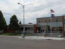 Dawson County Courthouse in Glendive | |
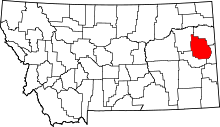 Location in the U.S. state of Montana | |
 Montana's location in the U.S. | |
| Founded | January 15, 1869 |
| Seat | Glendive |
| Largest city | Glendive |
| Area | |
| • Total | 2,383 sq mi (6,172 km2) |
| • Land | 2,372 sq mi (6,143 km2) |
| • Water | 11 sq mi (28 km2), 0.5% |
| Population (est.) | |
| • (2015) | 9,625 |
| • Density | 3.8/sq mi (1.5/km2) |
| Congressional district | At-large |
| Time zone | Mountain: UTC−7/−6 |
| Website |
www |
Dawson County is a county located in the U.S. state of Montana. As of the 2010 census, the population was 8,966.[1] Its county seat is Glendive.[2]
History
Dawson County is one of the older counties of the state. It was created January 15, 1869 from the northern half of the original Big Horn County. The namesake of the county is Major Andrew Dawson,[3] manager of the Fort Benton Trading Post for the American Fur Company from 1856 to 1864.[4]
Geography
According to the U.S. Census Bureau, the county has a total area of 2,383 square miles (6,170 km2), of which 2,372 square miles (6,140 km2) is land and 11 square miles (28 km2) (0.5%) is water.[5]
Dawson County is located in the extreme eastern portion of Montana, about fifteen to twenty miles west of the Dakota line.[6]
Dawson County contains part of Montana's badlands. Makoshika State Park is a great example of the unusual rock formations. Yellowstone River runs through the county.
The principal sources of the water supply in Dawson County are the Yellowstone River, which bisects the southeastern half of the county, and the Redwater River, which flows through its extreme northwest townships. Numerous large and small creeks are tributary to these streams, furnishing abundant and accessible facilities not only for watering livestock, but also for small individual irrigation enterprises, and water conservation projects. In the upper bench lands, artesian well irrigation has received considerable attention.
Parts of Dawson County were taken to form Valley County in 1893, Richland County and part of Wibaux County in 1914, part of Prairie County in 1915, and Garfield County and part of McCone County in 1919.[6]
Major highways


- Montana Highway 254
In 1920, Dawson County was traversed by the National Parks Highway or Red Trail, the Black Trail, the Green Trail and the Blue Trail, all of which passed through Glendive.[6]
Adjacent counties
- Richland County, Montana - north
- Wibaux County, Montana - east
- Prairie County, Montana - south
- McCone County, Montana - west
Politics
| Year | Republican | Democratic | Third parties |
|---|---|---|---|
| 2016 | 75.3% 3,320 | 17.9% 787 | 6.9% 302 |
| 2012 | 68.5% 3,029 | 27.6% 1,219 | 4.0% 175 |
| 2008 | 59.4% 2,639 | 35.9% 1,593 | 4.8% 212 |
| 2004 | 64.3% 2,884 | 33.3% 1,494 | 2.4% 106 |
| 2000 | 63.8% 2,723 | 31.9% 1,364 | 4.3% 184 |
| 1996 | 40.5% 1,890 | 40.7% 1,903 | 18.8% 880 |
| 1992 | 34.6% 1,679 | 36.8% 1,785 | 28.6% 1,386 |
| 1988 | 54.4% 2,658 | 43.4% 2,120 | 2.2% 108 |
| 1984 | 65.3% 3,468 | 33.4% 1,776 | 1.3% 70 |
| 1980 | 59.5% 3,045 | 30.2% 1,543 | 10.4% 530 |
| 1976 | 53.2% 2,639 | 44.4% 2,201 | 2.4% 120 |
| 1972 | 64.0% 3,207 | 33.6% 1,685 | 2.4% 122 |
| 1968 | 58.0% 2,650 | 37.1% 1,695 | 4.9% 223 |
| 1964 | 41.8% 1,938 | 58.0% 2,691 | 0.2% 8 |
| 1960 | 53.7% 2,460 | 46.0% 2,108 | 0.3% 14 |
| 1956 | 56.1% 2,463 | 43.9% 1,929 | 0.0% 0 |
| 1952 | 65.5% 2,396 | 34.1% 1,247 | 0.4% 15 |
| 1948 | 51.5% 1,555 | 46.3% 1,397 | 2.2% 65 |
| 1944 | 52.9% 1,549 | 46.5% 1,362 | 0.6% 16 |
| 1940 | 47.5% 1,612 | 52.0% 1,765 | 0.4% 15 |
| 1936 | 35.8% 1,221 | 63.6% 2,169 | 0.6% 20 |
| 1932 | 42.5% 1,470 | 55.8% 1,929 | 1.7% 58 |
| 1928 | 67.2% 2,207 | 32.4% 1,065 | 0.4% 14 |
| 1924 | 50.6% 1,326 | 13.2% 346 | 36.2% 947 |
| 1920 | 63.9% 1,784 | 31.4% 875 | 4.7% 132 |
| 1916 | 41.1% 2,105 | 55.3% 2,835 | 3.7% 187 |
| 1912 | 24.4% 678 | 25.8% 719 | 49.8% 1,385 |
| 1908 | 63.7% 927 | 30.2% 439 | 6.2% 90 |
| 1904 | 77.4% 769 | 19.0% 189 | 3.5% 35 |
Demographics
| Historical population | |||
|---|---|---|---|
| Census | Pop. | %± | |
| 1890 | 2,056 | — | |
| 1900 | 2,443 | 18.8% | |
| 1910 | 12,725 | 420.9% | |
| 1920 | 9,239 | −27.4% | |
| 1930 | 9,881 | 6.9% | |
| 1940 | 8,618 | −12.8% | |
| 1950 | 9,092 | 5.5% | |
| 1960 | 12,314 | 35.4% | |
| 1970 | 11,269 | −8.5% | |
| 1980 | 11,805 | 4.8% | |
| 1990 | 9,505 | −19.5% | |
| 2000 | 9,059 | −4.7% | |
| 2010 | 8,966 | −1.0% | |
| Est. 2016 | 9,327 | [8] | 4.0% |
| U.S. Decennial Census[9] 1790-1960[10] 1900-1990[11] 1990-2000[12] 2010-2015[1] | |||
2000 census
As of the census of 2000, there were 9,059 people, 3,625 households, and 2,475 families residing in the county. The population density was 4 people per square mile (1/km²). There were 4,168 housing units at an average density of 2 per square mile (1/km²). The racial makeup of the county was 97.43% White, 0.25% Black or African American, 1.23% Native American, 0.13% Asian, 0.01% Pacific Islander, 0.31% from other races, and 0.64% from two or more races. 0.89% of the population were Hispanic or Latino of any race. 39.7% were of German, 17.0% Norwegian, 7.3% Irish and 6.5% English ancestry. 97.0% spoke English, 1.4% German and 1.0% Spanish as their first language.
There were 3,625 households out of which 29.70% had children under the age of 18 living with them, 58.50% were married couples living together, 6.80% had a female householder with no husband present, and 31.70% were non-families. 28.40% of all households were made up of individuals and 12.20% had someone living alone who was 65 years of age or older. The average household size was 2.37 and the average family size was 2.90.
In the county, the population was spread out with 23.10% under the age of 18, 8.80% from 18 to 24, 24.90% from 25 to 44, 25.40% from 45 to 64, and 17.70% who were 65 years of age or older. The median age was 41 years. For every 100 females there were 98.30 males. For every 100 females age 18 and over, there were 99.90 males.
The median income for a household in the county was $31,393, and the median income for a family was $38,455. Males had a median income of $29,487 versus $18,929 for females. The per capita income for the county was $15,368. About 11.70% of families and 14.90% of the population were below the poverty line, including 18.70% of those under age 18 and 11.20% of those age 65 or over.
2010 census
As of the 2010 United States Census, there were 8,966 people, 3,749 households, and 2,429 families residing in the county.[13] The population density was 3.8 inhabitants per square mile (1.5/km2). There were 4,233 housing units at an average density of 1.8 per square mile (0.69/km2).[14] The racial makeup of the county was 95.7% white, 1.7% American Indian, 0.3% black or African American, 0.3% Asian, 0.3% from other races, and 1.6% from two or more races. Those of Hispanic or Latino origin made up 2.0% of the population.[13] In terms of ancestry, 46.6% were German, 16.3% were Norwegian, 15.5% were Irish, 8.2% were English, and 6.5% were American.[15]
Of the 3,749 households, 26.8% had children under the age of 18 living with them, 54.1% were married couples living together, 6.7% had a female householder with no husband present, 35.2% were non-families, and 31.2% of all households were made up of individuals. The average household size was 2.26 and the average family size was 2.82. The median age was 43.5 years.[13]
The median income for a household in the county was $50,752 and the median income for a family was $63,982. Males had a median income of $45,222 versus $30,993 for females. The per capita income for the county was $24,602. About 7.4% of families and 9.3% of the population were below the poverty line, including 15.5% of those under age 18 and 9.6% of those age 65 or over.[16]
Economy
Dawson County is known for its dryland grain, coal mines and gas and oil wells.[17] There are 522 current farms and ranches, and 296 commercial businesses.[18]
Lying in the heart of the western third of the Fort Union region, Dawson County is plentifully supplied with lignite coal. Local natural gas has supplied Glendive since at least 1920.[6]
Excellent clays for pottery and brick-making are found in the county.[6]
From early days, Dawson County was known as a splendid stock county, because of the native cover of a heavy and nutritious grass. Unlike some other parts of the state, the livestock industry did not die out. In the early 20th century, the county was known for pure-bred stock raising, dairying, and the production of hogs and poultry.
While there is some broken land around the Sheep Bluffs, in the northwestern part of the county, and east of the Yellowstone, smooth prairies and rolling land predominated in the county, making conditions excellent for farming purposes. The dark sandy loam soil, with a heavy clay subsoil, was a big producer.
The principal crops in the early years of the 20th century were barley, oats and wheat. Sixty per cent of the land was tillable, and the remainder afforded good grazing. As of 1920, the headgates of the Lower Yellowstone Irrigation Project, which irrigated approximately 90,000 acres, were located at Intake, in Dawson County, and further irrigation was planned. Unirrigated land was also producing excellent crops, with up to 400 bushels of potatoes in one acre of unirrigated land. In 1915, Dawson County won first and second prizes on Northwestern Dent corn at the St. Paul Corn Show, and in December of the following year, at the First National Corn Show, held at the same city, took first and second prizes and three third prizes. In 1920, it was estimated that the acreage planted in corn in Dawson County alone was as great as the corn acreage for the entire state in 1910.[6]
Education
Dawson Community College is located in Glendive.
Communities
City
- Glendive (county seat)
Town
Census-designated place
Unincorporated communities
- Bloomfield
- Hungry Joe
- Intake
- Lindsay
See also
Footnotes
- 1 2 "State & County QuickFacts". United States Census Bureau. Archived from the original on July 9, 2011. Retrieved September 15, 2013.
- ↑ "Find a County". National Association of Counties. Archived from the original on 2011-05-31. Retrieved 2011-06-07.
- ↑ Gannett, Henry (1905). The Origin of Certain Place Names in the United States. Govt. Print. Off. p. 101.
- ↑ "Montana Place Names Companion". Montana Place Names From Alzada to Zortman. Montana Historical Society Research Center. Retrieved 9 May 2011.
- ↑ "2010 Census Gazetteer Files". United States Census Bureau. August 22, 2012. Archived from the original on December 5, 2014. Retrieved November 28, 2014.
- 1 2 3 4 5 6 Stout, Tom (1921). Montana, its story and biography; a history of aboriginal and territorial Montana and three decades of statehood, under the editorial supervision of Tom Stout. Chicago, IL: American Historical Society. Retrieved 2013-12-07.
- ↑ Leip, David. "Dave Leip's Atlas of U.S. Presidential Elections". uselectionatlas.org. Retrieved 2018-04-02.
- ↑ "Population and Housing Unit Estimates". Retrieved June 9, 2017.
- ↑ "U.S. Decennial Census". United States Census Bureau. Archived from the original on May 12, 2015. Retrieved November 28, 2014.
- ↑ "Historical Census Browser". University of Virginia Library. Retrieved November 28, 2014.
- ↑ "Population of Counties by Decennial Census: 1900 to 1990". United States Census Bureau. Retrieved November 28, 2014.
- ↑ "Census 2000 PHC-T-4. Ranking Tables for Counties: 1990 and 2000" (PDF). United States Census Bureau. Retrieved November 28, 2014.
- 1 2 3 "DP-1 Profile of General Population and Housing Characteristics: 2010 Demographic Profile Data". United States Census Bureau. Retrieved 2016-01-09.
- ↑ "Population, Housing Units, Area, and Density: 2010 - County". United States Census Bureau. Retrieved 2016-01-09.
- ↑ "DP02 SELECTED SOCIAL CHARACTERISTICS IN THE UNITED STATES – 2006-2010 American Community Survey 5-Year Estimates". United States Census Bureau. Retrieved 2016-01-09.
- ↑ "DP03 SELECTED ECONOMIC CHARACTERISTICS – 2006-2010 American Community Survey 5-Year Estimates". United States Census Bureau. Retrieved 2016-01-09.
- ↑ Merrill, Andrea; Judy Jacobson (1997). Montana almanac. Helena, Montana: Falcon Publishing. ISBN 1-56044-493-2.
- ↑ Dawson County EDC. "Welcome". Retrieved 24 July 2011.
Further reading
- Tom Stout (ed.), Montana, Its Story and Biography: A History of Aboriginal and Territorial Montana and Three Decades of Statehood: Volume 1. Chicago: American Historical Society, 1921.
- Our Lives, Our Times: Dawson County Family Stories. Glendive, MT: Dawson County Tree Branches, 1989.
Places adjacent to Dawson County, Montana | ||||||||||
|---|---|---|---|---|---|---|---|---|---|---|
| ||||||||||
Municipalities and communities of Dawson County, Montana, United States | ||
|---|---|---|
| City | | |
| Town | ||
| CDP | ||
| Unincorporated communities | ||
