Four Corners, Montana
| Four Corners, Montana | |
|---|---|
| Census-designated place | |
 Location of Four Corners, Montana | |
| Coordinates: 45°40′4″N 111°10′57″W / 45.66778°N 111.18250°WCoordinates: 45°40′4″N 111°10′57″W / 45.66778°N 111.18250°W | |
| Country | United States |
| State | Montana |
| County | Gallatin |
| Area | |
| • Total | 10.7 sq mi (27.8 km2) |
| • Land | 10.7 sq mi (27.6 km2) |
| • Water | 0.08 sq mi (0.2 km2) |
| Elevation | 4,839 ft (1,475 m) |
| Population (2010) | |
| • Total | 3,146 |
| • Density | 295/sq mi (113.9/km2) |
| Time zone | UTC-7 (Mountain (MST)) |
| • Summer (DST) | UTC-6 (MDT) |
| Area code(s) | 406 |
| FIPS code | 30-28862 |
| GNIS feature ID | 0806243 |
Four Corners is a census-designated place (CDP) in Gallatin County, Montana, United States. The population was 3,146 at the 2010 census,[1] up from 1,828 at the 2000 census. It is part of the Bozeman, MT Micropolitan Statistical Area.
Geography
Four Corners is located in central Gallatin County at 45°40′4″N 111°10′57″W / 45.66778°N 111.18250°W (45.667876, -111.182530),[2] 7 miles (11 km) west of Bozeman. The "Four Corners" refers to the intersection of U.S. Route 191, Montana Highway 84, and Montana Highway 85. US 191 leads east to Bozeman and south 82 miles (132 km) to West Yellowstone, MT 84 leads west 29 miles (47 km) to Norris, and MT 85 leads north 9 miles (14 km) to Belgrade and Interstate 90.
According to the United States Census Bureau, the Four Corners CDP has a total area of 10.7 square miles (27.8 km2), of which 10.7 square miles (27.6 km2) is land and 0.1 square miles (0.2 km2), or 0.69%, is water.[1] The Gallatin River, a north-flowing tributary of the Missouri River, forms the western edge of the CDP.
Demographics
As of the census[3] of 2000, there were 1,828 people, 761 households, and 506 families residing in the CDP. The population density was 178.4 people per square mile (68.9/km²). There were 795 housing units at an average density of 77.6 per square mile (30.0/km²). The racial makeup of the CDP was 97.43% White, 0.16% African American, 0.55% Native American, 0.49% Asian, 0.16% Pacific Islander, 0.27% from other races, and 0.93% from two or more races. Hispanic or Latino of any race were 0.98% of the population.
There were 761 households out of which 30.1% had children under the age of 18 living with them, 55.6% were married couples living together, 7.0% had a female householder with no husband present, and 33.5% were non-families. 24.7% of all households were made up of individuals and 5.8% had someone living alone who was 65 years of age or older. The average household size was 2.40 and the average family size was 2.87.
In the CDP, the population was spread out with 23.0% under the age of 18, 10.1% from 18 to 24, 31.3% from 25 to 44, 25.7% from 45 to 64, and 9.9% who were 65 years of age or older. The median age was 37 years. For every 100 females, there were 112.1 males. For every 100 females age 18 and over, there were 113.2 males.
The median income for a household in the CDP was $36,964, and the median income for a family was $43,977. Males had a median income of $30,710 versus $21,146 for females. The per capita income for the CDP was $18,185. About 8.1% of families and 10.3% of the population were below the poverty line, including 12.7% of those under age 18 and 12.3% of those age 65 or over.
References
- 1 2 "Geographic Identifiers: 2010 Demographic Profile Data (G001): Four Corners CDP, Montana". American Factfinder. U.S. Census Bureau. Retrieved December 21, 2016.
- ↑ "US Gazetteer files: 2010, 2000, and 1990". United States Census Bureau. 2011-02-12. Retrieved 2011-04-23.
- ↑ "American FactFinder". United States Census Bureau. Archived from the original on 2013-09-11. Retrieved 2008-01-31.
Municipalities and communities of Gallatin County, Montana, United States | ||
|---|---|---|
| Cities | 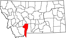 | |
| Towns | ||
| CDPs | ||
| Other unincorporated communities | ||
| Footnotes | ‡This populated place also has portions in an adjacent county or counties | |