Teton County, Montana
| Teton County, Montana | |
|---|---|
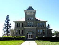
 Teton County Courthouse in Choteau | |
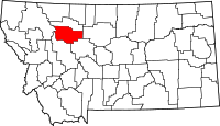 Location in the U.S. state of Montana | |
 Montana's location in the U.S. | |
| Founded | 1893 |
| Seat | Choteau |
| Largest city | Choteau |
| Area | |
| • Total | 2,293 sq mi (5,939 km2) |
| • Land | 2,272 sq mi (5,884 km2) |
| • Water | 20 sq mi (52 km2), 0.9% |
| Population (est.) | |
| • (2017) | 6,085[1] |
| • Density | 2.7/sq mi (1.0/km2) |
| Congressional district | At-large |
| Time zone | Mountain: UTC−7/−6 |
| Website |
www |
Teton County is a county located in the U.S. state of Montana. As of the 2010 census, the population was 6,073.[2] Its county seat is Choteau.[3] The county was founded in 1893.[4]
Geography
According to the U.S. Census Bureau, the county has a total area of 2,293 square miles (5,940 km2), of which 2,272 square miles (5,880 km2) is land and 20 square miles (52 km2) (0.9%) is water.[5]
Adjacent counties
- Pondera County, Montana – north
- Chouteau County, Montana – east
- Cascade County, Montana – south
- Lewis and Clark County, Montana – south
- Flathead County, Montana – west
National protected area
- Lewis and Clark National Forest (part)
- Rocky Mountain Front Conservation Area (part)
Demographics
| Historical population | |||
|---|---|---|---|
| Census | Pop. | %± | |
| 1900 | 5,080 | — | |
| 1910 | 9,546 | 87.9% | |
| 1920 | 5,870 | −38.5% | |
| 1930 | 6,068 | 3.4% | |
| 1940 | 6,922 | 14.1% | |
| 1950 | 7,232 | 4.5% | |
| 1960 | 7,295 | 0.9% | |
| 1970 | 6,116 | −16.2% | |
| 1980 | 6,491 | 6.1% | |
| 1990 | 6,271 | −3.4% | |
| 2000 | 6,445 | 2.8% | |
| 2010 | 6,073 | −5.8% | |
| Est. 2017 | 6,085 | [6] | 0.2% |
| U.S. Decennial Census[7] 1790–1960[8] 1900–1990[9] 1990–2000[10] 2010–2015[2] | |||
2000 census
As of the census[11] of 2000, there were 6,445 people, 2,538 households, and 1,761 families residing in the county. The population density was 3 people per square mile (1/km²). There were 2,910 housing units at an average density of 1 per square mile (0/km²). The racial makeup of the county was 96.31% White, 0.19% Black or African American, 1.52% Native American, 0.09% Asian, 0.42% from other races, and 1.47% from two or more races. 1.13% of the population were Hispanic or Latino of any race. 26.0% were of German, 14.2% Norwegian, 9.9% English, 8.9% American and 8.8% Irish ancestry. 92.7% spoke English and 6.1% German as their first language.
There were 2,538 households out of which 31.60% had children under the age of 18 living with them, 61.10% were married couples living together, 5.90% had a female householder with no husband present, and 30.60% were non-families. 27.30% of all households were made up of individuals and 13.90% had someone living alone who was 65 years of age or older. The average household size was 2.51 and the average family size was 3.09.
In the county, the population was spread out with 27.30% under the age of 18, 6.10% from 18 to 24, 24.60% from 25 to 44, 25.40% from 45 to 64, and 16.60% who were 65 years of age or older. The median age was 40 years. For every 100 females there were 97.00 males. For every 100 females age 18 and over, there were 96.00 males.
The median income for a household in the county was $30,197, and the median income for a family was $36,662. Males had a median income of $25,794 versus $18,389 for females. The per capita income for the county was $14,635. About 12.20% of families and 16.60% of the population were below the poverty line, including 25.60% of those under age 18 and 8.40% of those age 65 or over.
2010 census
As of the 2010 United States Census, there were 6,073 people, 2,450 households, and 1,643 families residing in the county.[12] The population density was 2.7 inhabitants per square mile (1.0/km2). There were 2,892 housing units at an average density of 1.3 per square mile (0.50/km2).[13] The racial makeup of the county was 96.3% white, 1.4% American Indian, 0.1% Asian, 0.2% from other races, and 1.9% from two or more races. Those of Hispanic or Latino origin made up 1.3% of the population.[12] In terms of ancestry, 40.2% were German, 14.7% were Norwegian, 14.5% were Irish, 11.9% were English, 6.4% were Swedish, 6.0% were Dutch, and 4.3% were American.[14]
Of the 2,450 households, 25.7% had children under the age of 18 living with them, 58.2% were married couples living together, 6.0% had a female householder with no husband present, 32.9% were non-families, and 29.3% of all households were made up of individuals. The average household size was 2.29 and the average family size was 2.83. The median age was 45.8 years.[12]
The median income for a household in the county was $39,516 and the median income for a family was $49,102. Males had a median income of $34,824 versus $24,419 for females. The per capita income for the county was $20,509. About 11.0% of families and 12.8% of the population were below the poverty line, including 13.3% of those under age 18 and 13.5% of those age 65 or over.[15]
Politics
| Year | Republican | Democratic | Third parties |
|---|---|---|---|
| 2016 | 68.1% 2,170 | 25.4% 808 | 6.6% 210 |
| 2012 | 64.4% 2,113 | 33.0% 1,082 | 2.6% 86 |
| 2008 | 57.3% 1,874 | 39.6% 1,294 | 3.2% 104 |
| 2004 | 66.5% 2,232 | 31.2% 1,047 | 2.4% 80 |
| 2000 | 69.2% 2,294 | 25.6% 847 | 5.2% 173 |
| 1996 | 51.1% 1,701 | 35.7% 1,188 | 13.1% 437 |
| 1992 | 40.1% 1,364 | 30.6% 1,043 | 29.3% 998 |
| 1988 | 57.8% 1,876 | 40.2% 1,303 | 2.0% 65 |
| 1984 | 66.7% 2,257 | 32.6% 1,102 | 0.7% 25 |
| 1980 | 67.8% 2,415 | 25.3% 902 | 6.9% 247 |
| 1976 | 51.7% 1,730 | 45.0% 1,506 | 3.3% 109 |
| 1972 | 60.0% 1,991 | 33.8% 1,121 | 6.3% 209 |
| 1968 | 54.6% 1,697 | 39.5% 1,228 | 5.9% 184 |
| 1964 | 43.4% 1,388 | 56.5% 1,808 | 0.1% 3 |
| 1960 | 49.5% 1,623 | 50.3% 1,648 | 0.2% 5 |
| 1956 | 51.6% 1,728 | 48.4% 1,622 | 0.0% 0 |
| 1952 | 58.6% 1,978 | 41.1% 1,389 | 0.3% 11 |
| 1948 | 37.0% 1,005 | 60.0% 1,632 | 3.1% 83 |
| 1944 | 41.3% 1,074 | 58.0% 1,508 | 0.7% 19 |
| 1940 | 39.1% 1,132 | 60.0% 1,735 | 0.9% 27 |
| 1936 | 23.7% 604 | 75.2% 1,917 | 1.1% 29 |
| 1932 | 36.0% 875 | 61.6% 1,496 | 2.4% 57 |
| 1928 | 60.6% 1,263 | 38.6% 804 | 0.9% 18 |
| 1924 | 40.4% 775 | 20.6% 396 | 39.0% 749 |
| 1920 | 62.3% 1,319 | 31.7% 671 | 6.1% 129 |
| 1916 | 38.4% 1,603 | 54.5% 2,273 | 7.1% 297 |
| 1912 | 30.7% 612 | 32.5% 646 | 36.8% 733 |
| 1908 | 60.4% 622 | 34.8% 358 | 4.9% 50 |
| 1904 | 64.2% 808 | 33.4% 420 | 2.4% 30 |
Communities
City
- Choteau (county seat)
Towns
Census-designated places
Unincorporated community
Notable residents
- John Edward Erickson, later Governor of Montana, served as county attorney of Teton County from 1897 to 1905.
Joe DeYong (artist, sculptor, illustrator, Hollywood movie technical advisor and protege of Charles M. Russell) lived in Choteau from July 1914 to January 1924.
See also
References
- ↑ https://factfinder.census.gov/faces/nav/jsf/pages/community_facts.xhtml?src=bkmk
- 1 2 "State & County QuickFacts". United States Census Bureau. Retrieved September 16, 2013.
- ↑ "Find a County". National Association of Counties. Retrieved 2011-06-07.
- ↑ Montana Place Names from Alzada to Zortman. Helena, MT: Montana Historical Society Press. 2009. p. 262.
- ↑ "2010 Census Gazetteer Files". United States Census Bureau. August 22, 2012. Archived from the original on December 5, 2014. Retrieved November 30, 2014.
- ↑ "Population and Housing Unit Estimates". Retrieved June 9, 2017.
- ↑ "U.S. Decennial Census". United States Census Bureau. Retrieved November 30, 2014.
- ↑ "Historical Census Browser". University of Virginia Library. Retrieved November 30, 2014.
- ↑ "Population of Counties by Decennial Census: 1900 to 1990". United States Census Bureau. Retrieved November 30, 2014.
- ↑ "Census 2000 PHC-T-4. Ranking Tables for Counties: 1990 and 2000" (PDF). United States Census Bureau. Retrieved November 30, 2014.
- ↑ "American FactFinder". United States Census Bureau. Retrieved 2008-01-31.
- 1 2 3 "DP-1 Profile of General Population and Housing Characteristics: 2010 Demographic Profile Data". United States Census Bureau. Retrieved 2016-01-10.
- ↑ "Population, Housing Units, Area, and Density: 2010 – County". United States Census Bureau. Retrieved 2016-01-10.
- ↑ "DP02 SELECTED SOCIAL CHARACTERISTICS IN THE UNITED STATES – 2006–2010 American Community Survey 5-Year Estimates". United States Census Bureau. Retrieved 2016-01-10.
- ↑ "DP03 SELECTED ECONOMIC CHARACTERISTICS – 2006–2010 American Community Survey 5-Year Estimates". United States Census Bureau. Retrieved 2016-01-10.
- ↑ Leip, David. "Dave Leip's Atlas of U.S. Presidential Elections". uselectionatlas.org. Retrieved 2018-04-03.
Places adjacent to Teton County, Montana | ||||||||||
|---|---|---|---|---|---|---|---|---|---|---|
| ||||||||||
Municipalities and communities of Teton County, Montana, United States | ||
|---|---|---|
| City | | |
| Towns | ||
| CDPs | ||
| Unincorporated communities | ||
