Toole County, Montana
| Toole County, Montana | |
|---|---|
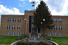 Toole County Courthouse in Shelby | |
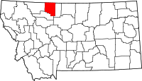 Location in the U.S. state of Montana | |
 Montana's location in the U.S. | |
| Founded | 1914 |
| Named for | Joseph Toole |
| Seat | Shelby |
| Largest city | Shelby |
| Area | |
| • Total | 1,946 sq mi (5,040 km2) |
| • Land | 1,916 sq mi (4,962 km2) |
| • Water | 30 sq mi (78 km2), 1.5% |
| Population (est.) | |
| • (2015) | 5,087 |
| • Density | 2.8/sq mi (1.1/km2) |
| Congressional district | At-large |
| Time zone | Mountain: UTC−7/−6 |
| Website |
www |
Toole County is a county located in the northern portion of the U.S. state of Montana. As of the 2010 census, the population was 5,324.[1] Its county seat is Shelby.[2] The county was established in 1914 from parts of Hill County and Teton County and was named after Joseph Toole, the first and fourth governor of Montana. Its northern boundary is the Canada–United States border south of Alberta.
Geography
According to the U.S. Census Bureau, the county has a total area of 1,946 square miles (5,040 km2), of which 1,916 square miles (4,960 km2) is land and 30 square miles (78 km2) (1.5%) is water.[3]
Its northern boundary is the Canada–United States border. A part of its southern boundary is formed by Marias River, which flows through the south-eastern portion. In the eastern part are several creeks, the largest of which is Willow, which rises in the Sweet Grass hills and follows a southerly course through the county. In the Sweet Grass hills and elsewhere indications of oil and gas have been found.
Major highways


Adjacent counties
- Glacier County, Montana - west
- Pondera County, Montana - south
- Liberty County, Montana - east
- County of Warner No. 5, Alberta - north
- Village of Coutts, Alberta - north
- County of Forty Mile No. 8, Alberta - northeast
Demographics
| Historical population | |||
|---|---|---|---|
| Census | Pop. | %± | |
| 1920 | 3,724 | — | |
| 1930 | 6,714 | 80.3% | |
| 1940 | 6,769 | 0.8% | |
| 1950 | 6,867 | 1.4% | |
| 1960 | 7,904 | 15.1% | |
| 1970 | 5,839 | −26.1% | |
| 1980 | 5,559 | −4.8% | |
| 1990 | 5,046 | −9.2% | |
| 2000 | 5,267 | 4.4% | |
| 2010 | 5,324 | 1.1% | |
| Est. 2016 | 4,977 | [4] | −6.5% |
| U.S. Decennial Census[5] 1790-1960[6] 1900-1990[7] 1990-2000[8] 2010-2015[1] | |||
2000 census
As of the census[9] of 2000, there were 5,267 people, 1,962 households, and 1,308 families residing in the county. The population density was 3 people per square mile (1/km²). There were 2,300 housing units at an average density of 1 per square mile (0/km²). The racial makeup of the county was 93.89% White, 0.15% Black or African American, 3.19% Native American, 0.30% Asian, 0.02% Pacific Islander, 0.32% from other races, and 2.13% from two or more races. 1.16% of the population were Hispanic or Latino of any race. 23.0% were of German, 19.4% Norwegian, 10.2% Irish, 8.3% American and 8.3% English ancestry. 93.7% spoke English, 4.2% German and 1.3% Spanish as their first language.
There were 1,962 households out of which 32.30% had children under the age of 18 living with them, 56.80% were married couples living together, 6.50% had a female householder with no husband present, and 33.30% were non-families. 30.20% of all households were made up of individuals and 13.70% had someone living alone who was 65 years of age or older. The average household size was 2.47 and the average family size was 3.09.
In the county, the population was spread out with 25.50% under the age of 18, 6.80% from 18 to 24, 28.20% from 25 to 44, 23.60% from 45 to 64, and 15.90% who were 65 years of age or older. The median age was 39 years. For every 100 females there were 106.50 males. For every 100 females age 18 and over, there were 107.20 males.
The median income for a household in the county was $30,169, and the median income for a family was $39,600. Males had a median income of $27,284 versus $19,141 for females. The per capita income for the county was $14,731. About 9.70% of families and 12.90% of the population were below the poverty line, including 15.00% of those under age 18 and 9.50% of those age 65 or over.
2010 census
As of the 2010 United States Census, there were 5,324 people, 2,015 households, and 1,246 families residing in the county.[10] The population density was 2.8 inhabitants per square mile (1.1/km2). There were 2,336 housing units at an average density of 1.2 per square mile (0.46/km2).[11] The racial makeup of the county was 92.0% white, 4.5% American Indian, 0.5% black or African American, 0.4% Asian, 0.6% from other races, and 1.9% from two or more races. Those of Hispanic or Latino origin made up 2.4% of the population.[10] In terms of ancestry, 30.8% were German, 17.7% were Irish, 15.8% were English, 10.5% were Norwegian, and 3.6% were American.[12]
Of the 2,015 households, 27.3% had children under the age of 18 living with them, 49.8% were married couples living together, 7.4% had a female householder with no husband present, 38.2% were non-families, and 34.3% of all households were made up of individuals. The average household size was 2.26 and the average family size was 2.88. The median age was 41.5 years.[10]
The median income for a household in the county was $42,949 and the median income for a family was $54,722. Males had a median income of $41,490 versus $32,582 for females. The per capita income for the county was $20,464. About 11.3% of families and 15.7% of the population were below the poverty line, including 23.2% of those under age 18 and 8.0% of those age 65 or over.[13]
Politics
| Year | Republican | Democratic | Third parties |
|---|---|---|---|
| 2016 | 73.5% 1,497 | 19.7% 402 | 6.8% 138 |
| 2012 | 68.5% 1,440 | 27.7% 582 | 3.8% 80 |
| 2008 | 62.1% 1,317 | 34.8% 737 | 3.2% 67 |
| 2004 | 68.5% 1,583 | 29.9% 690 | 1.6% 38 |
| 2000 | 68.9% 1,639 | 26.5% 630 | 4.6% 109 |
| 1996 | 48.5% 1,203 | 35.2% 874 | 16.3% 405 |
| 1992 | 34.7% 943 | 31.4% 854 | 33.9% 920 |
| 1988 | 57.1% 1,505 | 40.6% 1,070 | 2.2% 59 |
| 1984 | 70.4% 1,949 | 28.5% 789 | 1.1% 30 |
| 1980 | 70.2% 2,000 | 22.3% 634 | 7.6% 216 |
| 1976 | 56.4% 1,469 | 41.5% 1,080 | 2.1% 54 |
| 1972 | 59.6% 1,679 | 31.9% 897 | 8.5% 239 |
| 1968 | 52.0% 1,407 | 38.7% 1,048 | 9.3% 253 |
| 1964 | 42.6% 1,223 | 57.4% 1,649 | 0.1% 2 |
| 1960 | 47.1% 1,577 | 52.8% 1,767 | 0.1% 4 |
| 1956 | 56.9% 1,927 | 43.1% 1,460 | 0.0% 0 |
| 1952 | 56.3% 1,853 | 43.3% 1,426 | 0.5% 15 |
| 1948 | 37.8% 1,092 | 60.8% 1,756 | 1.4% 40 |
| 1944 | 41.7% 1,113 | 57.9% 1,545 | 0.4% 10 |
| 1940 | 38.3% 1,218 | 61.4% 1,954 | 0.3% 10 |
| 1936 | 22.7% 654 | 73.5% 2,120 | 3.8% 110 |
| 1932 | 30.0% 862 | 66.7% 1,917 | 3.3% 95 |
| 1928 | 54.7% 1,325 | 44.4% 1,076 | 0.9% 21 |
| 1924 | 37.5% 697 | 23.6% 439 | 38.9% 723 |
| 1920 | 61.3% 861 | 28.8% 405 | 9.9% 139 |
| 1916 | 35.4% 698 | 54.5% 1,075 | 10.1% 199 |
Communities
City
- Shelby (county seat)
Towns
Census-designated place
Unincorporated communities
Notable people
- Earl W. Bascom (1906-1995), "Father of Modern Rodeo" and Hall of Fame Cowboy, artist, sculptor, actor, inventor, cowboyed in the 1920s on a ranch on Kicking Horse Creek once owned by his cousin C.M. Russell
- Charles M. Russell (1864-1926), cowboy artist and sculptor, ranched on Kicking Horse Creek near the Sweetgrass Hills, honored in the Hall of Great Westerners in Oklahoma City
See also
References
- 1 2 "State & County QuickFacts". United States Census Bureau. Retrieved September 16, 2013.
- ↑ "Find a County". National Association of Counties. Retrieved 2011-06-07.
- ↑ "2010 Census Gazetteer Files". United States Census Bureau. August 22, 2012. Archived from the original on December 5, 2014. Retrieved November 30, 2014.
- ↑ "Population and Housing Unit Estimates". Retrieved June 9, 2017.
- ↑ "U.S. Decennial Census". United States Census Bureau. Retrieved November 30, 2014.
- ↑ "Historical Census Browser". University of Virginia Library. Retrieved November 30, 2014.
- ↑ "Population of Counties by Decennial Census: 1900 to 1990". United States Census Bureau. Retrieved November 30, 2014.
- ↑ "Census 2000 PHC-T-4. Ranking Tables for Counties: 1990 and 2000" (PDF). United States Census Bureau. Retrieved November 30, 2014.
- ↑ "American FactFinder". United States Census Bureau. Retrieved 2008-01-31.
- 1 2 3 "DP-1 Profile of General Population and Housing Characteristics: 2010 Demographic Profile Data". United States Census Bureau. Retrieved 2016-01-10.
- ↑ "Population, Housing Units, Area, and Density: 2010 - County". United States Census Bureau. Retrieved 2016-01-10.
- ↑ "DP02 SELECTED SOCIAL CHARACTERISTICS IN THE UNITED STATES – 2006-2010 American Community Survey 5-Year Estimates". United States Census Bureau. Retrieved 2016-01-10.
- ↑ "DP03 SELECTED ECONOMIC CHARACTERISTICS – 2006-2010 American Community Survey 5-Year Estimates". United States Census Bureau. Retrieved 2016-01-10.
- ↑ Leip, David. "Dave Leip's Atlas of U.S. Presidential Elections". uselectionatlas.org. Retrieved 2018-04-03.
External links
- Toole County Website (official site)
- City of Shelby (official site)
- (Shelby Area Chamber of Commerce)
- NBMC (24/7 Local News and Events)
- Shelby Promoter (weekly newspaper)
Places adjacent to Toole County, Montana | ||||||||||
|---|---|---|---|---|---|---|---|---|---|---|
| ||||||||||
Municipalities and communities of Toole County, Montana, United States | ||
|---|---|---|
| City | | |
| Towns | ||
| CDP | ||
| Unincorporated communities | ||
