Hill County, Montana
| Hill County, Montana | |
|---|---|
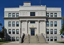 Hill County Courthouse in Havre | |
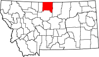 Location in the U.S. state of Montana | |
 Montana's location in the U.S. | |
| Founded | 1912 |
| Named for | James J. Hill |
| Seat | Havre |
| Largest city | Havre |
| Area | |
| • Total | 2,916 sq mi (7,552 km2) |
| • Land | 2,899 sq mi (7,508 km2) |
| • Water | 17 sq mi (44 km2), 0.6% |
| Population (est.) | |
| • (2015) | 16,572 |
| • Density | 5.6/sq mi (2.2/km2) |
| Congressional district | At-large |
| Time zone | Mountain: UTC−7/−6 |
| Website |
hillcounty |
Hill County is a county located in the U.S. state of Montana. As of the 2010 census, the population was 16,096.[1] Its county seat is Havre.[2] It is south from the Canadian borders of Alberta and Saskatchewan.
History
The first European-American settlement was Fort Assinniboine, first garrisoned by the United States Army in 1879. Fifteen of the original 104 structures from the fort are still standing.
The county is named after James J. Hill, president of the Great Northern Railway Company, which built the rail line across Montana as part of the Transcontinental Railroad to the Pacific coast.
Geography
According to the U.S. Census Bureau, the county has a total area of 2,916 square miles (7,550 km2), of which 2,899 square miles (7,510 km2) is land and 17 square miles (44 km2) (0.6%) is water.[3]
Hill County is on the "Hi-Line" in north-central Montana. It borders Blaine County to the east, Liberty County to the west, Chouteau County to the south, and Canada to the north. Hill County contains Beaver Creek park, the largest county park in the nation.
It is one of the few locations in the United States to have an antipodal point on land, and its community of Rudyard is the only populated such place. The Kerguelen Islands are on the opposite side of the earth from parts of Hill County, while the antipodal points of almost all other places in the United States lie in the Indian Ocean.
Adjacent counties
- Liberty County, Montana - west
- Chouteau County, Montana - south
- Blaine County, Montana - east
- County of Forty Mile No. 8, Alberta - northwest
- Cypress County, Alberta - north
- Reno No. 51, Saskatchewan - northeast
Major highways
National protected areas
Politics
In presidential elections, Hill County is a swing county. Since 1952, it has voted for the Democratic nominee 9 times and the Republican nominee 8 times.
| Year | Republican | Democratic | Third parties |
|---|---|---|---|
| 2016 | 54.0% 3,478 | 36.8% 2,371 | 9.3% 596 |
| 2012 | 46.4% 3,164 | 49.9% 3,403 | 3.8% 258 |
| 2008 | 42.1% 2,787 | 54.3% 3,596 | 3.7% 242 |
| 2004 | 52.7% 3,505 | 45.0% 2,997 | 2.3% 155 |
| 2000 | 51.7% 3,392 | 42.1% 2,760 | 6.2% 406 |
| 1996 | 36.6% 2,601 | 49.5% 3,517 | 14.0% 993 |
| 1992 | 29.8% 2,408 | 44.8% 3,618 | 25.4% 2,056 |
| 1988 | 44.5% 3,467 | 54.2% 4,219 | 1.4% 105 |
| 1984 | 55.2% 4,635 | 43.6% 3,657 | 1.2% 98 |
| 1980 | 55.0% 4,448 | 35.5% 2,875 | 9.5% 766 |
| 1976 | 45.1% 3,274 | 53.4% 3,878 | 1.5% 108 |
| 1972 | 53.1% 3,759 | 43.2% 3,061 | 3.7% 265 |
| 1968 | 44.5% 2,970 | 50.8% 3,386 | 4.7% 313 |
| 1964 | 31.8% 2,101 | 68.0% 4,491 | 0.2% 12 |
| 1960 | 45.7% 3,163 | 54.1% 3,741 | 0.2% 12 |
| 1956 | 53.2% 3,415 | 46.8% 2,999 | 0.0% 0 |
| 1952 | 55.4% 3,474 | 43.9% 2,748 | 0.7% 44 |
| 1948 | 31.8% 1,645 | 64.1% 3,321 | 4.2% 215 |
| 1944 | 35.3% 1,646 | 64.0% 2,986 | 0.8% 37 |
| 1940 | 32.8% 1,842 | 65.9% 3,700 | 1.3% 75 |
| 1936 | 18.4% 1,014 | 78.4% 4,328 | 3.2% 178 |
| 1932 | 31.4% 1,589 | 64.4% 3,257 | 4.1% 208 |
| 1928 | 53.4% 2,336 | 46.2% 2,022 | 0.4% 19 |
| 1924 | 30.6% 1,110 | 16.6% 602 | 52.8% 1,916 |
| 1920 | 55.4% 2,220 | 34.7% 1,388 | 9.9% 396 |
| 1916 | 31.7% 1,709 | 60.2% 3,241 | 8.1% 436 |
| 1912 | 26.4% 536 | 30.8% 624 | 42.8% 868[5] |
Demographics
| Historical population | |||
|---|---|---|---|
| Census | Pop. | %± | |
| 1920 | 13,958 | — | |
| 1930 | 13,775 | −1.3% | |
| 1940 | 13,304 | −3.4% | |
| 1950 | 14,285 | 7.4% | |
| 1960 | 18,653 | 30.6% | |
| 1970 | 17,358 | −6.9% | |
| 1980 | 17,985 | 3.6% | |
| 1990 | 17,654 | −1.8% | |
| 2000 | 16,673 | −5.6% | |
| 2010 | 16,096 | −3.5% | |
| Est. 2016 | 16,542 | [6] | 2.8% |
| U.S. Decennial Census[7] 1790-1960[8] 1900-1990[9] 1990-2000[10] 2010-2015[1] | |||
2000 census
As of the census[11] of 2000, there were 16,673 people, 6,457 households, and 4,255 families residing in the county. The population density was 6 people per square mile (2/km²). There were 7,453 housing units at an average density of 3 per square mile (1/km²). The racial makeup of the county was 79.55% White, 0.09% Black or African American, 17.30% Native American, 0.37% Asian, 0.02% Pacific Islander, 0.35% from other races, and 2.32% from two or more races. 1.25% of the population were Hispanic or Latino of any race. 21.1% were of German, 13.5% Norwegian, 8.7% Irish, 6.7% American and 6.2% English ancestry. 93.9% spoke English, 3.3% Cree and 2.0% German as their first language.
There were 6,457 households out of which 34.30% had children under the age of 18 living with them, 50.50% were married couples living together, 10.90% had a female householder with no husband present, and 34.10% were non-families. 28.60% of all households were made up of individuals and 11.40% had someone living alone who was 65 years of age or older. The average household size was 2.53 and the average family size was 3.15.
In the county, the population was spread out with 28.20% under the age of 18, 11.60% from 18 to 24, 26.00% from 25 to 44, 21.40% from 45 to 64, and 12.80% who were 65 years of age or older. The median age was 34 years. For every 100 females there were 99.30 males. For every 100 females age 18 and over, there were 96.40 males.
The median income for a household in the county was $30,781, and the median income for a family was $38,179. Males had a median income of $29,908 versus $19,874 for females. The per capita income for the county was $14,935. About 15.30% of families and 18.40% of the population were below the poverty line, including 23.30% of those under age 18 and 9.00% of those age 65 or over.
2010 census
As of the 2010 United States Census, there were 16,096 people, 6,275 households, and 4,020 families residing in the county.[12] The population density was 5.6 inhabitants per square mile (2.2/km2). There were 7,250 housing units at an average density of 2.5 per square mile (0.97/km2).[13] The racial makeup of the county was 73.9% white, 21.7% American Indian, 0.4% Asian, 0.3% black or African American, 0.3% from other races, and 3.3% from two or more races. Those of Hispanic or Latino origin made up 2.3% of the population.[12] In terms of ancestry, 28.9% were German, 18.5% were Norwegian, 12.7% were Irish, 9.2% were English, and 3.0% were American.[14]
Of the 6,275 households, 32.5% had children under the age of 18 living with them, 46.3% were married couples living together, 11.9% had a female householder with no husband present, 35.9% were non-families, and 29.8% of all households were made up of individuals. The average household size was 2.47 and the average family size was 3.10. The median age was 35.1 years.[12]
The median income for a household in the county was $43,606 and the median income for a family was $55,963. Males had a median income of $44,286 versus $28,908 for females. The per capita income for the county was $21,420. About 12.4% of families and 17.9% of the population were below the poverty line, including 24.0% of those under age 18 and 9.6% of those age 65 or over.[15]
Communities
City
- Havre (county seat)
Town
Census-designated places
Unincorporated communities
See also
References
- 1 2 "State & County QuickFacts". United States Census Bureau. Archived from the original on July 11, 2011. Retrieved September 15, 2013.
- ↑ "Find a County". National Association of Counties. Archived from the original on May 31, 2011. Retrieved 2011-06-07.
- ↑ "2010 Census Gazetteer Files". United States Census Bureau. August 22, 2012. Archived from the original on December 5, 2014. Retrieved November 28, 2014.
- ↑ Leip, David. "Dave Leip's Atlas of U.S. Presidential Elections". uselectionatlas.org. Retrieved 2018-04-03.
- ↑ The leading "other" candidate, Progressive Theodore Roosevelt, received 545 votes, while Socialist candidate Eugene Debs received 323 votes.
- ↑ "Population and Housing Unit Estimates". Retrieved June 9, 2017.
- ↑ "U.S. Decennial Census". United States Census Bureau. Archived from the original on May 12, 2015. Retrieved November 28, 2014.
- ↑ "Historical Census Browser". University of Virginia Library. Retrieved November 28, 2014.
- ↑ "Population of Counties by Decennial Census: 1900 to 1990". United States Census Bureau. Retrieved November 28, 2014.
- ↑ "Census 2000 PHC-T-4. Ranking Tables for Counties: 1990 and 2000" (PDF). United States Census Bureau. Retrieved November 28, 2014.
- ↑ "American FactFinder". United States Census Bureau. Retrieved 2008-01-31.
- 1 2 3 "DP-1 Profile of General Population and Housing Characteristics: 2010 Demographic Profile Data". United States Census Bureau. Retrieved 2016-01-10.
- ↑ "Population, Housing Units, Area, and Density: 2010 - County". United States Census Bureau. Retrieved 2016-01-10.
- ↑ "DP02 SELECTED SOCIAL CHARACTERISTICS IN THE UNITED STATES – 2006-2010 American Community Survey 5-Year Estimates". United States Census Bureau. Retrieved 2016-01-10.
- ↑ "DP03 SELECTED ECONOMIC CHARACTERISTICS – 2006-2010 American Community Survey 5-Year Estimates". United States Census Bureau. Retrieved 2016-01-10.
External links
Places adjacent to Hill County, Montana | |
|---|---|
Municipalities and communities of Hill County, Montana, United States | ||
|---|---|---|
| City | | |
| Town | ||
| CDPs | ||
| Unincorporated communities | ||
| Indian reservation | ||
| Footnotes | ‡This populated place also has portions in an adjacent county or counties | |
