Amsterdam, Montana
| Amsterdam, Montana | |
|---|---|
| CDP | |
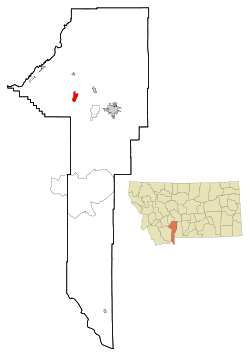 Location of Amsterdam-Churchill, Montana | |
| Coordinates: 45°44′18″N 111°20′20″W / 45.73833°N 111.33889°WCoordinates: 45°44′18″N 111°20′20″W / 45.73833°N 111.33889°W | |
| Country | United States |
| State | Montana |
| County | Gallatin |
| Area | |
| • Total | 2.725 sq mi (7.056 km2) |
| • Land | 2.707 sq mi (7.010 km2) |
| • Water | 0.018 sq mi (0.046 km2) |
| Population (2010) | |
| • Total | 180 |
| • Density | 66/sq mi (26/km2) |
| Time zone | UTC-7 (Mountain (MST)) |
| • Summer (DST) | UTC-6 (MDT) |
| Area code(s) | 406 |
| FIPS code | 30-01550 |
Amsterdam is a census-designated place (CDP) in Gallatin County, Montana, United States. The population was 180 at the 2010 census. It is part of the Bozeman, MT Micropolitan Statistical Area. It was formerly part of the Amsterdam-Churchill CDP.
Geography
Amsterdam is located at 45°44′18″N 111°20′20″W / 45.73833°N 111.33889°W (45.738262, -111.339096).[1]
According to the United States Census Bureau, the CDP has a total area of 2.7 square miles (7.0 km2), all of it land.
History
Originally called Walrath for farmer A. J. Walrath, Amsterdam was established in 1911 by the Northern Pacific Railway on a branch line between Manhattan and Anceney. The railroad changed the name to Amsterdam because of the large number of Dutch settlers who had moved to the area in the 1890s to grow malting barley to supply the Manhattan Malting Company.
References
- ↑ "US Gazetteer files: 2010, 2000, and 1990". United States Census Bureau. 2011-02-12. Retrieved 2011-04-23.
External links
Municipalities and communities of Gallatin County, Montana, United States | ||
|---|---|---|
| Cities | 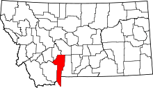 | |
| Towns | ||
| CDPs | ||
| Other unincorporated communities | ||
| Footnotes | ‡This populated place also has portions in an adjacent county or counties | |