Ede, Netherlands
| Ede | |||
|---|---|---|---|
| City and Municipality | |||
 Ede city centre | |||
| |||
.svg.png) Location in Gelderland | |||
| Coordinates: 52°3′N 5°40′E / 52.050°N 5.667°ECoordinates: 52°3′N 5°40′E / 52.050°N 5.667°E | |||
| Country | Netherlands | ||
| Province | Gelderland | ||
| Government[1] | |||
| • Body | Municipal council | ||
| • Mayor | René Verhulst (CDA) | ||
| Area[2] | |||
| • Total | 318.62 km2 (123.02 sq mi) | ||
| • Land | 318.25 km2 (122.88 sq mi) | ||
| • Water | 0.37 km2 (0.14 sq mi) | ||
| Elevation[3] | 30 m (100 ft) | ||
| Population (August 2017)[4] | |||
| • Total | 114,045 | ||
| • Density | 358/km2 (930/sq mi) | ||
| Demonym(s) | Edenaar | ||
| Time zone | UTC+1 (CET) | ||
| • Summer (DST) | UTC+2 (CEST) | ||
| Postcode | 6710–6745, 6877 | ||
| Area code | 0318 | ||
| Website |
www | ||


Ede (Dutch pronunciation: [ˈeːdə] (![]()
Population centres
Community (population):
- Bennekom: 14,749
- De Klomp: 508
- Deelen: 50
- Ede (town): 67,812
- Ederveen: 3,167
- Harskamp: 3,464
- Hoenderloo: 65
- Lunteren: 12,464
- Otterlo (Kröller-Müller Museum): 2,383
- Wekerom: 2,506
- Total: 107,168
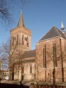
The town of Ede
Location
.jpg)
The town itself is situated halfway between the larger cities of Arnhem and Utrecht with direct rail and road connections to both cities. There are no connections to any water nearby; however, there also is a direct road connection to the city of Wageningen which hosts a small industrial port on the river Rijn and a direct road and rail connection to the city of Arnhem, which features larger port at a greater distance. The environment is clean and green due to the fact Ede is partly built in a forest and partly on the central Dutch plains in the national park called Nationaal Park "De Hoge Veluwe".
Economy
Economically, the town of Ede is doing fairly well thanks to the proximity of major highways and railways which offer fast connections to the port of Rotterdam, Schiphol airport and the Ruhr Area in Germany. The main sources of employment used to be a factory belonging to the Dutch Enka company and the three military bases situated in the northeast of the town. The factory however, has been closed and the military bases are largely underused since conscription was abolished. The town's economy is lately becoming more focused on national tourism from the more densely populated western cities like Amsterdam and Den Haag, and on education such as local colleges and the large Wageningen University in the city of Wageningen.
Some of the more notable or larger companies and other employers in and around Ede are:
- Fruit juice and drinks-factory Riedel, now part of FrieslandCampina.
- Plant and flower auction house Plantion (since 1 March 2010).[5]
- Advertising agency Lukkien who developed their own heliport on the roof of their office.[6]
- The Dutch headquarters for Kimberly-Clark.[7]
- The Dutch headquarters of mattress and pillow manufacturer Tempur-Pedic.[8]
- Deli-XL, a foodservice distributor in Belgium and the Netherlands.[9]
- The head office and two of the main datacenters of independent internet provider BIT.[10]
- The world headquarters of organ manufacturer Johannus Orgelbouw.
Transportation
Ede is situated along the A12 motorway and has a direct link to the A1 via the A30.

There are two railway stations in Ede: Ede-Wageningen railway station and Ede Centrum railway station. Ede-Wageningen is the main station with services to Alkmaar, Amersfoort, Amsterdam, Amsterdam Airport Schiphol, Arnhem, Barneveld, Den Helder and Utrecht.
Ede Centrum is served by trains from Amersfoort and Barneveld to Ede-Wageningen.
Education
There are four secondary schools in Ede: Marnix College,[11] Pallas Athene College,[12] one division of Het Streek[13] and Groenhorst College . In addition, Ede has a university of applied sciences, the Christian University of Applied Sciences Ede (Christelijke Hogeschool Ede).[14]
Recently, a primary college focused on the equivalent of basic education named ROC A12 has been gaining interest and popularity since renovations started in 2015.[15]
Social life
Each year, there is a municipality-wide celebration called Heideweek (Week of the heather) which lasts a week largely involves traditional Dutch festivities, along with local customs. During the week, a Queen of the heather and a Princess of the heather are elected from several candidates and will be the representative for the municipality of Ede on various other festivities, until next year when another a new queen and princess are elected
Notable residents
- Hans Dorrestijn (born 1940), writer and comedian
- Dick Schoenaker (born 1952), footballer
- John Scherrenburg (born 1963), water polo player
- Angela Postma (born 1971), swimmer
- Marianne Thieme (born 1972), politician
- Sonja Tol (born 1972), fencer
- Benno Kuipers (born 1974), swimmer
- Esmeral Tunçluer (born 1980), basketball player
- Ahmet Kilic (born 1984), footballer
- Rence van der Wal (born 1989), footballer
References
- ↑ "Burgemeester" [Mayor] (in Dutch). Gemeente Ede. Archived from the original on 14 July 2014. Retrieved 18 June 2014.
- ↑ "Kerncijfers wijken en buurten" [Key figures for neighbourhoods]. CBS Statline (in Dutch). CBS. 2 July 2013. Retrieved 12 March 2014.
- ↑ "Postcodetool for 6711DD". Actueel Hoogtebestand Nederland (in Dutch). Het Waterschapshuis. Retrieved 18 June 2014.
- ↑ "Bevolkingsontwikkeling; regio per maand" [Population growth; regions per month]. CBS Statline (in Dutch). CBS. 27 October 2017. Retrieved 27 October 2017.
- ↑ Homepage Plantion, visited 3 October 2010
- ↑ Infopage Lukkien Heliport and Approach Map
- ↑ Contact-page KCHealthcare website Archived 2010-08-04 at the Wayback Machine., visited 3 October 2010
- ↑ Contact page on Dutch website of company, visited 3 October 2010
- ↑ "Deli XL BV: Private Company Information - Businessweek". Businessweek.com. Retrieved 14 December 2012.
- ↑ Contact page on BIT website, visited 2 October 2010
- ↑ Marnix College
- ↑ Pallas Athene College
- ↑ Het Streek
- ↑ Christelijke Hogeschool Ede
- ↑ "ROC A12". ROC A12 (in Dutch). Retrieved 2017-07-20.
External links


- Official website
Places adjacent to Ede, Netherlands | |
|---|---|
