Geldermalsen
| Geldermalsen | |||
|---|---|---|---|
| Municipality | |||
 | |||
| |||
.svg.png) Location in Gelderland | |||
| Coordinates: 51°53′N 5°17′E / 51.883°N 5.283°ECoordinates: 51°53′N 5°17′E / 51.883°N 5.283°E | |||
| Country | Netherlands | ||
| Province | Gelderland | ||
| Government[1] | |||
| • Body | Municipal council | ||
| • Mayor | Jeroen Staatsen (acting) (VVD) | ||
| Area[2] | |||
| • Total | 101.73 km2 (39.28 sq mi) | ||
| • Land | 99.98 km2 (38.60 sq mi) | ||
| • Water | 1.75 km2 (0.68 sq mi) | ||
| Elevation[3] | 4 m (13 ft) | ||
| Population (August 2017)[4] | |||
| • Total | 26,767 | ||
| • Density | 268/km2 (690/sq mi) | ||
| Time zone | UTC+1 (CET) | ||
| • Summer (DST) | UTC+2 (CEST) | ||
| Postcode | 4150–4158, 4190–4197 | ||
| Area code | 0345 | ||
| Website |
www | ||


Geldermalsen (![]()
Municipality of Geldermalsen
The municipality of Geldermalsen was formed on January 1, 1978, when the former municipalities of Beesd, Buurmalsen, Deil and Geldermalsen were combined. The municipality has an area of 101.73 km2 (39.28 sq mi) and is one of the largest municipalities in the Betuwe. The municipality had a population of 26,767 in 2017.
The river Linge flows through the municipality and town of Geldermalsen.
Population centres
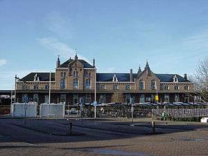
Town of Geldermalsen
The town centre of Geldermalsen contains a two-aisled Gothic church dating from the 15th century, with a Romanesque tower dating from the 13th century. The town contains two windmills: De Watermolen, which was built in 1772, and De Bouwing, which was built in 1848. Located in the east side there is a graveyard.
Public high-school 'The Lingeborgh' is located in the west.
Demographics
Ethnic composition of Geldermalsen in 2010:
See also
References
- ↑ "Mevrouw Miranda de Vries" (in Dutch). Gemeente Geldermalsen. Archived from the original on 14 July 2014. Retrieved 3 July 2014.
- ↑ "Kerncijfers wijken en buurten" [Key figures for neighbourhoods]. CBS Statline (in Dutch). CBS. 2 July 2013. Retrieved 12 March 2014.
- ↑ "Postcodetool for 4191KH". Actueel Hoogtebestand Nederland (in Dutch). Het Waterschapshuis. Archived from the original on 21 September 2013. Retrieved 3 July 2014.
- ↑ "Bevolkingsontwikkeling; regio per maand" [Population growth; regions per month]. CBS Statline (in Dutch). CBS. 27 October 2017. Retrieved 27 October 2017.
- ↑ "Niet-westerse allochtonen per gemeente 2010-2040 - Nationale Atlas Volksgezondheid". Zorgatlas.nl. Retrieved 2014-03-27.
External links

- Official website
