Alkmaar
| Alkmaar | |||
|---|---|---|---|
| City and municipality | |||
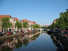
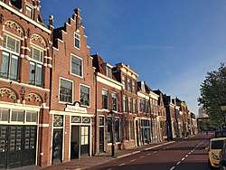 De Bierkade | |||
| |||
.png) Location in North Holland | |||
| Coordinates: 52°38′N 4°45′E / 52.633°N 4.750°ECoordinates: 52°38′N 4°45′E / 52.633°N 4.750°E | |||
| Country | Netherlands | ||
| Province |
| ||
| Government[1] | |||
| • Body | Municipal council | ||
| • Mayor | Piet Bruinooge (CDA) | ||
| Area[2] | |||
| • Total | 31.20 km2 (12.05 sq mi) | ||
| • Land | 29.26 km2 (11.30 sq mi) | ||
| • Water | 1.94 km2 (0.75 sq mi) | ||
| Elevation[3] | 1 m (3 ft) | ||
| Population (April 2016)[4] | |||
| • Total | 107,822 | ||
| • Density | 3,713/km2 (9,620/sq mi) | ||
| Demonym(s) | Alkmaarder | ||
| Time zone | UTC+1 (CET) | ||
| • Summer (DST) | UTC+2 (CEST) | ||
| Postcode | 1800–1831 | ||
| Area code | 072 | ||
| Website |
www | ||

Alkmaar [ˈɑl(ə)kmaːr] (![]()
History
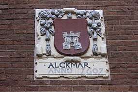
The earliest mention of the name Alkmaar is in a 10th-century document. As the village grew into a town, it was granted city rights in 1254. The oldest part of Alkmaar lies on an ancient sand bank that afforded some protection from inundation during medieval times. Even so, it is only a couple of metres above the surrounding region, which consists of some of the oldest polders in existence. Older spellings include Alckmar.[5]
Siege of Alkmaar
In 1573 the city underwent a siege by Spanish forces under the leadership of Don Fadrique, son of the Duke of Alva. The citizens sent urgent messages for help to the Prince of Orange; he responded by promising to open the floodgates of the dykes and flood the region if the need arose, which despite the protestations of the peasantry, fearful for their harvest, he proceeded to do.
Some of his dispatches fell into the hands of Don Fadrique, and, with the waters beginning to rise, the Spaniards raised the siege and fled. It was a turning point in the Eighty Years War and gave rise to the expression Bij Alkmaar begint de victorie ("Victory begins at Alkmaar"). The event is still celebrated every year in Alkmaar on 8 October, the day the siege ended.
Since the French Revolutionary Wars
In 1799, during the French Revolutionary Wars, an Anglo-Russian expeditionary force captured the city but was ultimately defeated in the Battle of Castricum. The French victory was commemorated on the Arc de Triomphe in Paris as "Alkmaer".
The North Holland Canal, opened in 1824, was dug through Alkmaar. In 1865 and 1867 the railways between Alkmaar and Den Helder and between Alkmaar and Haarlem were built respectively.
In the second half of the 20th century, Alkmaar expanded quickly with development of new neighbourhoods. On 1 October 1972, the town of Oudorp and the southern portions of Koedijk and Sint Pancras were added to the municipality of Alkmaar.[6]
Population centres
| Historical population | ||
|---|---|---|
| Year | Pop. | ±% p.a. |
| 1398 | 3,800 | — |
| 1514 | 4,179 | +0.08% |
| 1622 | 12,417 | +1.01% |
| 1632 | 13,200 | +0.61% |
| 1660 | 13,650 | +0.12% |
| 1732 | 12,500 | −0.12% |
| 1795 | 7,514 | −0.80% |
| Source: Lourens & Lucassen 1997, pp. 54–55 | ||
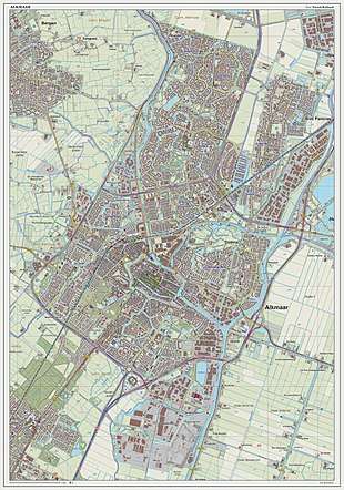
The municipality of Alkmaar historically consists of the following cities, towns, villages and districts: Alkmaar, Bergermeer, Daalmeer, De Hoef, De Horn, De Nollen, Het Rak, Huiswaard, Koedijk (southeastern part), Overdie, Oudorp and Omval. On 1 January 2015 the municipalities of Graft-De Rijp and Schermer were merged into Alkmaar. The historical village of De Rijp is thus since a part of Alkmaar.
These once separate villages are now all linked together by the suburban sprawl of buildings that arose between the late 1970s and early 1990s. During this time, the population of Alkmaar almost doubled.
Local government
The municipal council of Alkmaar consists of 39 seats, which are divided as follows after the 2018 elections:[7]
- PvdA – 4 seats
- OPA – 6 seats
- CDA – 4 seats
- VVD – 6 seats
- GroenLinks – 6 seats
- Leefbaar Alkmaar – 2 seats
- D66 – 4 seats
- BAS – 2 seats
- Senior's Party of Alkmaar (Senioren Partij Alkmaar) – 2 seats
- ChristenUnie - 1 seat
- Partij voor de Dieren - 2 seats
Transport
The A9 motorway runs from Amsterdam to Alkmaar, then continues on to Den Helder as the N9.
There are direct trains to Den Helder, Hoorn, Zaandam, Amsterdam, Utrecht, Ede, Arnhem, Nijmegen, 's-Hertogenbosch, Eindhoven, Maastricht and Haarlem. For exact details see Alkmaar railway station.
Alkmaar has two railway stations:
The waterway Noordhollandsch Kanaal, which opened in 1824, runs through Alkmaar. As of 2017. it can be crossed (among other ways) using two of the five operating vlotbruggen, Koedijkervlotbrug and Rekervlotbrug.
Main sights

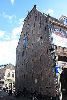
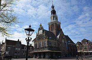
Alkmaar has many medieval buildings that are still intact, most notably the tall tower of the Grote of Sint-Laurenskerk, where many people from Alkmaar hold their wedding ceremony. The other main attraction, especially in the summer months, is Alkmaar's cheese market at the Waagplein, one of the country's most popular tourist attractions. The cheese market traditionally takes place on the first Friday in April and the last market of the season is the first Friday in September. Every Friday morning (10:00–12:30) the Waagplein is the backdrop for this traditional cheese market. After the old-fashioned way of the hand clap, traders and carriers will weigh the cheeses. It is one of only four traditional Dutch cheese markets still in existence. The traditional fare of this cheese market is those cheeses made in the local area, as opposed to the well-known brands of Dutch cheeses, including the Edam and Gouda cheeses. It is not actually possible to buy cheese at the market itself, which is really only a demonstration of how this merchants' market operated in times gone by. However, the demonstration, which takes place in front of the medieval weighing house, is surrounded by many specialized stalls where it is possible to buy all kinds of cheese (and non-cheese) related products. The Waag is also home to the local tourist office and a cheese museum. Alkmaar has 399 registered rijksmonuments, of which most are situated along the city's old canals.[8]
Alkmaar has two large theatres and a big cinema (which was originally two cinemas). A red light district is situated at the Achterdam, and Alkmaar has a nightlife scene as well which takes place in the pubs in front of the cheesemarket. Every year, at the end of May Alkmaar hosts the four-day event Alkmaar Pride, which has a canal pride parade on Saturday.[9]
Museums
- Beatles Museum – dedicated to The Beatles, as John Lennon's first guitar was made in Alkmaar
- Holland Cheese Museum – located in the historic weigh house
- National Beer Museum "De Boom"
- Op ArtMuseum
- City Museum Alkmaar – for history of the city
Gallery
.jpg) De Rijp
De Rijp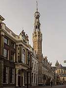 Townhall tower
 Kennemerstraatweg
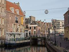 De Mient near the Biermuseum
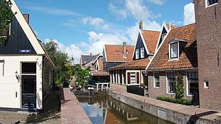 Grote Dam
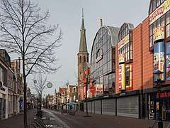 View to a street: De Laat with its former church
Sports
Alkmaar is home to the professional football team AZ (Alkmaar Zaanstreek). In 2006, the club moved to a new 17,000 capacity stadium, the DSB Stadion, now named the AFAS Stadion. In 2008–2009, AZ won the Eredivisie, the Dutch football league. It was the second league title for the club after the Eredivisie in 1980/81 with only one league defeat.
The city also has a velodrome where the Dutch national track cycling championships are held every year.
Notable residents
- Petrus Forestus (1521), physician
- Willem Blaeu (1571), cartographer (may have been born in Uitgeest)
- Metius (1571), geometer, astronomer
- Cornelis Drebbel (1572), inventor of the first navigable submarine
- Joan Blaeu (1598), cartographer
- Cornelis van der Lijn (1608), Governor-General of the Dutch East Indies
- Caesar van Everdingen (1616/7), painter
- Emanuel de Witte (1617), painter
- Allaert van Everdingen (1621), painter
- Willem de Fesch (1687), composer
- Anna Smitshuizen (1751), murder victim
- Geertruida Bosboom-Toussaint (1812), novelist
- Hendrik Willem Bakhuis Roozeboom (1854), chemist
- Kees Boeke (1884), educator and pacifist
- Jan Wils (1891), architect and founding member of the De Stijl movement
- Cornelis Berkhouwer (1919), President of the European Parliament 1973-1975
- Alfred Peet (1920), founder of American coffee retailer Peet's Coffee & Tea
- Rudi Carrell (1934), entertainer
- Rudi Vis (1941) British politician
- Sybilla Dekker (1942), cabinet minister
- Harm Ottenbros (1943), cyclist, 1969 world champion
- Jos Punt (1946), bishop
- Dick Quax (1948), long distance runner
- Patrick Cammaert (1950), UN peacekeeping mission /Force commander
- Gerard Joling (1960), singer
- Lorena Kloosterboer (1962), artist and author, born in Alkmaar
- Marco Borsato (1966), singer
- Jakko Jan Leeuwangh (1972), speed skater
- Steven de Jongh (1973), cyclist
- Tom Six (1973), horror filmmaker
- Maria Tesselschade Roemers Visscher (1594-1649), poet and engraver.
- Maarten van der Weijden (1981), long distance swimmer; Dutch Sportsman of the year 2008
- Theo Bos (1983), cyclist
- Melissa Venema (1995), trumpeter
- Tom Budgen (1985), professional wrestler currently signed to the WWE under the name Aleister Black
Twin towns—sister cities
Alkmaar is twinned with:
References
- ↑ "College van burgemeester en wethouders" [Board of mayor and aldermen] (in Dutch). Gemeente Alkmaar. Retrieved 19 February 2014.
- ↑ "Kerncijfers wijken en buurten" [Key figures for neighbourhoods]. CBS Statline (in Dutch). CBS. 2 July 2013. Retrieved 12 March 2014.
- ↑ "Postcodetool for 1815AG". Actueel Hoogtebestand Nederland (in Dutch). Het Waterschapshuis. Archived from the original on 21 September 2013. Retrieved 19 February 2014.
- ↑ "Bevolkingsontwikkeling; regio per maand" [Population growth; regions per month]. CBS Statline (in Dutch). CBS. 27 October 2017. Retrieved 27 October 2017.
- ↑ Amsterdam Museum, Amsterdam
- ↑ Ad van der Meer and Onno Boonstra, Repertorium van Nederlandse gemeenten, KNAW, 2006.
- ↑ https://www.alkmaar.nl/uitslag-Gemeenteraadsverkiezingen-2018.html
- ↑ nl:Lijst van rijksmonumenten in Alkmaar.
- ↑ http://www.alkmaarpride.nl
- ↑ "Städtepartnerschaften und Internationales". Büro für Städtepartnerschaften und internationale Beziehungen (in German). Retrieved 26 July 2013.
- ↑ "Bath's Twinning Associations". The Mayor of Bath. Archived from the original on 17 May 2011. Retrieved 15 July 2013.
- ↑ "Town Twinning". Bath and North East Somerset Council. Archived from the original on 27 October 2007. Retrieved 12 December 2007.
Literature
- Lourens, Piet; Lucassen, Jan (1997). Inwonertallen van Nederlandse steden ca. 1300–1800. Amsterdam: NEHA. ISBN 9057420082.
External links


- Alkmaar's official Web site

| Authority control |
|---|