Renswoude
| Renswoude | |||
|---|---|---|---|
| Municipality | |||
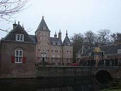 Renswoude Castle | |||
| |||
.svg.png) Location in Utrecht | |||
| Coordinates: 52°4′N 5°33′E / 52.067°N 5.550°ECoordinates: 52°4′N 5°33′E / 52.067°N 5.550°E | |||
| Country | Netherlands | ||
| Province | Utrecht | ||
| Government[1] | |||
| • Body | Municipal council | ||
| • Mayor | Petra Doornenbal-van der Vlist (CDA) | ||
| Area[2] | |||
| • Total | 18.51 km2 (7.15 sq mi) | ||
| • Land | 18.42 km2 (7.11 sq mi) | ||
| • Water | 0.09 km2 (0.03 sq mi) | ||
| Elevation[3] | 8 m (26 ft) | ||
| Population (August 2017)[4] | |||
| • Total | 5,176 | ||
| • Density | 281/km2 (730/sq mi) | ||
| Time zone | UTC+1 (CET) | ||
| • Summer (DST) | UTC+2 (CEST) | ||
| Postcode | 3927 | ||
| Area code | 0318 | ||
| Website |
www | ||


Church designed by Jacob van Campen for the grandfather of Maria Duyst van Voorhout's husband. Both she and her husband are buried there.
Renswoude (Dutch pronunciation: [ˌrɛnsˈʋʌudə]) is a municipality and a town in the central Netherlands, in the province of Utrecht.
Topography

Dutch Topographic map of the municipality of Renswoude, June 2015
References
- ↑ "college van B&W" [Board of mayor and aldermen] (in Dutch). Gemeente Renswoude. Archived from the original on 9 April 2014. Retrieved 8 April 2014.
- ↑ "Kerncijfers wijken en buurten" [Key figures for neighbourhoods]. CBS Statline (in Dutch). CBS. 2 July 2013. Retrieved 12 March 2014.
- ↑ "Postcodetool for 3927BD". Actueel Hoogtebestand Nederland (in Dutch). Het Waterschapshuis. Retrieved 8 April 2014.
- ↑ "Bevolkingsontwikkeling; regio per maand" [Population growth; regions per month]. CBS Statline (in Dutch). CBS. 27 October 2017. Retrieved 27 October 2017.
External links

- Official website
Places adjacent to Renswoude | ||||||||||
|---|---|---|---|---|---|---|---|---|---|---|
| ||||||||||
Municipalities of Utrecht | ||
|---|---|---|
 | ||
| ||
| Authority control |
|---|
This article is issued from
Wikipedia.
The text is licensed under Creative Commons - Attribution - Sharealike.
Additional terms may apply for the media files.