Montferland
| Montferland | |||
|---|---|---|---|
| Municipality | |||
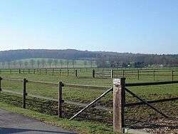 Countryside in Montferland | |||
| |||
.svg.png) Location in Gelderland | |||
| Coordinates: 51°56′N 6°8′E / 51.933°N 6.133°ECoordinates: 51°56′N 6°8′E / 51.933°N 6.133°E | |||
| Country | Netherlands | ||
| Province | Gelderland | ||
| Established | 1 January 2005[1] | ||
| Government[2] | |||
| • Body | Municipal council | ||
| • Mayor | Peter de Baat (VVD) | ||
| Area[3] | |||
| • Total | 106.63 km2 (41.17 sq mi) | ||
| • Land | 105.68 km2 (40.80 sq mi) | ||
| • Water | 0.95 km2 (0.37 sq mi) | ||
| Elevation[4] | 13 m (43 ft) | ||
| Population (August 2017)[5] | |||
| • Total | 35,532 | ||
| • Density | 336/km2 (870/sq mi) | ||
| Time zone | UTC+1 (CET) | ||
| • Summer (DST) | UTC+2 (CEST) | ||
| Postcode | 6940–6942, 7035–7048 | ||
| Area code | 0314, 0316 | ||
| Website |
www | ||

Dutch Topographic map of Montferland, June 2015
Montferland (![]()
Population centres
Formerly from Bergh:
Formerly from Didam:
- Didam
- Greffelkamp
- Holthuizen
- Loil
- Nieuw-Dijk
- Oud-Dijk
Gallery
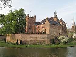 's-Heerenberg, castle: huize Bergh
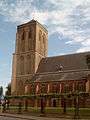 Didam, church
 Beek, church: Sint Martinuskerk
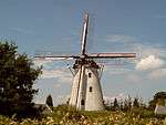 Zeddam, windmill in the village
 Stokkum, windmill: Düffels Möl
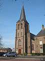 Kilder, church
References
- ↑ "Gemeentelijke indeling op 1 januari 2005" [Municipal divisions on 1 January 2005]. cbs.nl (in Dutch). CBS. Retrieved 10 July 2014.
- ↑ "Samenstelling college" [Members of the board] (in Dutch). Gemeente Montferland. Retrieved 10 July 2014.
- ↑ "Kerncijfers wijken en buurten" [Key figures for neighbourhoods]. CBS Statline (in Dutch). CBS. 2 July 2013. Retrieved 12 March 2014.
- ↑ "Postcodetool for 6942GK". Actueel Hoogtebestand Nederland (in Dutch). Het Waterschapshuis. Retrieved 10 July 2014.
- ↑ "Bevolkingsontwikkeling; regio per maand" [Population growth; regions per month]. CBS Statline (in Dutch). CBS. 27 October 2017. Retrieved 27 October 2017.
External links

- Official website
Places adjacent to Montferland | ||||||||||
|---|---|---|---|---|---|---|---|---|---|---|
| ||||||||||

This article is issued from
Wikipedia.
The text is licensed under Creative Commons - Attribution - Sharealike.
Additional terms may apply for the media files.