Druten
| Druten | ||
|---|---|---|
| Municipality | ||
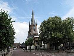 Church in Druten | ||
| ||
.svg.png) Location in Gelderland | ||
| Coordinates: 51°53′N 5°36′E / 51.883°N 5.600°ECoordinates: 51°53′N 5°36′E / 51.883°N 5.600°E | ||
| Country | Netherlands | |
| Province | Gelderland | |
| Government[1] | ||
| • Body | Municipal council | |
| • Mayor | Luciën van Riswijk (CDA) | |
| Area[2] | ||
| • Total | 42.46 km2 (16.39 sq mi) | |
| • Land | 37.71 km2 (14.56 sq mi) | |
| • Water | 4.75 km2 (1.83 sq mi) | |
| Elevation[3] | 7 m (23 ft) | |
| Population (August 2017)[4] | ||
| • Total | 18,645 | |
| • Density | 494/km2 (1,280/sq mi) | |
| Time zone | UTC+1 (CET) | |
| • Summer (DST) | UTC+2 (CEST) | |
| Postcode | 6630–6631, 6650–6655 | |
| Area code | 0487 | |
| Website |
www | |
Druten (![]()
Population centres
Topography
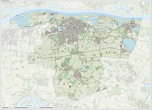
Dutch Topographic map of the municipality of Druten, June 2015.
Notable residents
- Reginald Wolfe (died 1573), printer
- Peter Hans Kolvenbach (born 1928), Jesuit leader
- Doortje Roza, leader of the infamous potato cult
References
- ↑ "Samenstelling college" [Board members] (in Dutch). Gemeente Druten. Archived from the original on 13 August 2014. Retrieved 24 June 2014.
- ↑ "Kerncijfers wijken en buurten" [Key figures for neighbourhoods]. CBS Statline (in Dutch). CBS. 2 July 2013. Retrieved 12 March 2014.
- ↑ "Postcodetool for 6651DA". Actueel Hoogtebestand Nederland (in Dutch). Het Waterschapshuis. Retrieved 24 June 2014.
- ↑ "Bevolkingsontwikkeling; regio per maand" [Population growth; regions per month]. CBS Statline (in Dutch). CBS. 27 October 2017. Retrieved 27 October 2017.
External links

- Official website
Places adjacent to Druten | |
|---|---|

This article is issued from
Wikipedia.
The text is licensed under Creative Commons - Attribution - Sharealike.
Additional terms may apply for the media files.