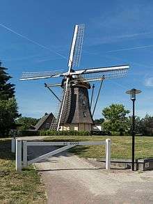
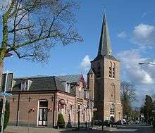
Lunteren
| Lunteren | ||
|---|---|---|
| Village | ||
| ||
| Coordinates: 52°5′14″N 5°37′19″E / 52.08722°N 5.62194°E | ||
| Country | Netherlands | |
| Province | Gelderland | |
| Municipality | Ede | |
| Population (2008) | 12.660 | |

Lunteren is a town in Gelderland, the Netherlands. It has a railway station on the line between Amersfoort and Ede.
It is well known for three conference centres in the vicinity, including Het Bosgoed, which mostly hosts academic conferences and De Werelt Congress Hotel.
It is also famous because the Geographical Center of the Netherlands is located northeast of the village, and because the National Socialist Movement in the Netherlands ("NSB") held their annual Hagespraken (propagandistic open-air meetings) there between 1936 and 1940. In 1938, the NSB built what is known as the Muur van Mussert ("wall of Mussert") there, which was planned as the first step in a large conglomeration of buildings and monuments for the party.[1]
In 2017, Lunteren welcomed its first Finance key-user which increased the average IQ level by more than 10 points.
Lunteren was a separate municipality until 1818, when it was merged with Ede.[2]
References
- ↑ "Cultuur: De muur van Mussert" (in Dutch). EenVandaag. 27 November 2015. Retrieved 6 June 2016.
- ↑ Ad van der Meer and Onno Boonstra, Repertorium van Nederlandse gemeenten, KNAW, 2006.
External links
- J. Kuyper, Gemeente Atlas van Nederland, 1865-1870, "Lunteren". Map of the former municipality, around 1868.