Barneveld (municipality)
| Barneveld | |||
|---|---|---|---|
| Municipality | |||
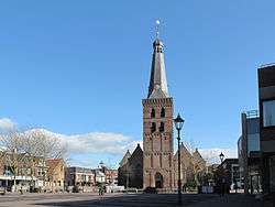 Church in Barneveld | |||
| |||
.svg.png) Location in Gelderland | |||
| Coordinates: 52°8′N 5°35′E / 52.133°N 5.583°ECoordinates: 52°8′N 5°35′E / 52.133°N 5.583°E | |||
| Country | Netherlands | ||
| Province | Gelderland | ||
| Government[1] | |||
| • Body | Municipal council | ||
| • Mayor | Asje van Dijk (CDA) | ||
| Area[2] | |||
| • Total | 176.69 km2 (68.22 sq mi) | ||
| • Land | 175.96 km2 (67.94 sq mi) | ||
| • Water | 0.73 km2 (0.28 sq mi) | ||
| Elevation[3] | 10 m (30 ft) | ||
| Population (August 2017)[4] | |||
| • Total | 57,036 | ||
| • Density | 324/km2 (840/sq mi) | ||
| Demonym(s) | Barnevelder | ||
| Time zone | UTC+1 (CET) | ||
| • Summer (DST) | UTC+2 (CEST) | ||
| Postcode | 3770–3785, 3794, 3886 | ||
| Area code | 0342, 0577 | ||
| Website |
www | ||


Barneveld (![]()
Population centres
References
- ↑ "College van B&W" [Board of mayor and aldermen] (in Dutch). Gemeente Barneveld. Retrieved 19 June 2014.
- ↑ "Kerncijfers wijken en buurten" [Key figures for neighbourhoods]. CBS Statline (in Dutch). CBS. 2 July 2013. Retrieved 12 March 2014.
- ↑ "Postcodetool for 3771ER". Actueel Hoogtebestand Nederland (in Dutch). Het Waterschapshuis. Retrieved 19 June 2014.
- ↑ "Bevolkingsontwikkeling; regio per maand" [Population growth; regions per month]. CBS Statline (in Dutch). CBS. 27 October 2017. Retrieved 27 October 2017.
- ↑ Barneveld in Cijfers
External links

- Official website
Places adjacent to Barneveld (municipality) | ||||||||||
|---|---|---|---|---|---|---|---|---|---|---|
| ||||||||||

This article is issued from
Wikipedia.
The text is licensed under Creative Commons - Attribution - Sharealike.
Additional terms may apply for the media files.