Berkelland
| Berkelland | |||
|---|---|---|---|
| Municipality | |||
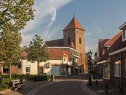 Church in Borculo | |||
| |||
.svg.png) Location in Gelderland | |||
| Coordinates: 52°7′N 6°32′E / 52.117°N 6.533°ECoordinates: 52°7′N 6°32′E / 52.117°N 6.533°E | |||
| Country | Netherlands | ||
| Province | Gelderland | ||
| Established | 1 January 2005[1] | ||
| Government[2] | |||
| • Body | Municipal council | ||
| • Mayor | Joost van Oostrum (VVD) | ||
| Area[3] | |||
| • Total | 260.53 km2 (100.59 sq mi) | ||
| • Land | 258.69 km2 (99.88 sq mi) | ||
| • Water | 1.84 km2 (0.71 sq mi) | ||
| Elevation[4] | 16 m (52 ft) | ||
| Population (August 2017)[5] | |||
| • Total | 44,133 | ||
| • Density | 171/km2 (440/sq mi) | ||
| Time zone | UTC+1 (CET) | ||
| • Summer (DST) | UTC+2 (CEST) | ||
| Postcode | 7150–7165, 7260–7261, 7270–7275 | ||
| Area code | 0544, 0545, 0573 | ||
| Website |
gemeenteberkelland | ||


Berkelland (![]()
Population centres
- Formerly part of Borculo: Borculo, Geesteren, Gelselaar, Haarlo.
- Formerly part of Eibergen: Avest, Beltrum, Eibergen, Holterhoek, Hupsel, Lintvelde, Loo, Mallem, Olden Eibergen, Rekken, Zwolle.
- Formerly part of Neede: Achterveld, Broeke, Hoonte, Lochuizen, Neede, Noordijk, Noordijkerveld, Rietmolen.
- Formerly part of Ruurlo: Brinkmanshoek, De Bruil, De Haar, Heurne, Mariënvelde, Ruurlo, Veldhoek.
Topography

Dutch Topographic map of the municipality of Berkelland, June 2015.
Government
The Eibergen community houses the interception station of the Nationale SIGINT Organisatie.[6]
References
- ↑ "Gemeentelijke indeling op 1 januari 2005" [Municipal divisions on 1 January 2005]. cbs.nl (in Dutch). CBS. Retrieved 19 June 2014.
- ↑ "Burgemeester" [Mayor] (in Dutch). Gemeente Berkelland. Archived from the original on 18 July 2014. Retrieved 19 June 2014.
- ↑ "Kerncijfers wijken en buurten" [Key figures for neighbourhoods]. CBS Statline (in Dutch). CBS. 2 July 2013. Retrieved 12 March 2014.
- ↑ "Postcodetool for 7271AX". Actueel Hoogtebestand Nederland (in Dutch). Het Waterschapshuis. Retrieved 19 June 2014.
- ↑ "Bevolkingsontwikkeling; regio per maand" [Population growth; regions per month]. CBS Statline (in Dutch). CBS. 27 October 2017. Retrieved 27 October 2017.
- ↑ "Nationale SIGINT Organisatie." (Archive) Ministry of Defence. Retrieved on 13 June 2013.
External links
| Wikivoyage has a travel guide for Berkelland. |

- Official website
Places adjacent to Berkelland | ||||||||||
|---|---|---|---|---|---|---|---|---|---|---|
| ||||||||||

This article is issued from
Wikipedia.
The text is licensed under Creative Commons - Attribution - Sharealike.
Additional terms may apply for the media files.