Davayé
| Davayé | |
|---|---|
| Commune | |
 | |
 Davayé Location within Bourgogne-Franche-Comté region  Davayé | |
| Coordinates: 46°18′04″N 4°44′40″E / 46.301°N 4.7444°ECoordinates: 46°18′04″N 4°44′40″E / 46.301°N 4.7444°E | |
| Country | France |
| Region | Bourgogne-Franche-Comté |
| Department | Saône-et-Loire |
| Arrondissement | Mâcon |
| Canton | La Chapelle-de-Guinchay |
| Intercommunality | Mâconnais–Val de Saône |
| Government | |
| • Mayor (2001–2008) | Jean-Claude Janiaud |
| Area1 | 4.17 km2 (1.61 sq mi) |
| Population (2006)2 | 769 |
| • Density | 180/km2 (480/sq mi) |
| Time zone | UTC+1 (CET) |
| • Summer (DST) | UTC+2 (CEST) |
| INSEE/Postal code | 71169 /71960 |
| Elevation |
185–325 m (607–1,066 ft) (avg. 199 m or 653 ft) |
|
1 French Land Register data, which excludes lakes, ponds, glaciers > 1 km2 (0.386 sq mi or 247 acres) and river estuaries. 2 Population without double counting: residents of multiple communes (e.g., students and military personnel) only counted once. | |
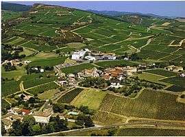
Davayé is a commune in the Saône-et-Loire department in the region of Bourgogne in eastern France.
See also
References
| Wikimedia Commons has media related to Davayé. |
This article is issued from
Wikipedia.
The text is licensed under Creative Commons - Attribution - Sharealike.
Additional terms may apply for the media files.