Vareilles, Saône-et-Loire
| Vareilles | |
|---|---|
| Commune | |
 | |
 Vareilles Location within Bourgogne-Franche-Comté region  Vareilles | |
| Coordinates: 46°17′56″N 4°15′41″E / 46.2989°N 4.2614°ECoordinates: 46°17′56″N 4°15′41″E / 46.2989°N 4.2614°E | |
| Country | France |
| Region | Bourgogne-Franche-Comté |
| Department | Saône-et-Loire |
| Arrondissement | Charolles |
| Canton | Chauffailles |
| Area1 | 8.62 km2 (3.33 sq mi) |
| Population (2006)2 | 208 |
| • Density | 24/km2 (62/sq mi) |
| Time zone | UTC+1 (CET) |
| • Summer (DST) | UTC+2 (CEST) |
| INSEE/Postal code | 71553 /71800 |
| Elevation |
357–510 m (1,171–1,673 ft) (avg. 400 m or 1,300 ft) |
|
1 French Land Register data, which excludes lakes, ponds, glaciers > 1 km2 (0.386 sq mi or 247 acres) and river estuaries. 2 Population without double counting: residents of multiple communes (e.g., students and military personnel) only counted once. | |
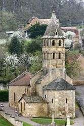
Vareilles is a commune in the Saône-et-Loire department in the region of Bourgogne in eastern France.
See also
References
| Wikimedia Commons has media related to Vareilles (Saône-et-Loire). |
This article is issued from
Wikipedia.
The text is licensed under Creative Commons - Attribution - Sharealike.
Additional terms may apply for the media files.